

Whetstone Mountains
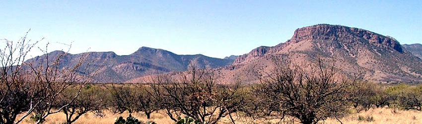
 The Whetstone Mountains are a small range with no roads that reach the higher elevations. Photo by Roger Weller, Cochise College.
High Point: Apache Peak, 7,711 feet
Elevation Change from Base: 2,811 feet
Vegetation at Highest Elevations: open oak-juniper woodland
The Whetstone Mountains are a dry and rugged fault-block mountain range only about 15 miles long. The upper slopes support open oak-juniper woodland; the lower slopes are scrub-grasslands. The only access to this mountain range is by a few unimproved four-wheel drive routes that reach some of the lower canyons. There are no roads reaching higher elevations. A single hiking trail into the heart of the mountain range is accessed from Kartchner Caverns State Park.
Special Places:
Kartchner Caverns: These caverns at the western base of the Whetstone Mountains were discovered in 1974 and their existence was kept secret for many years. The caverns were ultimately purchased by the State of Arizona and developed as a state park. Visitation is by guided tour only and special efforts are being made to maintain the caverns in their pristine condition.
Special Plants:
- None.
Further reading: