

Tumacacori Highlands (Pajarito Mountains, Atascosa Mountains, Tumacacori Mountains) and San Luis Mountains

 This hiking trail goes to the Atascosa Fire Lookout. Although no longer used for fires, the lookout is still maintained as an historic structure. Photo by Charlie McDonald.
 Oaks and junipers grow on north-facing slopes. South-facing slopes support grasslands. Photo by Charlie McDonald.
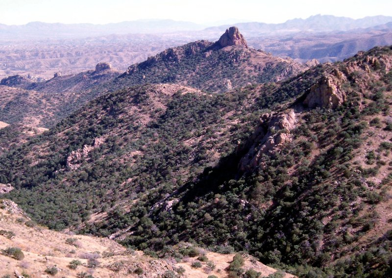
 The Tumacacori Highlands are extremely rugged resulting in relatively few roads being built in the area. Photo by Charlie McDonald.
 Sycamore Canyon in the Pajarita Wilderness has permanent water that supports several endangered fish. Photo by Charlie McDonald.
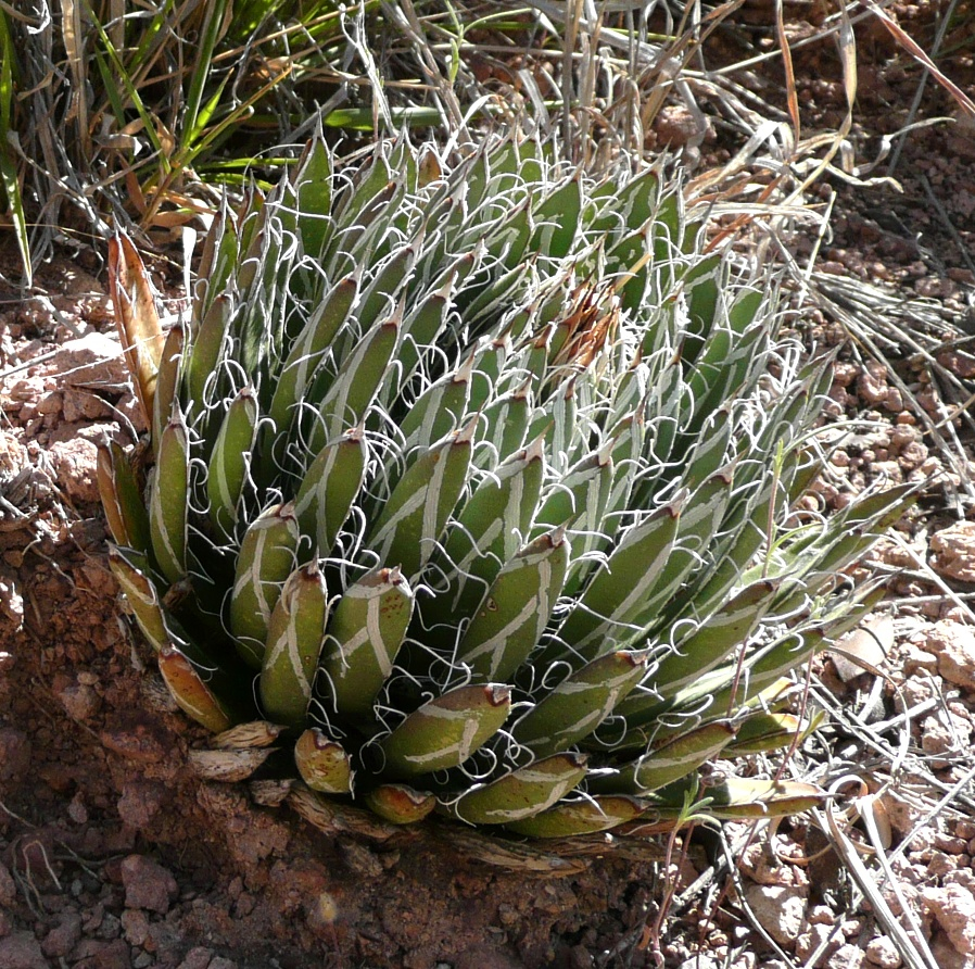 The Santa Cruz striped agave (Agave parviflora) is one of the rare and protected plants that grows in the Tumacacori Highlands. It is one of the smallest agaves. Photo by Charlie McDonald.
 Gentry indigo bush (Dalea tentaculoides) is know from only three locations with one of them being in the Tumacacori Highlands. Photo by Charlie McDonald.
High Point: Atascosa Peak, 6,422 feet
Elevation Change from Base: 2,822 feet
Vegetation at Highest Elevations: evergreen oak woodlands and scrub-grasslands
The Tumacacori Highlands comprise three small closely spaced mountain ranges on the United States and Mexico border just west of Nogales. The San Luis Mountains lie just to the west of these three mountain ranges. These ranges are continuous with similar highlands that stretch southward into Mexico. Although unimposing in elevation, the Tumacacori Highlands have sharp ridges, steep slopes, and rocky cliffs that limit the number of roads and give the area a feeling of remoteness. The vegetation is scattered evergreen oak woodlands on north facing slopes with scrub-grasslands on south facing slopes. Mesquite and acacia shrubs are common, as are agaves and sotols.
Special Places:
- Ruby Road Scenic Drive: Ruby Road (Arizona State Highway 289 and Forest Service Road 39) was named for the mining town, now a ghost town, of Ruby on the western edge of the Pajarito Mountains. This backcountry route offers a good way to view the diverse vegetation in this area.
- Pajarita Wilderness: This wilderness of 7,420 acres is located on the U.S./Mexico border in the heart of the Tumacacori Highlands. Sycamore Canyon, which drains into Mexico, is an important feature of the wilderness. The canyon has permanent pools of water that support endangered fish and is an outstanding area for viewing rare neotropical birds coming up from Mexico. It also has several very rare plants.
- Wild Chile Botanical Area: The Wild Chile Botanical Area was designated in 1999 to protect the northernmost natural population of the chiltepin pepper (Capsicum annuum), the wild ancestor of many cultivated peppers. The tiny red peppers are super hot. They are used as spicy flavorings, preservatives, and animal repellants.
Special Plants:
- Agave parviflora
- Amsonia grandiflora
- Choisya mollis
- Coryphantha recurvata
- Coryphantha robustispina
- Dalea tentaculoides
- Laennecia eriophylla
- Lotus alamosanus
- Macroptilium supinum
- Metastelma mexicanum
- Muhlenbergia duboides
- Muhlenbergia xerophila
- Paspalum virletii
- Passiflora arizonica
- Pectis imberbis
- Penstemon discolor
- Stevia lemmonii
- Tragia laciniata
Further Reading: