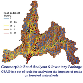
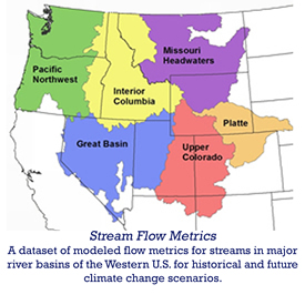
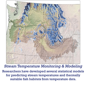
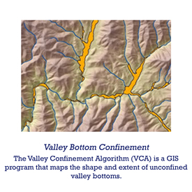
• The Cold-Water Climate Shield - Newly developed forecasts delineate climate refugia for two native salmonids - bull trout and cutthroat trout - enabling their protection and improving their odds of conservation
  • The National Stream Ineternet (NSI) is a network of people, data, and analytical techniques that interact synergistically to create information about streams.
  • The The Range-Wide Bull Trout eDNA Project - A rapid range-wide assessment of bull trout distributions: a crowd-sourced, eDNA-based approach with application to many aquatic species
  • NorWeST Stream Temperature - the NorWeST webpage hosts stream temperature data and geospatial map outputs from a regional temperature model of the northwest US
  • Geomorphic Road Analysis & Inventory Package - GRAIP is a set of tools for analyzing the impacts of roads on forested watersheds
  • VIC - Stream Flow Metrics - A dataset of modeled flow metrics for streams in major river basins of the western US for historic and future climate change scenarios
  • Stream Temperature Monitoring and Modeling - Researchers have developed several statistical models for predicting stream temperatures and thermally suitable fish habitats from temperature data
  • Valley Bottom Confinement - The Valley Confinement Algorithm )VCA) is a GIS program that maps the shape and extent of unconfined valley bottoms
  • Water Erosion Prediction Project (WEPP) is a set of interfaces designed to allow users to quickly evaluate erosion and sediment delivery potential from forest roads. Erosion rates and sediment delivery are predicted by the WEPP model, using input values for forest conditions developed by AWAE scientists.