

Legacy Roads and Trails Program Reporting, Guidance, and Directives
Annual Reporting Requirements
The Forest Service annually reports work accomplished in this program area as:
- Miles of roads improved
- Miles roads receiving maintenance
- Miles of roads decommissioned
- Stream crossings replaced
- Miles of trail improved
- Miles of trail maintained to standard
Tools
Geomorphic Road Analysis and Inventory Package (GRAIP)
The U.S. Forest Service Rocky Mountain Research Station sponsors the Geomorphic Road Assessment and Inventory Package (GRAIP). GRAIP is a process and a set of tools for analyzing the impacts of roads on forested watersheds. GRAIP combines a road inventory with a powerful GIS analysis tool set to predict sediment production and delivery, mass wasting risk from gullies and landslides, stream diversion potential, culvert maintenance, and fish passage at stream crossings.
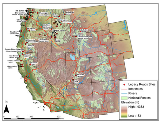
Legacy Roads Monitoring Project GRAIP Case Study map.