Agroforestry Inventory
Agroforestry encompasses a complex system of interactions that must be managed for multiple objectives, alternatives, and social interests and preferences, while being applied across a wide range of landscapes. Landowners and decision makers need regionally relevant decision support tools to quantify the objectives and goals that would result from various scenarios and that would aid in the application of agroforestry technologies on the ground.
An inventory of agroforestry activities has long been a missing piece of information sought by land planners, resource managers, and decision makers. No coordinated, permanent, recurring monitoring program exists for inventorying tree cover present in agroforestry systems in the U.S. This limits the amount of data which can be useful for multi-scale efforts. From local windbreak renovation plans to national carbon sequestration accounting, the ecosystem services these agroforestry systems are being missed.
Inventory Challenges
The challenges of large-scale inventory efforts for agroforestry include the site characteristics of a typical agroforestry system. Small, linear patches of trees are common in windbreaks, riparian forest buffers, alley cropping and some silvopasture plantings. These tree patches are often excluded from current forest inventories due to their size not meeting the criteria of forest land. Other types of land cover data are too coarse of scale to reliably count these small, discrete patches of trees. Agroforestry practices that take place at sites with higher tree densities, including forest farming and some silvopasture systems, are hard to easily differentiate from forests without agroforestry activities.
Recent Developments
There are a number of recent developments for inventorying agroforestry particularly in the central Plains states agricultural region. Using 1-meter resolution aerial imagery and computer learning algorithms, researchers with the USDA Forest Service Forest Inventory and Analysis and the National Agroforestry Center have developed the methodology to locate and map these trees. Phase 1 of the project is to map all of the tree cover in North Dakota, South Dakota, Nebraska, Kansas, and the panhandle of Texas. High-resolution tree cover of Kansas GIS dataset is currently available for each of the 105 counties within Kansas. High-resolution tree cover datasets for the other states can be found on the U.S. Forest Service Northern Research Station website.
Agroforestry Inventory Publications
Information Sheets
Infosheet

Infosheet
Infosheet
Infosheet


Brochures
Inside Agroforestry
Inside Agroforestry
Inside Agroforestry

Agroforestry Notes
Agroforestry Note
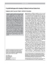
Conducting Landscape Assessments For Agroforestry
Download

Research
Research
A Cultural Landscape Archive: Digitizing The New Deal’s Prairie States Forestry Project
DownloadResearch
Challenges And Opportunities For Agroforestry Practitioners To Participate In State Preferential Property Tax Programs For Agriculture And Forestry
DownloadResearch
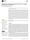
Tree Advisor: A Novel Woody Plant Selection Tool To Support Multifunctional Objectives
DownloadResearch
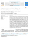
Agroforestry Extent In The United States: A Review Of National Datasets And Inventory Efforts
DownloadResearch
Silvopasture In The USA: A Systematic Review Of Natural Resource Professional And Producer-reported Benefits, Challenges, And Management Activities
DownloadResearch
Windbreaks In The United States: A Systematic Review Of Producer-reported Benefits, Challenges, Management Activities And Drivers Of Adoption
DownloadResearch
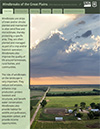
Windbreaks Of The Great Plains Story Map
DownloadResearch
Making Trees Outside Forests Count
DownloadResearch
Temperate Agroforestry Systems & Insect Pollinators: A Review
DownloadResearch
High-resolution Land Cover Of Kansas
DownloadResearch
A Spatial Model Approach For Assessing Windbreak Growth And Carbon Stocks
DownloadResearch
Filling The Gap: Improving Estimates Of Working Tree Resources In Agricultural Landscapes
DownloadResearch
Agroforestry: Working Trees For Sequestering Carbon On Agricultural Lands
DownloadResearch
Agroforestry-Working Trees For Sequestering Carbon On Ag-Lands
DownloadResearch
Inventorying Trees In Agricultural Landscapes: Towards An Accounting Of Working Trees
Download