
Official websites use .gov
A .gov
website belongs to an official government organization in the
United States.
Secure .gov websites use HTTPS
A lock
(
) or https:// means you've safely
connected to the .gov website. Share sensitive information only
on official, secure websites.


2021 ADS Quad Maps
Click on a rectangle (below) to view a quad map; each map is a 1-5 MB .pdf file. View quad maps for other years (2003-present).
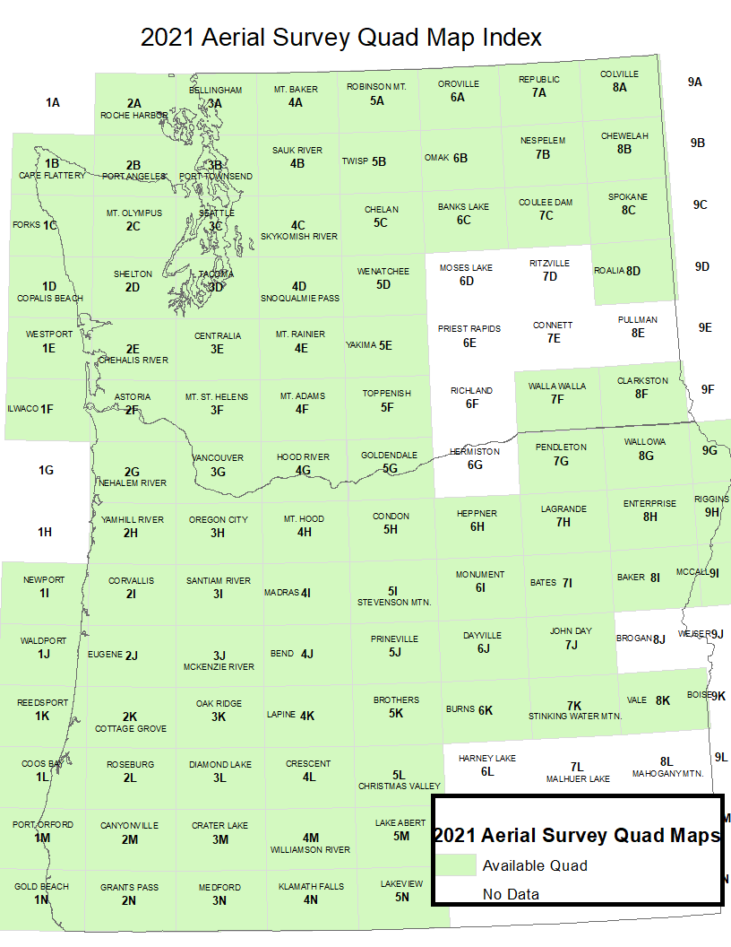
Table of Quadrants
| 2A | 3A | 4A | 5A | 6A | 7A | 8A | ||
| 1B | 2B | 3B | 4B | 5B | 6B | 7B | 8B | |
| 1C | 2C | 3C | 4C | 5C | 6C | 7C | 8C | |
| 1D | 2D | 3D | 4D | 5D | 8D | |||
| 1E | 2E | 3E | 4E | 5E | ||||
| 1F | 2F | 3F | 4F | 5F | 7F | 8F | ||
| 2G | 3G | 4G | 5G | 7G | 8G | 9G | ||
| 2H | 3H | 4H | 5H | 6H | 7H | 8H | 9H | |
| 1I | 2I | 3I | 4I | 5I | 6I | 7I | 8I | 9I |
| 1J | 2J | 3J | 4J | 5J | 6J | 7J | ||
| 1K | 2K | 3K | 4K | 5K | 6K | 7K | ||
| 1L | 2L | 3L | 4L | 5L | 6L | 7L | 8L | 9L |
| 1M | 2M | 3M | 4M | 5M | ||||
| 1N | 2N | 3N | 4N | |||||
After matching up the rectangle of focus that interests you match up and click on the corresponding name within the list below to be taken to a print friendly PDF.
Aerial Detection Surveys
The above map is based on annual cooperative aerial surveys conducted by Forest Health Protection staffs of the Oregon Department of Forestry, Washington Department of Natural Resources, and the USDA Forest Service Pacific Northwest Region. View more information about these aerial detection surveys.
The maps can also be used with the Avenza PDF Maps Mobile App. This application is a geospatial reader for Apple and Android mobile devices and allows for interaction with spatially referenced maps to view your location, record GPS tracks, add placemarks, and find places.
