

Intermountain Region Viewing Area
LOCATION and PHOTOS
 Mt. Terrill. Photo by Kreig Rassmussen.
 A Tall Forb meadow consisting of fleabane daisy, paintbrush, and arnica flowers. Photo by Kreig Rassmussen.
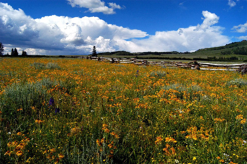 Mountain sneezeweed (Helenium autumnale var. montanum) dominates high elevation meadows during the late summer. Photo by Kreig Rassmussen.
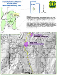
Mount Terrill Flower Garden
Forest: Fishlake National Forest
District: Richfield Ranger District
Description: The Mt. Terrill Guard Station is located in Sevier County about 30 miles east southeast of Richfield, Utah. At about 10,000 ft. in elevation the whole 7-mile valley is a nice area to beat the summer heat.
Viewing Information: Over 50 forbs can be seen in flower at one time in a very small geographic area west of the Guard Station. Flowering is between early July and early August. Peak flowering varies from year to year. There is no need to prepare for an arduous activity as one can drive to the site in most vehicles. The 7-mile road is currently being paved. This will provide even easier access to the site.
Safety First: Hiking at these high elevations can be strenuous. It is recommended that you don’t go alone if you wish to hike among the flowers.
Directions: From the center of Richfield, Utah, follow the signs to Fish Lake: east on UT 119 about 9 miles, southeast 23 miles on UT 24, then northeast 8.5 miles on UT 25. From Fish Lake Lodge, continue on UT 25 for 8 miles to the Sevenmile Road at Johnson Valley Reservoir. Proceed north on Sevenmile Road to the Mt. Terrill Guard Station, about 7 miles. The flower garden is just east of the Guard Station. Other flowers can be seen as you continue north toward Nioche Pass. In fact, the flora is seasonally spectacular all along the Sevenmile-Gooseberry Road from Johnson Valley Reservoir north to I-70.
Ownership and Management: USDA Forest Service, Fishlake National Forest, Richfield Ranger District.
Closest Town: The towns of Richfield, Salina and Loa, Utah, are about equidistant from this location.