

Intermountain Region Viewing Area
LOCATION and PHOTOS
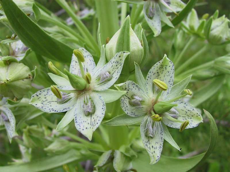 Elkweed (Frasera speciosa). Photo by Teresa Prendusi.
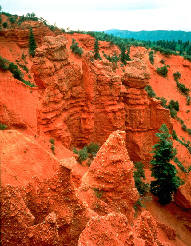 Devil's Kitchen, along the Mt. Nebo Scenic Byway.
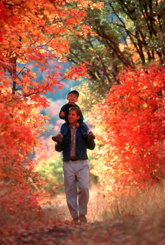 Enjoying fall colors along the Nebo Loop.
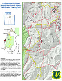
Mount Nebo Scenic Byway (Nebo Loop)
Forest: Uinta National Forest
District: Spanish Fork Ranger District
Description: A 35-mile paved road paralleling the Mt. Nebo Wilderness Area on the Uinta National Forest. The road runs through vegetation communities ranging from oak and juniper to aspen and spruce-fir. Middle and upper elevation wildflowers are common and diverse in summer, especially on side roads joining the main paved road. Several campgrounds and many trailheads and scenic view pullouts are found along the byway.
Viewing Information: Visitors will be able to enjoy spectacular views of 12,000 foot Mount Nebo and the diverse vegetation all along the scenic byway. Several pullouts with scenic overlooks, informational signs and trails are located along the byway. A very popular stop accesses Devil’s Kitchen, with its red rock cliffs and spires. The byway is nationally known for its wonderful views of bright fall foliage. Best viewing time varies year to year, usually starting mid to late September. A wide range of wildflowers can be seen along the byway from June through late September.
Safety First: The byway is a two lane road in mountainous terrain. Don’t be distracted by the scenery while driving. Stay on your side of the road except while crossing into a pullout. Watch for opposing traffic, cattle and large wildlife on the road. In colder weather, watch for icy conditions in shaded or snowmelt areas.
Directions: To access the south end – from Interstate 15 at Nephi, take Exit 225 to travel east on State Route 132. Five miles from the Interstate, look for a left turn (north) onto Forest Road 015, which is the scenic byway. Travel north on the byway, following the signs at junctions. The byway ends just outside Payson, from which you can access I15 again.
To access the byway from the north – from Interstate 15 take Exit 248 in Payson, heading east on 800 South. Turn right onto 600 East, which becomes the Nebo Loop Road (FR 015) into the mountains.
Ownership and Management: USDA Forest Service, Uinta National Forest, Spanish Fork Ranger District; Utah and Juab Counties.
Closest Town: The north end is about one mile south of Payson, Utah. The south end is about five miles east of Nephi, Utah.