Intermountain Region
You Are There! Hike the Highline Trail
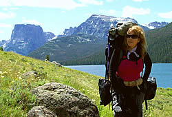 Charmaine Delmatier. Photo by Elissa Refsdal Delmatier.
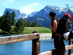 At the trailhead of the Highline Trail, Elissa Refsdal Delmatier begins a 22-mile round trip trek. Photo by Charmaine Delmatier.
There is a place you can go, which has been a vision seen only in your dreams; but it is not a dream, it is a very real place. Let us take you there, to a rugged hidden mountain range deep in the intermountains of the United States, bordering the Continental Divide.
I am delighted to bring to you a small glimpse of what so many others have explored. From the indigenous people that first roamed these mountains, to early pioneers, to venturing explorers, to recent scientists, naturalists, and backcountry enthusiasts, these granite monoliths and ice-carved valleys remain virtually unspoiled challenging us to explore them further.
Please enjoy this virtual tour of the Lower and Upper Green River Lakes and Squaretop Mountain, where fast-moving glacial runoff feeds the headwaters of the Green River. I hope this will inspire you to come and take the adventure yourself.
~Charmaine Delmatier
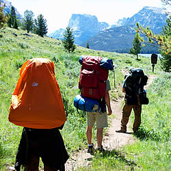
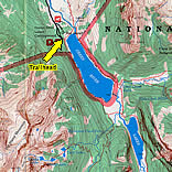
We begin our exploration of the Highline Trail on an ordinary, relatively flat trail, departing from an ordinary parking lot at the Green River Lakes on the Bridger-Teton National Forest in Wyoming.
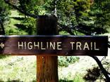
We can follow either of the trails located on both sides of Lower Green River Lake to hike southward to the Upper Green River Lake. The trail on the east side of Lower Green River Lake is the official Highline Trail. It is located in an open dry-meadow landscape with occasional forest woodlands. The trail on the west side of the lake stays within the canopy of dense subalpine coniferous forest, but is not as well marked as the official trail on the east side. These two lakeside trails intersect at the top of Lower Green River Lake (south end) along the Highline Trail.
Many remain at the Green River Lakes to enjoy the lower elevations (about 8,000 feet). Others are inclined to continue along the Highline Trail ascending quickly to 13,800 feet where the alpine landscape awaits them with incredible vistas.
Let's continue to ascend the Highline Trail to view spectacular topography and to discover many wildflowers, hopefully to include some of the rare flowers of the Wind River Range.


