

Pacific Southwest Region Viewing Area
LOCATION and PHOTOS
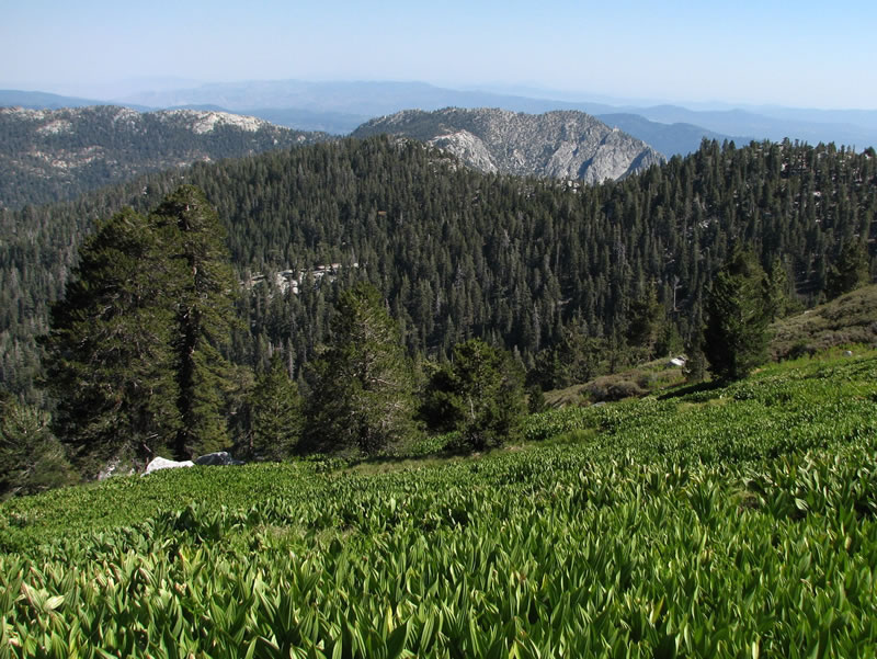 Corn lily. Photo by Jordan Zylstra.
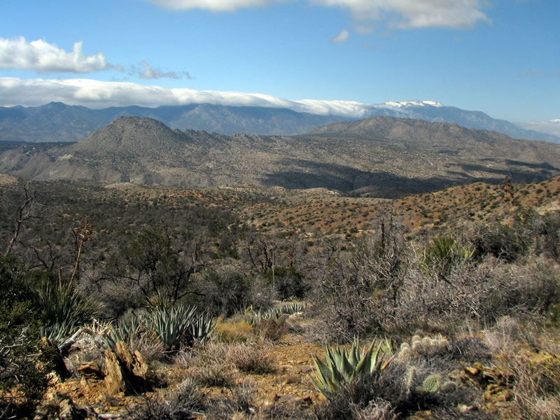 Desert landscape with agaves. Photo by Jordan Zylstra.
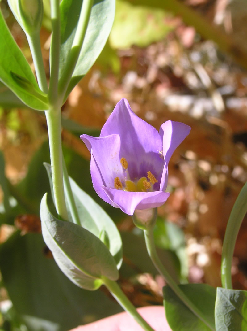 Eustoma exaltatum. Photo by Jordan Zylstra.
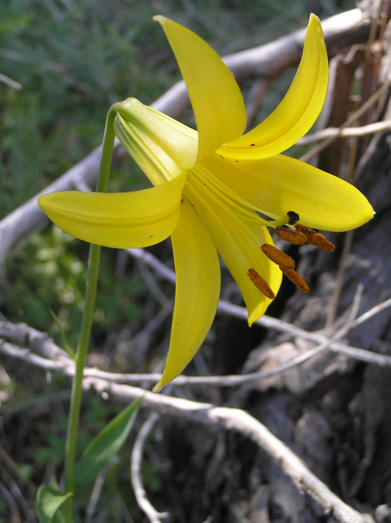 Lemon lily (Lilium parryi). Photo by Jordan Zylstra.
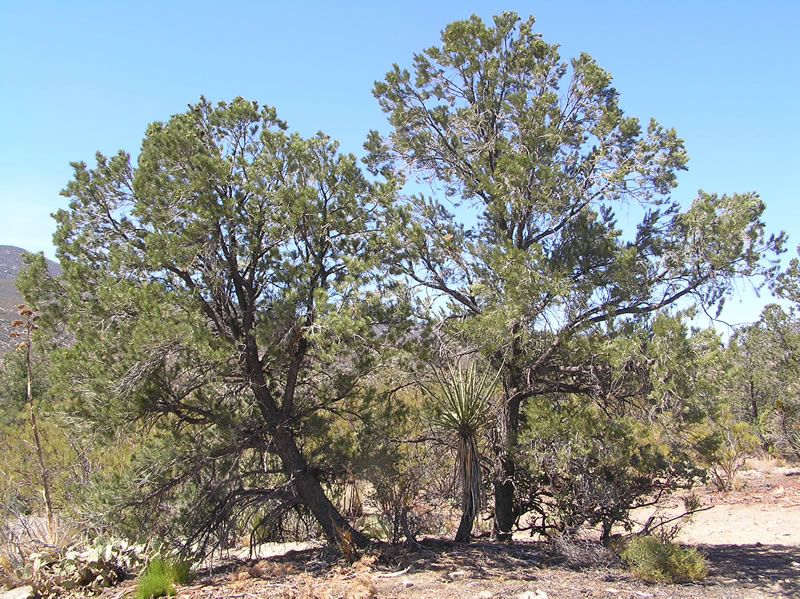 Singleleaf pinyon pine (Pinus monophylla). Photo by Jordan Zylstra.
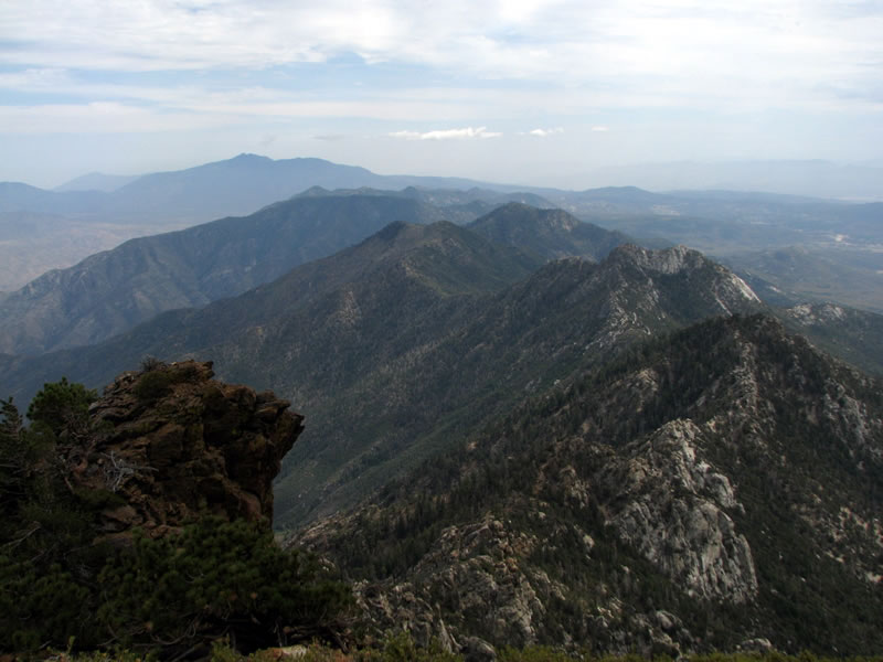 Rocky ridges. Photo by Jordan Zylstra.
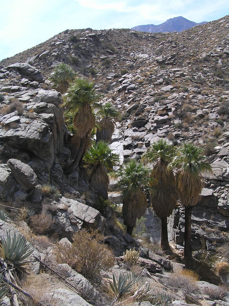 California fan palm (Washingtonia filifera). Photo by Jordan Zylstra.
Santa Rosa and San Jacinto Mountains National Monument
Forest: San Bernardino National Forest
District: San Jacinto Ranger District
Description: The Santa Rosa and San Jacinto Mountains National Monument is located in the northernmost end of the 900-mile Peninsular Range of Southern and Baja California. The 272,000-acre Monument includes one of the steepest escarpments in the lower 48 states: Mount San Jacinto Peak at 10,834 feet, rising 10,000 feet above the desert floor. This Monument is all about gradients: from sand dunes, creosote bushes, and California fan palm oases, to agaves and pinyon trees, to Jeffrey pines and white firs, and up to limber pines and high mountain meadows. Look to the south when traveling on Interstate Highway 10 through Indio to Palm Springs. This land is both the ancestral and contemporary home of the native Cahuilla people.
Viewing Information: Although this is a very interesting area to view from the car, the best way to see it is to hike the trails or visit the high country by way of the Palm Springs Aerial Tramway (in Chino Canyon off of Highway 111).
Unique plant communities include the palm oases. California fan palm (Washingtonia filifera) grows in the lower elevations of several desert canyons. Indian Canyons, managed by the Agua Caliente Band of Cahuilla Indians, is accessible by car and short hikes. Other smaller oases are in Palm Canyon. Many of the plants used in basketry also grow in these desert canyons: deergrass (Muhlenbergia rigens) and basket rush (Juncus textilis).
Singleleaf pinyon (Pinus monophylla), desert agave (Agave deserti), California juniper (Juniperus californica), Western bernardia (Bernardia myricifolia), desert ceanthous (Ceanothus greggii), hollyleaf cherry (Prunus ilicifolia) Mohave yucca (Yucca schidigeri), along with other species flourish in the Pinyon Flats area along Highway 74.
The high country of the San Jacinto Wilderness, both State and Federal, includes seasonally moist mountain meadows with both corn lily (Veratrum californium) and lemon lily (Lilium parryi). Limber pine (Pinus flexilis) and lodgepole pine (P. contorta ssp. murrayana) also grow here. The dry desert peaks of the Santa Rosa Range support several near-endemic species: rock draba (Draba corrugata), Ziegler’s aster (Dieteria canescens var. ziegleri), shaggy-haired alumroot (Heuchera hirsutissima), and Davidson’s stonecrop (Sedum niveum).
Safety First: The 15.6 mile stretch of State Highway 74 takes you through the Monument and is a two lane road. It is the only road access through this National Monument. The road is curvy coming up from the desert floor. Be cautious when passing and be courteous to other vehicles on the road. If you plan to hike, take plenty of water and sunscreen with you and be aware of spiny plants and rattlesnakes.
Directions: The Monument Visitor Center is a good place to begin a driving tour; it is located 4 miles south of Highway 111. There is parking, information, several trails, and a bookstore. A good place to stop and view one of the steep canyons, Deep Canyon, is the Cahuilla Tewanet Scenic Overlook that is 10 miles from the Visitor Center on Highway 74. This scenic highway, known as the Palms to Pines Highway, will take you through the single-leaf pinyon and desert agave stands to Garner Valley where you can view the Monument to the north.
Ownership and Management: U.S. Forest Service, San Bernardino National Forest, San Jacinto Ranger District, The Bureau of Land Management, the Agua Caliente Band of Cahuilla Indians, and other partners.
Closest Town: Palm Desert, California
For More Information:
- Santa Rosa and San Jacinto Mountains National Monument
- San Bernardino National Forest: (909) 382-2600
- Monument Visitor Center: (760) 862-9984
- San Jacinto Ranger District Office: (909) 382-2922
- Palm Springs Aerial Tramway: (760) 325-1391