

Pacific Northwest Region Viewing Area
LOCATION and PHOTOS
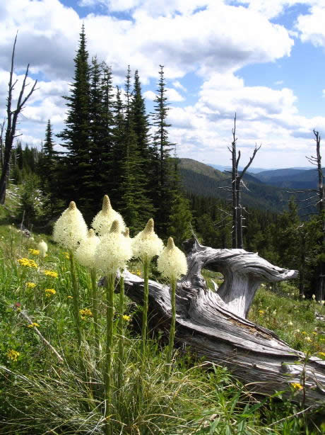 Beargrass on Abercrombie Mountain, Colville National Forest. Photo courtesy of Kathy Ahlenslager.
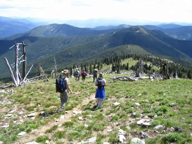 Hikers Descend Abercrombie Peak, Colville National Forest. Photo courtesy of Kathy Ahlenslager.
Abercrombie Mountain
Forest: Colville National Forest
District: Sullivan Lake Ranger District
Description: The steep trail climbs 3,218 feet in 3.2 miles via switch-backs under a mixed evergreen forest, and then breaks out onto a ridge of beargrass with panoramic views of the Pend Oreille and Columbia River Valleys, as well as the Kettle Crest Mountain Range. This 6.4 mile round-trip hike is recommended for experienced hikers. Abercrombie Mountain (7,308 feet high) is in of the Purcell Mountains on the Colville National Forest in northeastern Washington. Wildfires are one way nature regenerates higher elevation forests such as this one. The trail leads through a mixed conifer forest of subalpine fir (Abies lasiocarpa), Englemann spruce, Douglas-fir (Pseudotsuga menziesii), western larch (Larix occidentalis), and lodgepole pine (Pinus contorta).
Viewing Information: Over 100 plant species occur along the gorgeous trail to the peak. Hike in July for prime wildflower viewing with brilliant displays of beargrass (Xerophyllum tenax), silky lupine (Lupinus sericeus), and red paintbrush (Castilleja rhexifolia). Common shrubs include Cascades azalea (Rhododendron albiflorum), Utah honeysuckle (Lonicera utahensis), black elderberry (Sambucus racemosa), yellow mountain-heath (Phyllodoce glanduliflora), and dwarf huckleberry (Vaccinium myrtillus). Wildflowers not to miss are heart-leaved arnica (Arnica cordifolia), queen’s cup (Clintonia uniflora), larkspur (Delphinium nuttallianum), fireweed (Epilobium angustifolium), subalpine daisy (Erigeron peregrinus), rattlesnake plantain (Goodyera oblongifolia), parrot’s beak (Pedicularis contorta), and twisted stalk (Streptopus amplexifolius).
Safety First: Be prepared in spring, summer, and autumn for rapid changes in weather as thunderstorms can develop rapidly. Rattlesnakes, bears, cougars, and moose might be seen, so be alert to your surroundings. Since summer temperatures often reach 90o to 100o F, bring plenty of water and sunscreen. Insect repellant may also come in handy. Let someone know where you are heading and when you expect to return.
Directions: From Colville at the junction of Hwy 395 and 20 drive east on Hwy 20 about 1 mile. Turn north onto Aladdin Road and go about 2 miles to a Y, staying to the right towards Northport. Drive about 24 miles northeast on County Road 9435 to County Road 9445. Turn east onto County Road 9445 and continue north about 7 miles on it to Forest Service Road 4720 at Leadpoint. Follow County Road 4720 (Silver Creek Road) about 0.5 mile and stay left at the Y on County Road 4720. Continue about 1 mile before crossing a cattle guard onto the Colville National Forest. Go 0.4 mile and turn left onto Forest Service Road 7078. Take Road 7078 north about 5 miles and turn right onto Forest Service Road 300. Follow Road 300 about 3 miles to the trailhead.
Ownership and Management: USDA Forest Service, Colville National Forest, Sullivan Lake Ranger District.
Closest Town: Metaline Falls, Washington.