

Mapping & Reporting
Individual Tree Species Parameter Maps
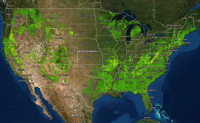
The Individual Tree Species Parameter Maps (ITSP) were developed to support the National Insect and Disease Risk Map (NIDRM) since insect and disease risk is often driven by the density of a given species. While similar to the Tree Atlas, the ITSP project mapped basal area and stand density index for each individual tree species. The parameter products are based on 30-meter Landsat satellite data, climate, terrain, and soil predictor layers and ground samples from the USFS Forest Inventory and Analysis plot data. Many other applications and analyses requiring tree-species density could benefit from this spatially refined dataset.
These data are available in View-Only mode from the ITSP web map viewer. The map services that drive the ITSB web map viewer are accessible from the Hosts folder at the ArcGIS Server connection https://apps.fs.usda.gov/fsgisx05/rest/services. Image services at a finer 30-meter pixel resolution area available in the ‘RDW_FHP_TreeSpeciesMetrics’ folder at the https://apps.fs.usda.gov/fsgisx01/rest/services Server connection.
The ITSP rasters used in NIDRM models are available for download from the following GIS Data Downloads.
National Individual Tree Species Atlas

National Individual Tree Species Atlas Publication
National Individual Tree Species Atlas updates the previous Atlas of United States Trees with better spatial accuracy and finer spatial resolution and includes 264 species which are mapped to a more precise location. Many applications and analyses require accurate tree species information and will benefit from a more current, spatially refined dataset. The Atlas fixes errors in the original maps allowing for better utility in a spatially aware world.
- National Individual Tree Species Atlas-Print Ready (75 MB PDF)
- National Individual Tree Species Atlas-Spread (75 MB PDF)
GIS Data Downloads
Within each zip file* is a file geodatabase that includes the relevant raster data and a Data Dictionary that explains the file naming conventions, Each raster has embedded metadata with detailed descriptions.
*Please keep your web browser window open and allow extra time when downloading large zip files.
| TREE SPECIES RASTERS | ZIP |
|---|---|
| Basal Area rasters (Contiguous US) | |
| Spatial Density Index rasters (Contiguous US) | |
| All species totals (Contiguous US) | |
| Basal Area, Spatial Density Index & Totals (Alaska) |
Individual Tree Species Parameter Maps Viewer