
South Park Ranger Dsitrict

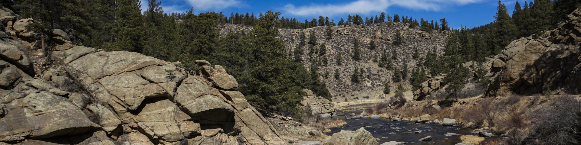
South Park Ranger District includes South Park, part of the Mosquito Range, Eleven Mile Canyon and Jefferson Lake Recreation Areas, and the Tarryall Mountains and Puma Hills.

The district manages 456,599 acres of land ranging in elevation from 7,100 to 14,285 feet. Mostly in Park and Teller counties. 

The main highways through the district include Highway 285 south of Kenosha Pass to Trout Creek Pass, and Highway 24 from Florissant, Colorado, to the intersection with Highway 285 at Trout Creek Pass. 

General Information

This recreation region is managed by the South Park Ranger District

Passes & Permits

Visit recreation.gov or call 1-877-444-6777 for campground reservations. Campground reservations cannot be made ranger district offices.

Special use permits are required for groups of 75 or more persons and all commercial activities including outfitting and guiding.  Visit the Pike-San Isabel National Forests & Cimarron and Comanche National Grasslands Recreation Special Use Permits page to learn more.

America the Beautiful - National Parks and Federal Recreational Lands Passes are a suite of annual and lifetime passes that provides U.S. citizens and visitors an affordable and convenient way to access Federal recreational lands. Up to 100% of the Pass program's proceeds are used to improve and enhance visitor recreation services.

Recreation Sites

Showing: 1 - 10 of 54 results

Aspen Campground

Aspen Campground is four miles north of Jefferson off County Road 35 and County Road 37. It is an excellent place for campers looking to relax, hike, fish and enjoy the sounds of nature. The…

Beaver Ponds Picnic Area

Site Open
Picnicking
Beaver Ponds Picnic Area offers day use visitors four designated sites each with parking, a grill and a picnic table.It is difficult to access Jefferson Lake Recreation Area during the winter…

Blue Mountain Campground

Blue Mountain Campground is located 1.5 miles south of Lake George off County Road 96 and County Road 61. It has 21 campsites with parking spurs 16-40 feet and a maximum trailer length of 25 feet.…

Boreas Pass Auto Tour

Scenic Drives
Boreas Pass Auto Tour is a 21 1/2-mile drive that follows the former Denver, South Park and Pacific Railroad route from Como to Breckenridge.The Boreas Pass road closes at both ends when the…

Boreas Pass Section House

The section house is located at the summit of Boreas Pass and in the late 1800s and early 1900s served as the main building for the Denver, South Pacific and Pacific Railroad when it made its way…

Brookside-McCurdy Trailhead

Site Open
Horse Riding and Camping Hiking
The Brookside-McCurdy Trail is an arterial route from south to north or vice versa through the Lost Creek Wilderness Area. It leads hikers through high elevation meadows, low grassy valleys,…

Buckskin Gulch Auto Tour

Scenic Drives
Buckskin Gulch Auto Tour begins in Alma, 5 1/2 miles north of Fairplay. Of this 5-mile route, the first 4 miles are suitable for most passenger cars; the last mile is steep, rocky, and rough.

Buffalo Peaks Trailhead

Site Open
Biking Horse Riding and Camping Hiking
Buffalo Peaks Trailhead provides access to a middle section of Salt Creek Trail which accesses southeast portions of Buffalo Peaks Wilderness.Seasonal wildlife closure on Forest Service Road 431,…

Buffalo Peaks Wilderness - East side

Site Open
Hiking Horse Riding and Camping
Buffalo Peaks Wilderness offers a great variety of recreational opportunities. There are many miles of trail in or near the wilderness area, and all wilderness regulations apply. Trails in the…

Buffalo Springs Campground

Buffalo Springs Campground is located 12.5 miles south of Fairplay on Forest System Road 431. It has 18 campsites with parking spurs 24-40 feet and a maximum trailer length of 30 feet. At an…

Last updated April 29th, 2025