
Official websites use .gov
A .gov
website belongs to an official government organization in the
United States.
Secure .gov websites use HTTPS
A lock
(
) or https:// means you've safely
connected to the .gov website. Share sensitive information only
on official, secure websites.


Recreation
During the inception of national forest reserves in the late 1800s, the San Bernardino National Forest was recognized as one of the premier forests for recreation, and a top destination for people to escape their urban lives for a peaceful retreat in the mountains.
Now, with hundreds of miles of nationally recognized hiking trails, seven designated Wildernesses, 42 campgrounds, four winter recreation resorts, seven wild and scenic rivers, the two tallest mountains in Southern California, and one of the best destinations for off-highway vehicle riding, there is more than a lifetime of activities to do on the San Bernardino National Forest. Which adventure will you choose next?
Recreation Fees
Current Recreation Conditions
| Area Name | Status | Area Conditions |
|---|---|---|
| 1N09 Recreational Shooting Sites | Closed |  As of 7/2/2024 Recreational Shooting has been temporarily prohibited due to Forest Order 05-12-00-24-06. Please see the Current Fire Restrictions section. As of 7/2/2024 Recreational Shooting has been temporarily prohibited due to Forest Order 05-12-00-24-06. Please see the Current Fire Restrictions section.
|
| Alpine Pedal Path Trail 1E50 | Open | |
| Applewhite Campground | Temporarily Closed |
Vista Fire Emergency ClosureTemporarily closed for public safety due to the Vista Fire. |
| Applewhite Picnic Area | Temporarily Closed |
Vista Fire Emergency ClosureTemporarily closed for public safety due to the Vista Fire. |
| Arrastre Recreational Shooting Site 1 | Open | Winter Road conditions will vary with snow, ice and mud. Please be cautious in driving on unpredictable Forest Service Roads. |
| Arrastre Recreational Shooting Site 2 | Open | Winter Road conditions will vary with snow, ice and mud. Please be cautious in driving on unpredictable Forest Service Roads. |
| Arrastre/Deer Springs PCT Trail Camp (hike-in only | Open | As of Thursday, 05/26/2022, No wood or charcoal fires or barbecues are allowed due to high fire danger. Gas/Propane appliances are permitted with fuel shut-off valve, stoves, fire-rings, etc. CA Campfire Permit: https://www.readyforwildfire.org/permits/campfire-permit/ |
| Arrowhead Fish & Game - Shooting Range | Open | |
| Aspen Glen Picnic Area | Open | Permanent restrooms are closed. Recreational Fee Passes- Adventure Passes are not required at this time. Wood or charcoal fires, or barbecues are allowed in the agency provided grills. Gas/Propane appliances - stoves, fire-rings, etc. - are permitted with fuel shut-off valve. CA Campfire Permit: https://www.readyforwildfire.org/permits/campfire-permit/ |
| Aspen Glen Snow Play Area | Open | Please note: snow sledding conditions will vary depending on recent snowfall and expected warmer temperature. There is limited parking. |
| Aspen Grove Trail 2E05 | Temporarily Closed | A portion of the trail was burned over in the 2015 Lake Fire. Potential hazards include falling trees and limbs, loose rocks and ash pits. Portions of the trail may be damaged or blocked with debris. |
| Baldy Mesa (Trestles) OHV Staging Area | Open |
|
| Baldy Mesa OHV Road 3N21 | Open |
|
| Barton Flats Family Campground | Open | |
| Barton Flats Snow Play Area | Closed | Please call for current snow conditions. |
| Baylis Park Picnic Area | Open | |
| Bear Mountain Ski Resort | Closed |         |
| Bee Canyon OHV Road 5S07 | Temporarily Closed | As of 1/19/23, road is closed for safety precautions, due to a sink hole in the road. Road is closed by Forest Order #05-12-55-24-01. There are many other OHV Green Sticker routes starting from Highway 243. OHV routes are 5S09, 4S21, 4S05, 4S06. Free maps are available at the Forest Service Visitor Center at 54270 Pine Crest Ave, in Idyllwild. |
| Bee Canyon Recreational Shooting Sites | Closed | Target Shooting is currently closed on the Forest until January 16, 2025. |
| Big Bear Snow Play | Open |  |
| Big Bear Valley Sportsman's Club - Shooting Range | Closed | Call ahead to determine range status days, hours and shooting options vary. Range phone during hours of operation only. (909) 585-4686 |
| Big Bear Yellow Post Sites | Open | . As of 7/2/2024 wood and/or charcoal BBQ fires are not allowed due to Forest Order 05-12-00-24-06. Please see the Current Fire Restrictions section. Gas/Propane appliances - stoves, fire-rings, etc. - are permitted with fuel shut-off valve. Get your CA Campfire Permit. |
| Big Falls Trail 1E13 | Open | |
| Big Pine Flat Equestrian Group Campground | Open | |
| Big Pine Flat Family Campground | Open | |
| Big Pine Flat Recreational Shooting Site # 1 | Open | High clearance vehicles are highly recommended due to winter conditons. Winter road conditions will vary with snow, ice, and mud. Please be cautious whendriving on Forest Service Roads. |
| Big Pine Flat Recreational Shooting Site # 2 | Open | High clearance vehicles are highly recommended due to winter conditons. Winter road conditions will vary with snow, ice, and mud. Please be cautious when driving on Forest Service Roads. |
| Big Pine Flat Recreational Shooting Site # 3 | Open | High clearance vehicles are highly recommended due to winter conditons. Winter road conditions will vary with snow, ice, and mud. Please be cautious when driving on Forest Service Roads. |
| Black Mountain Fire Lookout | Open | Lookout tower is open. Walk a half mile to the lookout from the Boulder Basin campground. |
| Black Mountain Group Campground | Open | Open. Reservation only. Wood and charcoal campfires are not allowed as of 7/2/2024. Please call or click for current conditions. |
| Black Mountain Trail 2E35 | Open | Trail begins 1.3 miles south of Vista Grande Fire Station. |
| Black Mountain Yellow Post Sites | Open | Black Mountain road is open. High clearance vehicles recommended. Wood and charcoal fires are not allowed as of 7/2/2024. Call or click for current conditions. |
| Bluff Mesa Group Campground | Open | |
| Boo Hoff Trail | Open | Please report trail conditions to (760) 862-9984 |
| Boulder Basin Campground | Open | Open. Wood and charcoal fires are not allowed as of 7/2/2024. Please call or click for current conditions. |
| Butler Peak Fire Lookout | Closed | |
| Buttercup Group Campground | Open | As of July 15, 2024, our facility is experiencing a temporary water outage. Please bring all the water you’ll need for your visit, including drinking water. Water is available at Pineknot Campground, if necessary. |
| Cactus Flat OHV Staging Area | Open | No wood or charcoal fires or barbecues are allowed due to high fire danger. Gas/Propane appliances are permitted with fuel shut-off valve, stoves, fire-rings, etc. CA Campfire Permit: https://www.readyforwildfire.org/permits/campfire-permit/ |
| Cactus Spring Trail 5E01 | Open | Please report trail conditions to (760) 862-9984 |
| Cahuilla Mountain Trail 2E45 | Open | Please report trail conditions to Idyllwild Ranger Station 1-909-382-2921. |
| Cahuilla Tewanet Scenic Overlook | Open | |
| Carumba Trail 3E04 | Temporarily Closed | This is a connector trail in the San Jacinto Wilderness. The Caramba trail is not maintained from the Skunk Cabbage junction to Laws junction. |
| Cedar (Laws) Trail 3E16 | Temporarily Closed | The trail has been unmaintained since the Mountain Fire (July 2013). This trail has many downed trees, trail is hard to follow. This is a connector trail within the wilderness. |
| Cedar Springs Trail 4EI7 | Open | |
| Champion Lodgepole Trail 1W11 | Open | |
| Clark's Ranch Yellow Post Site | Open | Gas/Propane appliances are permitted with fuel shut-off valve with a valid CA Campfire permit. Get your campfire permit |
| Cleghorn Ridge OHV Road 2N47 | Open | |
| Climbers Trail 3E06 to Suicide Rock | Open | |
| Coldwater Canyon Yellow Post Sites | Temporarily Closed |
Vista Fire Emergency ClosureTemporarily closed for public safety due to the Vista Fire. |
| Coon Creek Cabin Group Campground | Temporarily Closed | |
| Coon Creek Yellow Post Sites | Unreachable | |
| Cougar Crest Trail 1E22 | Open | Gas/Propane appliances are permitted with fuel shut-off valve, stoves, fire-rings, etc. CA Campfire Permit: https://www.readyforwildfire.org/permits/campfire-permit/ |
| Council Group Campground | Open | |
| Crab Flat Loop OHV Route 2N31Y | Temporarily Closed | |
| Crab Flats Family Campground | Open | |
| Crab Flats OHV Road 3N34 | Open | |
| Crest Park Picnic Area | Open | Wood or charcoal fires are only allowed in agency provided grills. Gas/Propane appliances are permitted with fuel shut-off valve, stoves, fire-rings, etc. CA Campfire Permit: https://www.readyforwildfire.org/permits/campfire-permit/ |
| Dark Canyon Campground | Open | Dark Canyon is open. First come, first serve only, 14 sites available. No reservations. Wood and charcoal fires are not allowed as of 7/2/2024. Call or click for current conditons. |
| Deep Creek | None | |
| Deep Creek Hot Springs | Open |
|
| Deer Group Campground | Open | |
| Deer Hunt Zone D19 - San Jacinto / Santa Rosa Mtns | Closed | Be aware of the Fairview Fire Closure area. Click on Alerts and Notices for Forest Order. Be aware of State Game Refuge; know your boundaries. |
| Deer Springs Trail to Suicide Rock 3E17 to 3E33 | Open | Open. |
| Desert Front OHV Road 3N24 | Not Cleared | Road has severe damage due to recent storms. High clearance, 4x4 vehicles are highly recommended. Area may still be impassable. |
| Devils Slide Trail 3E05 | Open | Day use permits are required for all wilderness trails. Devil's Slide permits are limited on Saturdays and Sundays beginning Memorial Day weekend until Labor Day weekend. You must have a permit stamped for that date, issued by the staff. All others are not valid Send your permit request in advance by mail or fax. Have a second choice in mind, in case you cannot get a Devil's Slide permit for Saturday or Sunday during that period. San Jacinto Wilderness Visitor Permit Application |
| Dogwood Family Campground | Open | ... |
| Dollar Lake Spur Trail 1E03 | Open | |
| Dry Lake Trail 1E05.3 | Open | |
| East Indian Creek OHV Road 4S10 | Open | 5S07 Bee Canyon Road is closed for public safety, due to a sink hole in the road under Forest Order 05-12-55-24-01. |
| Ernie Maxwell Scenic Trail 3E07 | Open | Open. |
| Falls Picnic Area | Open | As of 7/2/2024 wood and/or charcoal BBQ fires are not allowed due to Forest Order 05-12-00-24-06. Please see the Current Fire Restrictions section. Gas/propane appliances with fuel shut-off valve are allowed with a valid CA Campfire Permit.
|
| Farview Point | Open | Black Mountain Road 4S01 will open. High clearance, and four-wheel drive is highly recommended when open. Call for updates. |
| Fern Basin Campground | Open | Campground is open. Water will not be available at Fern Basin. Campers can get water at Marion Mountain campground or bring their own. Wood and charcoal fires are not allowed as of 7/2/2024. |
| Fish Creek Trail 1W07 | Unreachable | Forest Service Road 1N02 and 1N05 are closed to motorized vehicles for the winter season. A portion of the trail was burned over in the 2015 Lake Fire. Potential hazards include falling trees and limbs, loose rocks and ash pits. Portions of the trail may be damaged or blocked with debris. |
| Fisherman's Group Campground | Open | ... |
| Fobes Trail 4E04 | Open | No permit needed unless hiking north or south on the Pacific Crest Trail. |
| Forsee Basin / Johns Meadow Trail 1E16 | Open |
|
| Forsee Creek Trail 1E06 | Open |
|
| Fuller Mill Creek Picnic Area | Open | www.preventwildfiresca.org |
| Fuller Ridge Trail | Open | Four-wheel drive, with high clearance is highly recommended. |
| Garstin Trail | Open | Please report trail conditions to (760) 862-9984 |
| Gobbler's Knob Yellow Post Sites | Temporarily Closed |
Vista Fire Emergency ClosureTemporarily closed for public safety due to the Vista Fire. |
| Goff Flat Yellow Post Site | Open | Wood and charcoal fires are not allowed as of 7/2/2024. Call or click for current conditions. Road may be in bad condition due to recent storms. Please report conditions to 909-382-2921. |
| Gold Fever Interpretive Site | Open | 4WD high clearance vehicles, mud or snow tires, chains and a shovel are the recommendations. |
| Gray's Peak Group Campground | Closed | |
| Grays Peak Trail 1W06 | Open | Currently closed due to Forest Order 05-12-52-23-07. (Closure Map)This order is effective unil July, 31,2024. |
| Green Spot Equestrian Group | Closed | |
| Green Valley Family Campground | Open | ... |
| Grout Bay Picnic Area | Open | |
| Halfway Trail 1E18 | Open | |
| Hanna Flat Family Campground | Open | |
| Heaps Peak Arboretum Day Use Area | Open | Visitors are strongly encouraged to remain on the trails. |
| Heaps Peak Arboretum Trail 3W05 | Open | Visitors are strongly encouraged to remain on trails. |
| Heart Bar Equestrian Group Campground | Temporarily Closed | |
| Heart Bar Family Campground | Temporarily Closed | |
| Holcomb Valley Campground | Open | Wood or charcoal fires and barbecues are allowed in the agency provided campfire rings and barbecues. Gas/Propane appliances are permitted with fuel shut-off valve, stoves, fire-rings, etc. |
| Humber Park Trailhead Parking | Open | Open. |
| Indian Canyon OHV Road 4S06 | Open | 5S07 Bee Canyon Road is closed to vehicle traffic for public safety, due to a sink hole in the road per Forest Order 05-12-55-24-01. |
| Indian Mountain OHV Road 4S21 | Open |  Black Diamond Trail. 5S07 Bee Canyon Road is closed to vehicle traffic for public safety, due to a sink hole in the road per Forest Order 05-12-55-24-01. Black Diamond Trail. 5S07 Bee Canyon Road is closed to vehicle traffic for public safety, due to a sink hole in the road per Forest Order 05-12-55-24-01. |
| Ironwood Group Campground | Closed | |
| Jenks Lake Day Use Area | Open | |
| Juan Bautista de Anza National Historic Trail | Temporarily Closed | |
| Juan Diego OHV Road 6S89 | Open | |
| Juniper Point Picnic Area | Open | |
| Juniper Springs Group Campground | Temporarily Closed | |
| Keller Peak Fire Lookout | Open | ... |
| Keller Peak Yellow Post Sites | Open | |
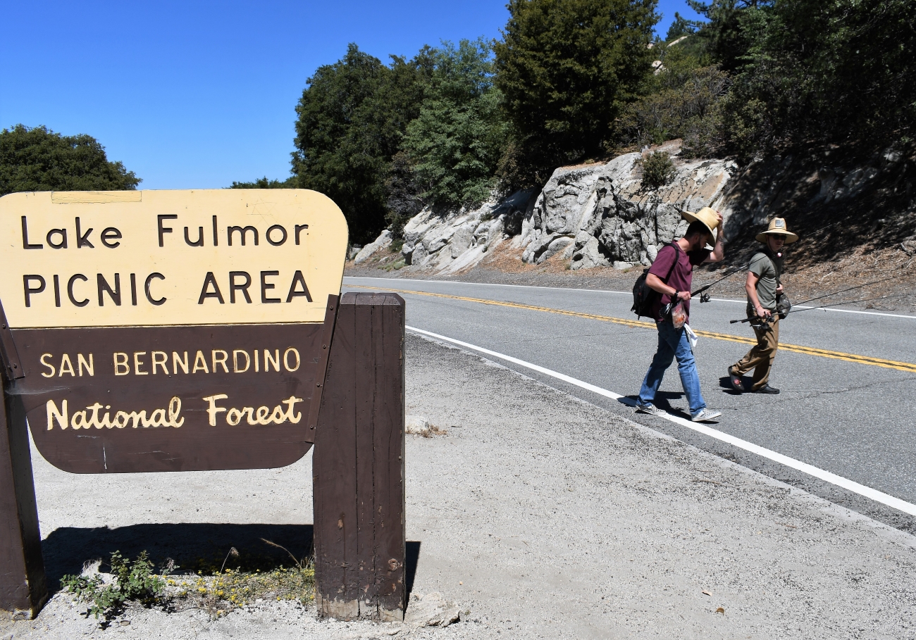
| Lake Fulmor Day Use Area | Open | Call or click for current conditions. |
| Lake Gregory County Regional Park | Open | |
| Lake Hemet Day Use Area | Open | Call or click for current conditions. Day use only. A fee machine is available in the first parking lot. Adventure passes can be bought using a debit or credit card. |
| Little San Gorgonio Trail 1E11.2 | Open | Day use permits required. For overnight permits, reserve through the San Gorgonio Wilderness Association. |
| Little Tahquitz Valley Trail 3E41 | Open | |
| Lobo Group Campground | Open | |
| Lodgepole Trail 1E14 | Open | |
| Lost Creek Trail 1E09 | Open | A portion of the trail was burned over in the 2015 Lake Fire. Potential hazards include falling trees and limbs, loose rocks and ash pits. Portions of the trail may be damaged or blocked with debris. The trail may be hard to follow at times. |
| Lost Lake Day Use Area | Temporarily Closed |
Vista Fire Emergency ClosureTemporarily closed for public safety due to the Vista Fire. |
| Lytle Creek Firing Line - Shooting Range | Temporarily Closed |
Vista Fire Emergency ClosureTemporarily closed for public safety due to the Vista Fire. |
| Marion Mountain Campground | Open | Campground is open. Call or click for current conditons. |
| Marion Mountain Trail 2E14 | Open | |
| Mellor Ranch OHV Road 4S05 | Open | 5S07 Bee Canyon Road is closed to vehicle traffic for public safety, due to a sink hole in the road per Forest Order 05-12-55-23-03. |
| Metate / Rock Camp Trail 3W15 | Open | |
| Metate OHV Trail 3W11 | Temporarily Closed | |
| Miller Canyon Creek | Open | |
| Miller Canyon OHV Connector Trail 3W14 | Open | |
| Miller Canyon OHV Road 2N37 | Open | |
| Miller Canyon OHV Staging Area | Open | No ground fires or building of rock-fire-rings permitted anywhere on Southern CA Forests! No wood fires, charcoal bbqs or charcoal stoves allowed outside agency provided fire-rings. Gas/Propane appliances are permitted with fuel shut-off valve, stoves, fire-rings, etc. CA Campfire Permit: https://www.readyforwildfire.org/permits/campfire-permit/ |
| Mission Springs PCT Trail Camp | Temporarily Closed | Forest Service Road 1N02, Coon Creek Jump is closed to motorized vehicles. It is one of the district's season winter road closures. Gas/Propane appliances are permitted with fuel shut-off valve, stoves, fire-rings, etc. CA Campfire Permit: https://www.readyforwildfire.org/permits/campfire-permit/ |
| Momyer Creek Trail 1E06 | Open | |
| North Fork Meadows (Big Tree) Trail 1E05.3A | Open | |
| North Shore Family Campground | Open | ... |
| Oso Group Campground | Open | |
| Pacific Crest Trail (PCT) Garner Valley to I-10 | Open | |
| Pacific Crest Trail (PCT) Holcomb Ck to Silverwood | Open |
|
| Pacific Crest Trail (PCT) Onyx Peak to Holcomb Ck | Open | |
| Pacific Crest Trail (PCT) Silverwood to Wrightwood | Temporarily Closed |
Vista Fire Emergency ClosureTemporarily closed for public safety due to the Vista Fire. |
| Pacific Crest Trail (PCT) Whitewater to Onyx Peak | Open | Storm damage along Whitewater and Mission Creek in Sand to Snow National Monument - Pacific Crest Trail Association (pcta.org) |
| Paiute Canyon Yellow Post Sites | Temporarily Closed |
Vista Fire Emergency ClosureTemporarily closed for public safety due to the Vista Fire. |
| Palm Canyon Creek - National Wild & Scenic River | Open | |
| Palm Canyon Trail 4E01 | Open | |
| Palms to Pines Scenic Byway | Open | Exercise caution entering and exiting the highway. Slower traffic please use designated turn-outs. |
| Pilot Fuelbreak OHV Route 2N17X | Open |
|
| Pilot Rock OHV Road 2N33 | Open | |
| Pilot Rock Ridge OHV Road 2N36 | Open | |
| Pineknot Family Campground | Open | |
| Pinnacles OHV Staging Area | Open | Wood or charcoal fires or barbecues are only allowed n agency provided grills. Gas/Propane appliances are permitted with fuel shut-off valve, stoves, fire-rings, etc. CA Campfire Permit: https://www.readyforwildfire.org/permits/campfire-permit/ |
| Pinnacles Trail 3W16 | Open | |
| Pinyon Flat Campground | Open | Check our fire restrictions page for details and exemptions. Campfires are allowed in the agency provided grill. |
| Ponderosa Vista Nature Trail 1E19 | Unreachable | |
| Poopout Hill Trail 1E21 | Open | |
| Ramona Trail 3E26 | Open | Call or click for current condtions. |
| Red Mountain Fire Lookout | Closed | |
| Red Mountain OHV Road 6S22 | Temporarily Closed | Closed due to Fairview Fire Closure Order #05-12-55-23-07. |
| Ribbonwood Equestrian Campground | Open | Available by reservation only. Check our fire restrictions page for details and exemptions. |
| Rim Nordic Ski Area | Open | |
| Rim of the World Scenic Byway | Open | Exercise caution entering and exiting the highway. Slower traffic please use designated turn-outs. |
| San Bernardino Peak Trail 1W07 | Open | A portion of the trail was burned over in the 2020 El Dorado Fire. Potential hazards include falling trees and limbs, loose rocks and ash pits. Portions of the trail may be damaged or blocked with debris. |
| San Gorgonio Family Campground | Open | |
| San Gorgonio Mountain Trail 1E02 | Open | |
| Sand to Snow National Monument | Open | |
| Santa Ana River Trail 2E03 | Open | |
| Santa Rosa Road (7S02) | Open | Four wheel drive and high clearance recommended. Call for current fire restrictions 760-862-9984 or 909-382-2921. |
| Santa Rosa Yellow Post Sites | Open | Santa Rosa road 7S02 is open. Road is in rough condition, four wheel drive and high clearance recommended when road is open. |
| Serrano Family Campground | Open | |
| Seven Pines Trail 2E13 | Open | Trail has many downed trees. |
| Skunk Cabbage Trail 3E42 | Open | |
| Sky High Trail 1W07.3 | Open | |
| Skyline Group Campground | Temporarily Closed | |
| Snow Summit Ski Resort | Open |  |
| Snow Valley Mountain Resort | Open | |
| South Fork Family Campground | Temporarily Closed | |
| South Fork Trail 1E04 | Open | A portion of the trail was burned over in the 2015 Lake Fire. Potential hazards include falling trees and limbs, loose rocks and ash pits. Portions of the trail may be damaged or blocked with debris. |
| South Fork Trail 2E17 (San Jacinto District) | Open | Please report trail conditions to (909) 382-2921. |
| South Ridge Road | Open | Wood and charcoal fires are not allowed as of 7/2/2024. Call or click for current conditions. Road is open, high clearance is recommended. |
| South Ridge Trail (3E08) | Open | |
| Spitler Peak Trail 3E22 | Open | |
| Stockton Flats Yellow Post Sites | Temporarily Closed |
Vista Fire Emergency ClosureTemporarily closed for public safety due to the Vista Fire. |
| Stone Creek Yellow Post Sites (5S09) | Open | Wood and charcoal fires are not allowed as of 7/2/2024. Call or click for current conditions. Sites can be accessed from 5S09 San Jacinto Truck Trail near Pine Cove. Cannot exit through Bee Canyon road, 5S07 it is closed due to a major washout and sink hole. |
| Stonehouse Yellow Post Site | Temporarily Closed |
Vista Fire Emergency ClosureTemporarily closed for public safety due to the Vista Fire. |
| Strawberry Peak Fire Lookout | Open | ... |
| Summit OHV Staging Area | Open |
|
| Switzer Park Picnic Area | Open | Wood or charcoal fires are only allowed in agency provided grills. Gas/Propane appliances are permitted with fuel shut-off valve, stoves, fire-rings, etc. CA Campfire Permit: https://www.readyforwildfire.org/permits/campfire-permit/ |
| Tahquitz Peak Fire Lookout | Open | Open. |
| Tanglewood Group Campground | Closed | |
| Tent Peg Group Campground | Closed | ... |
| Thomas Hunting Grounds Yellow Post Sites | Open | As of 7/2/2024 wood and/or charcoal BBQ fires are not allowed due to Forest Order 05-12-00-24-06. Please see the Current Fire Restrictions section. Gas/propane appliances with fuel shut-off valve are allowed with a valid CA Campfire Permit. |
| Thomas Mountain & Toolbox Springs Yellow Post Site | Open | Wood and charcoal fires are not allowed as of 7/2/2024. Road 6S13 one mile south of Lake Hemet is also known as Little Thomas Mountain Road. Easier access is via Pyramid Peak Road off of Highway 74, near the community. Call or click for current conditions. |
| Thomas Mountain Bike Trail 3E27 | Open | |
| Thurman Flats Picnic Area | Open | As of 7/2/2024 wood and/or charcoal BBQ fires are not allowed due to Forest Order 05-12-00-24-06. Please see the Current Fire Restrictions section. Gas/propane appliances with fuel shut-off valve are allowed with a valid CA Campfire Permit. |
| Trail of the Phoenix 2W09 | Open |  Adventure Pass Required $5/day or $30/year. Interagency Passes also accepted. For more information, please visit our recreation pass page. Adventure Pass Required $5/day or $30/year. Interagency Passes also accepted. For more information, please visit our recreation pass page. |
| Tramway to San Jacinto Peak | Open | Contact Palm Springs Aerial Tramway for updated information. |
| Vivian Creek Trail 1E08 | Open | Hiking at high elevations (Cucamonga Peak, Ice House Canyon, San Gorgonio Peak, etc..) in winter, spring and even early to mid-summer requires experienced mountaineering skills and IS NOT recommended for those unprepared for extreme conditions that can change very quickly.
A small upper portion of the trail burned in the 2020 Apple Fire. Potential hazards include falling trees and limbs and loose rocks. Portions of the trail may be damaged or blocked with debris. |
| Whispering Pines Trail 1E33 | Open | |
| Wild Horse Equestrian Campground | Temporarily Closed | |
| Willow Creek Trail 3E02 | Open | |
| Wilshire Peak Trail 1E10 | Open | This trail is currently closed due to the Apple Fire Closure and to protect public safety. MAP |
| Wilson Creek Trail 1W20 | Open | A portion of the trail was burned over in the 2020 El Dorado Fire. Potential hazards include falling trees and limbs, loose rocks and ash pits. Portions of the trail may be damaged or blocked with debris. |
| Woodland Trail 1E23 | Open |


Featured Events
- Forest Festival 2024
Date(s): Jul 20, 2024 - Summer Bioblitz: Santa Rosa and San Jacinto Mts National Monument
Date(s): Jul 21, 2024 - Jul 27, 2024 - Star Party at the Monument
Date(s): Jul 27, 2024