
Official websites use .gov
A .gov
website belongs to an official government organization in the
United States.
Secure .gov websites use HTTPS
A lock
(
) or https:// means you've safely
connected to the .gov website. Share sensitive information only
on official, secure websites.


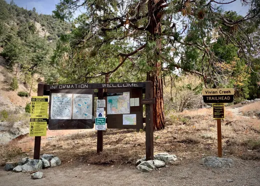
Vivian Creek Trail 1E08
The Vivian Creek Trail is the shortest and the steepest route to the summit of Mt. San Gorgonio, located in the San Gorgonio Wilderness Area. There are three designated wilderness campsites on this trail: Vivian Creek Camp at 7,100' (no camping within 200 feet of the trail or creek), Halfway Camp at 8,100' (water is obtained from the creek 200 yards before camp), and High Creek Camp at 9,200' (water flows the best in this creek right below the camp).
The summit of San Gorgonio (11,499') is 3 miles beyond High Creek, which you can also camp at. The upper end of this trail offers outstanding views of Yucaipa Ridge and Galena Peak, as well as sweeping panoramic views from the top of Mt. San Gorgonio.
At a Glance
| Current Conditions: |  Hiking at high elevations (Cucamonga Peak, Ice House Canyon, San Gorgonio Peak, etc..) in winter, spring and even early to mid-summer requires experienced mountaineering skills and IS NOT recommended for those unprepared for extreme conditions that can change very quickly.
A small upper portion of the trail burned in the 2020 Apple Fire. Potential hazards include falling trees and limbs and loose rocks. Portions of the trail may be damaged or blocked with debris. Hiking at high elevations (Cucamonga Peak, Ice House Canyon, San Gorgonio Peak, etc..) in winter, spring and even early to mid-summer requires experienced mountaineering skills and IS NOT recommended for those unprepared for extreme conditions that can change very quickly.
A small upper portion of the trail burned in the 2020 Apple Fire. Potential hazards include falling trees and limbs and loose rocks. Portions of the trail may be damaged or blocked with debris. |
|---|---|
| Fees: |  Adventure Pass Required $5/day or $30/year. Interagency Passes are also accepted to park at trailhead, and in lower overflow parking lot below picnic area. For more information, please visit our recreation pass page. Adventure Pass Required $5/day or $30/year. Interagency Passes are also accepted to park at trailhead, and in lower overflow parking lot below picnic area. For more information, please visit our recreation pass page. |
| Permit Info: | Wilderness permits are required. Permits can be obtained online at San Gorgonio Wilderness Association (SGWA) permits webpage.
|
| Usage: | Light |
| Restrictions: |
 Pack out what you pack in and Leave No Trace! Pack out what you pack in and Leave No Trace! |
| Closest Towns: | Forest Falls, Mentone, Yucaipa |
| Restroom: | Pit toilets |
| Information Center: | Mill Creek Visitor Center 34701 Mill Creek Road Mentone, CA 92359 1-909-382-2882 open Friday thru Sunday |
General Information
Directions: The trailhead is reached by turning east off Highway 38 to Forest Falls.Activities
Day Hiking
Backpacking


Location