
Official websites use .gov
A .gov
website belongs to an official government organization in the
United States.
Secure .gov websites use HTTPS
A lock
(
) or https:// means you've safely
connected to the .gov website. Share sensitive information only
on official, secure websites.


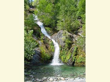
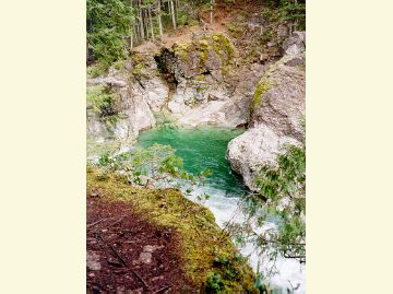
Opal Creek Scenic Recreation Area
Travel Oregon’s “Grant’s Getaways” features the Opal Creek Wilderness
This popular destination, known for its great beauty where old growth towers above the Little North Santiam River, is enjoyed by around 20,000 visitors each year.
Legislation designating the Opal Creek Wilderness and the Opal Creek Scenic Recreation Area was passed in 1996 and established November 1998. The Opal Creek Scenic Recreation Area is 13,538 acres. It includes Elkhorn Creek, a Wild and Scenic River. The Opal Creek Wilderness is 20,827 acres and includes the 8,000 acres of the Bull of the Woods Wildernes, located within the Willamette National Forest Boundary. After the designations, an advisory council was set up to guide management of this special area.
Today, many trails traverse across Opal Creek Wilderness and the adjoining Bull of the Woods Wilderness.
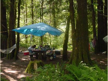
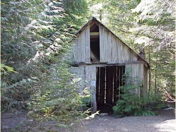
The Opal Creek Ancient Forest Center, a non-profit under a special use permit with the Willamette and Mt. Hood National Forests, operates from jawbone flats, a historic mining town in the heart of the forest.
Special regulations are in place to help protect this area and preserve the experience for you and for future visitors. Please practice Leave No Trace Principles during your visit. Garbage service is not provided so please pack-it-in pack-it-out.
At a Glance
| Current Conditions: | 03/25/2024: Forest Service road accessing Opal Creek Scenic Recreation Area is closed due to Beachie Creek and Lionshead Fires closure. See map of Beachie Creek and Lionshead Fire closure area. |
|---|---|
| Usage: | Heavy |
| Restrictions: | Special regulations are in place to help protect this area and preserve the experience for you and for future visitors including:
|
| Closest Towns: | Detroit, OR |
| Restroom: | At Opal Creek Trailhead |
| Information Center: | Detroit Ranger Station |
General Information
Parking:Tightly packed cars and resulting congestion can prevent emergency vehicle access; please park only in designated spots.
Parking Restrictions
Forest Road 2209
- Parking allowed only along the south shoulder within ¼ mile of the Opal Creek Trailhead and at the designated trailhead parking areas for Henline Falls, Henline Mountain and Nasty Rock Trailheads.
- 15 minute parking limit at the visitor information kiosk at the 2209/2207 road junction.
Forest Road 2207
- No parking along Road 2207 between the junction with Road 2209 and the Shady Cove Bridge.
- No parking along the south side of Road 2207 between Shady Cove Bridge and the eastern Opal Creek SRA boundary. Parking on the north shoulder allowed.
- Access into existing dispersed or undeveloped campsites open for parking, camping and day use.
General Notes:
- Overview Map of Opal Creek Scenic Recreation Area
- Opal Creek and Surrounding Area Map
- Opal Creek Vicinity Map
Close To
Activities
Day Hiking
Recreation areas with activity Day Hiking:- Battle Ax Creek Trail #3339
- Battle Ax Creek Trailhead
- Battle Ax Mountain Trail #3340
- Beachie Trail #3341
- Elkhorn Ridge Trail #3347
- Elkhorn Ridge Trailhead
- French Creek Trail #3349
- French Creek Trailhead - East
- French Creek Trailhead - West
- Henline Falls Trail #3348
- Henline Falls Trailhead
- Henline Mountain Trail #3352
- Henline Mountain Trailhead
- Kopetski / Opal Creek Trail #4187
- Little North Santiam Trail #3338
- Little North Santiam, East Trailhead (Shady Cove)
- Little North Santiam, West Trailhead (Elkhorn)
- Nasty Rock Trail #3356
- Nasty Rock Trailhead
- Ogle Mountain Trail #3357
- Opal Creek Trailhead (Gate)
- Opal Lake Trail #3372, Opal Creek Wilderness
- Opal Lake Trailhead
- Phantom Bridge Trailhead
- Whetstone Mountain Trail #3369
Backpacking
Recreation areas with activity Backpacking:- Battle Ax Creek Trail #3339
- Battle Ax Creek Trailhead
- Battle Ax Mountain Trail #3340
- Beachie Trail #3341
- Elkhorn Ridge Trail #3347
- Elkhorn Ridge Trailhead
- French Creek Trail #3349
- French Creek Trailhead - East
- French Creek Trailhead - West
- Henline Falls Trail #3348
- Henline Falls Trailhead
- Henline Mountain Trail #3352
- Henline Mountain Trailhead
- Kopetski / Opal Creek Trail #4187
- Little North Santiam, West Trailhead (Elkhorn)
- Nasty Rock Trail #3356
- Nasty Rock Trailhead
- Ogle Mountain Trail #3357
- Opal Creek Trailhead (Gate)
- Opal Lake Trail #3372, Opal Creek Wilderness
- Opal Lake Trailhead
- Phantom Bridge Trailhead
- Whetstone Mountain Trail #3369
Viewing Scenery
Recreation areas with activity Viewing Scenery:- Little North Santiam Trail #3338
- Little North Santiam, East Trailhead (Shady Cove)
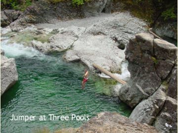
- Three Pools Day Use Area
Gold Panning
Recreation areas with activity Gold Panning:


Related Information
Highlights
- Accessible Adventures Videos
See accessible adventures at Detroit Lake & the McKenzie River Valley
Location