
Recreation
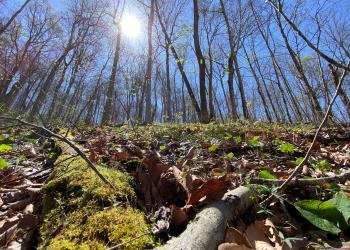
The Daniel Boone National Forest offers an abundance of outdoor recreation opportunities. Camping, hiking and fishing are just a few of the many attractions that draw more than one million visitors to the forest each year. Abundant wildlife, lush vegetation, magnificent scenery and numerous recreation opportunities offer visitors much to enjoy.


The Central Forest region of the Daniel Boone National Forest surrounds the centermost trailhead of the Sheltowee Trace National Recreation Trail in McKee, KY.

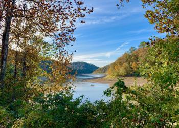
Laurel River Lake features 5,600 acres of clear, deep water and nearly 200 miles of tree-lined shore.

The Red River Gorge is a unique, scenic natural area that attracts thousands of visitors each year.
The Redbird Purchase has many recreational opportunities from hiking, fishing, picnicking, backpacking, horse riding and OHV trail riding.
The Cumberland River flows north through the heart of the Daniel Boone National Forest and offers great canoeing and rafting opportunities.

Much of the Stearns Ranger District lies within the South Fork of the Cumberland River, located in the remote foothills of the Jellico Mountains.
