
Laurel River Lake
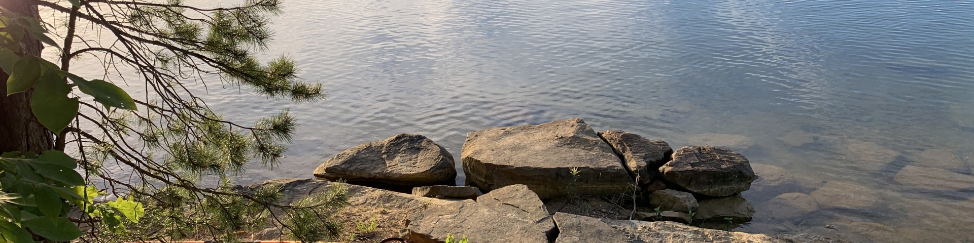
Laurel River Lake features 5,600 acres of clear, deep water and nearly 200 miles of tree-lined shore. The quiet coves and cliff-lined shores offer relaxation and quiet reflection, as well as boating, fishing, skiing and scuba diving in one of the deepest and cleanest lakes in Kentucky. Fishing for black bass, walleye, crappie, blue gill and catfish is excellent.
The U.S. Forest Service administers the lake and surrounding shoreline. The U.S. Army Corps of Engineers oversees the operation of the lake's dam and nearby recreation facilities, including a picnic area and a swimming beach at the spillway.
Laurel River Lake and the recreation sites below are located on the London Ranger District.
Complexes

Grove Boat-In Campground is one of two boat-in campgrounds on Laurel River Lake.
Grove Drive-In Campground is perched on a forested ridge above Laurel River Lake in Kentucky's Daniel Boone National Forest.
Grove Marina is located on Laurel River Lake near Grove Campground and Grove Boat Ramp. This year-round full-service marina provides boat and slip renta
Laurel Bridge Boat Ramp is located near Laurel Bridge Picnic Area and provides access to the upper arm of Laurel River Lake.
Laurel Bridge Picnic Area is located off KY 312 near the Laurel Bridge Boat Ramp and is the nearest Laurel River Lake access point to I-75 and Corbin, KY.
Bald Rock Picnic Area is located off KY 192 north of Laurel River Lake and offers a great place for picnicking as a group.
Cane Creek Wildlife Management Area is cooperatively managed with the Kentucky Department of Fish and Wildlife Resources to promote and sustain native wildlife populations.
Craigs Creek Boat Ramp provides access to Laurel River Lake, across the lake from Holly Bay Marina.
Craigs Creek Group Campground is located off Craigs Creek Road (#62) on the Craigs Creek arm of Laurel River Lake.
Holly Bay Recreation Area is located on the west side of Laurel River Lake and offers a variety of family-friendly recreation opportunities. The area includes a developed campground with wooded campsites near the lakeshore, a bathhouse with showers, a boat ramp, a fish cleaning station and easy access to Sheltowee Trace National Recreation Trail #100 and Wintergreen Trail #480. The area is adjacent to Holly Bay Marina, a full-service marina where visitors may rent boats and purchase fuel, groceries, and other supplies. Nearby Spillway Beach, managed by the U.S. Army Corps of Engineers, provides public swimming access to the lake.
Fishing Point is a popular fishing area is located off of Forest Service Road 611B near the Laurel River Dam. A paved trail along the lake provides anglers an opp
Holly Bay Boat Ramp is located on Laurel River Lake and provides public boat access at Holly Bay Marina.
Holly Bay Campground is the perfect launch point for exploring Laurel River Lake.

Holly Bay Marina is located on Laurel River Lake near Holly Bay Campground and Holly Bay Boat Ramp.
Long Bend Fishing Site is a popular fishing area located off of Forest Service Road 611A near Laurel River Dam.
Marsh Branch Boat Ramp is located on the northwest side of Laurel River Lake and provides the closest boating access to White Oak Boat-in Campground.
White Oak Boat-In Campground is one of two boat-in campgrounds on Laurel River Lake.
Flatwoods Boat Ramp is located along the shores of Laurel River Lake adjacent to the Flatwoods Picnic Area.
Flatwoods Picnic Area is located at the end of Flatwoods Picnic Area Road (#758C) along the shores of Laurel River Lake.