Explore the Trail by Region
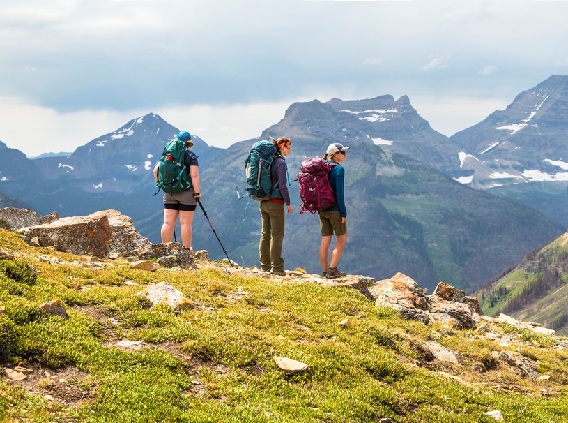
The Continental Divide Trail (CDT) stretches 3,100 miles from the Mexican border, winding through New Mexico, Colorado, Wyoming, Idaho, and Montana to reach the Canadian border in Glacier National Park. Learn more below about what kinds of landscapes and wildlife each state has to offer.
New Mexico
820 Miles
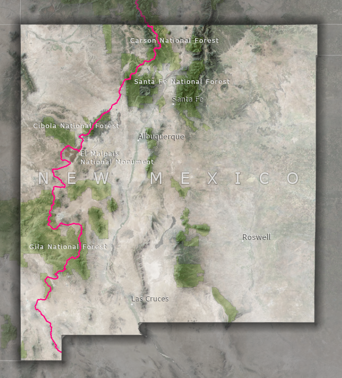
The southern end-point of the CDT can be found in the bootheel of New Mexico, at the Mexican border. Most thru-hikers, people who attempt to traverse the entire trail in one go, will start here to avoid the deep snow still clinging to the mountains in Montana during the spring. In the expanse of the Chihuahuan Desert, the Continental Divide may not be an obvious feature, but the hidden life of the desert may reveal itself to those who look closely. Gila monsters and javelinas roam through the mesquite, yucca, and grasses of the Chihuahuan Desert, but more likely encounters are with smaller reptiles and diverse bird life.
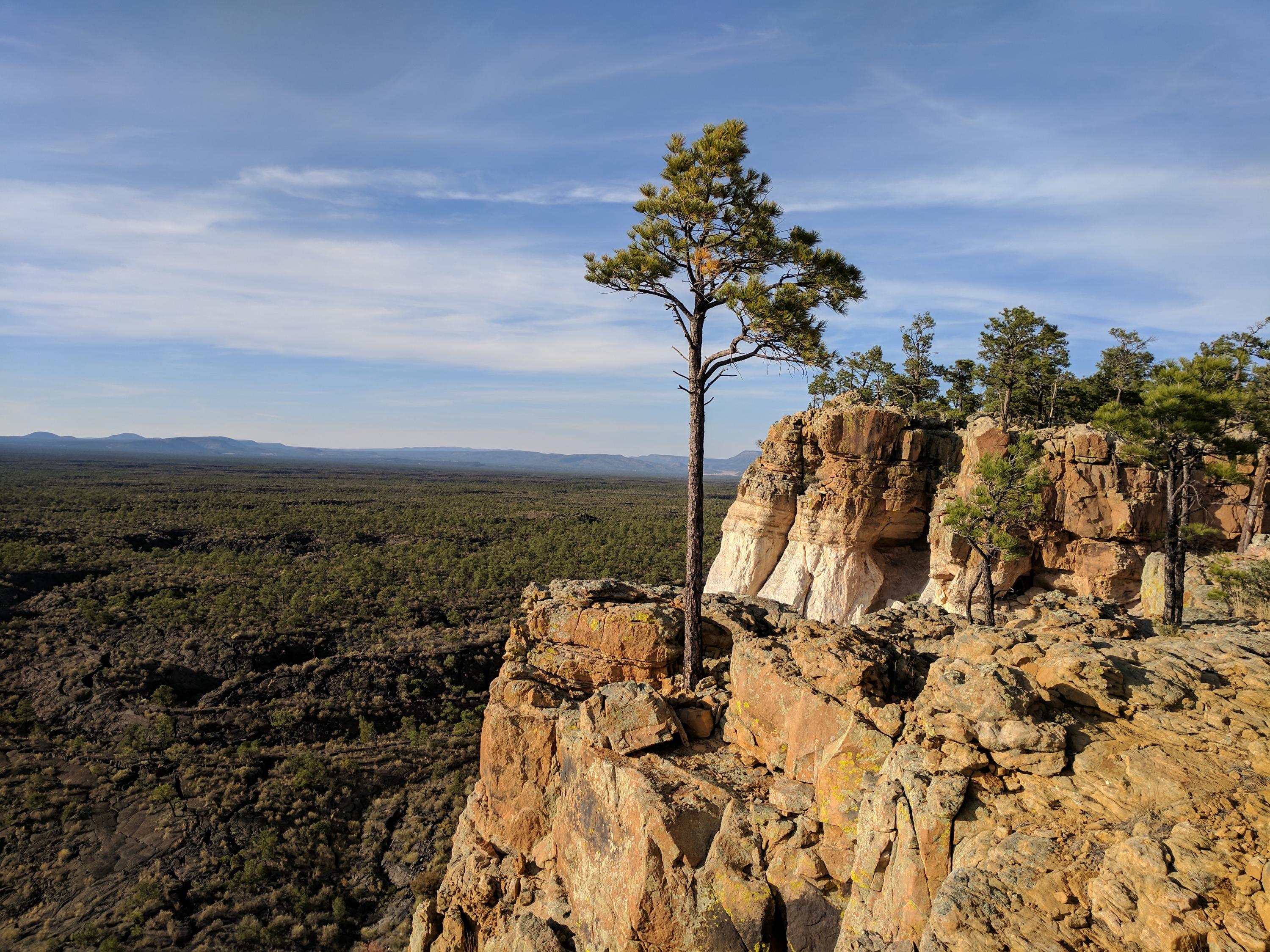
To the north, the trail passes through El Malpais National Monument, a sea of dark volcanic rock. The blooms of wildflowers and cactus add splashes of color to the landscape, and the region is home to the oldest Douglas fir trees in the American Southwest. Herds of elk roam the land, and bats find roosts in the lava tube caves left by ancient volcanic activity.
Higher elevations in New Mexico are dominated by Pinyon-juniper and Ponderosa pine forests, home to larger mammals such as gray foxes, black bears, elk, and mule deer.
Colorado
750 Miles
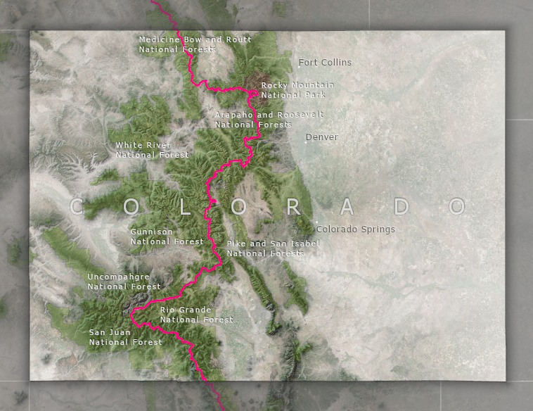
The CDT in Colorado is dominated by the sharp, tall spine of the Rockies. The average elevation of the trail in Colorado is 10,000 feet above sea level, and along the way summits the highest peak on the Continental Divide, and also the highest elevation of any National Scenic Trail: Gray’s Peak, a stunning 14,270 feet above sea level. The alpine tundra and high-elevation pine forests of Colorado are home to mountain goats, coyotes, pikas, black bears, and elk.
Heading north from the border with New Mexico, the CDT soon enters the Weminuche Wilderness, Colorado’s largest designated wilderness area, situated in the Rio Grande and San Juan National Forests. This 100-mile section of the CDT is known for its ruggedness and isolation, and presents a thrilling and rewarding challenge for hikers.
Other alpine highlights along Colorado’s Continental Divide Trail include the Collegiate Peaks and Rocky Mountain National Park, both boasting unparalleled views of glacial lakes, deep rounded valleys, and sharp, snow-capped summits.
Wyoming
510 Miles
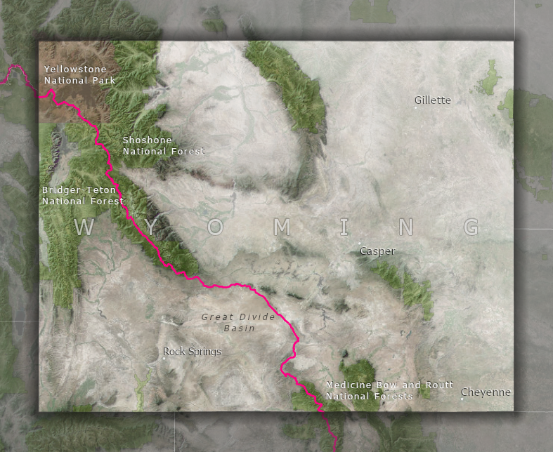
The Continental Divide Trail traverses diverse and unique landscapes in Wyoming. Descending northward from the high peaks of Colorado, the trail enters the Great Divide Basin. Here, the Continental Divide splits into two, forming a circle around a vast desert-like plain. The small amount of precipitation that does fall in this basin does not join streams or rivers flowing to the Atlantic or the Pacific Ocean, but stays put, absorbed by the thirsty earth. Wild horses roam this desert, along with pronghorn, mule deer, and diverse bird life.
To the north, the CDT climbs out of the desert and into the mountains of the Wind River Range, known for its jagged peaks and alpine meadows. The Wind River Range also contains 7 of the largest 10 glaciers in the lower 48 states. Wildlife in the mountains of Wyoming is truly wild, with remote forests and glacial valleys providing habitat for moose, elk, deer, black and grizzly bears, and mountain lions.
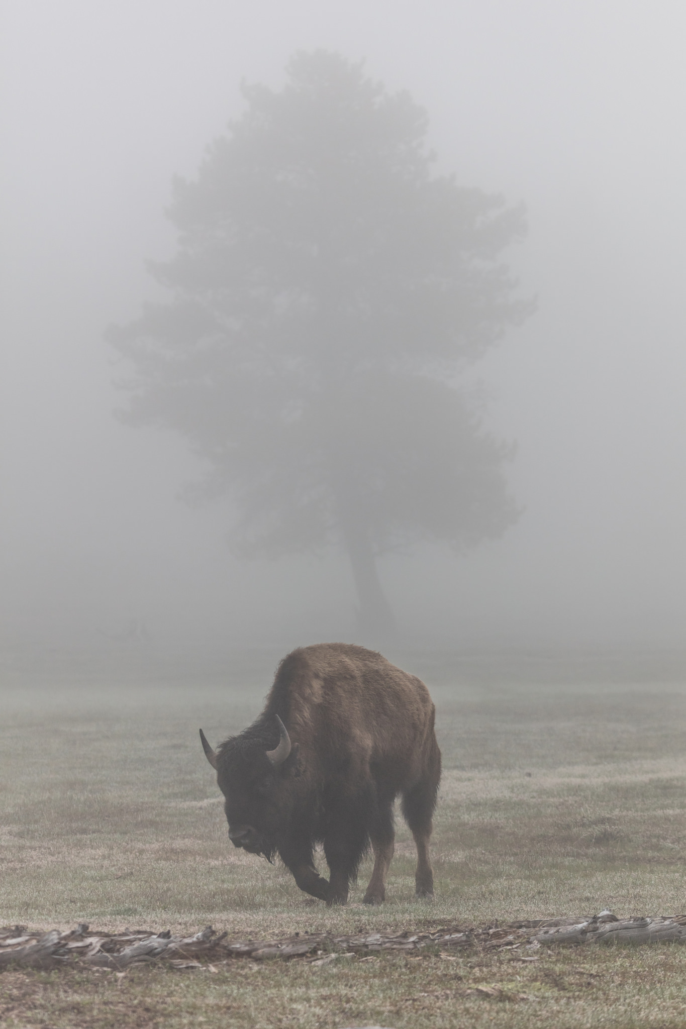
A stunningly unique highlight in the northeastern corner of Wyoming is the famed volcanic landscape of Yellowstone National Park. The Continental Divide Trail passes directly by the nation’s favorite geyser, Old Faithful, but also offers opportunities to enjoy less-traveled areas of the park containing geysers, colorful hot springs, and diverse wildlife.
Idaho and Montana
1020 Miles
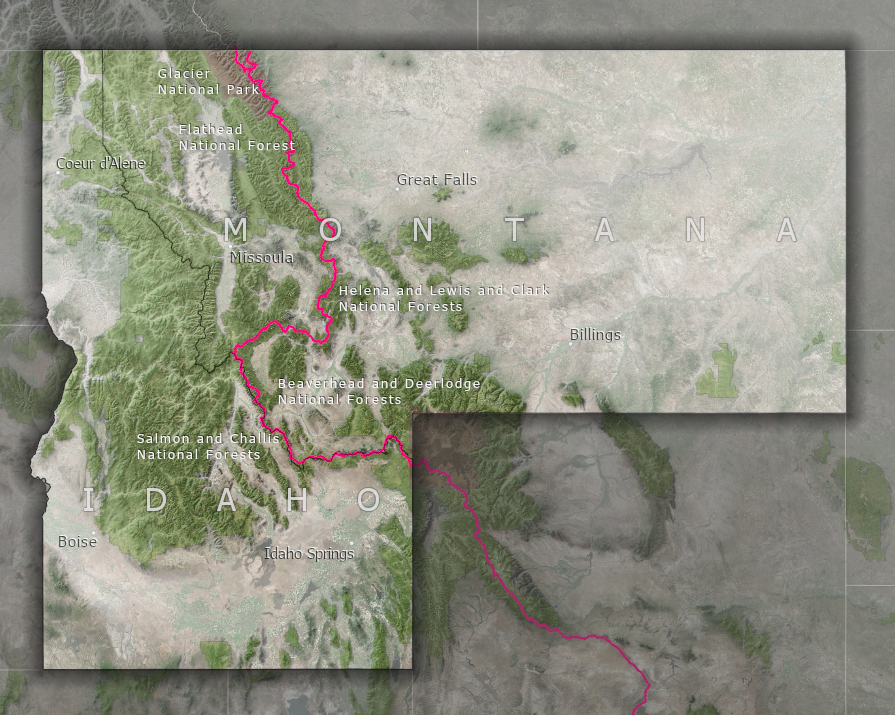 The Continental Divide Trail weaves along the border of Montana and Idaho before turning north, traversing Big Sky Country towards Glacier National Park and the Canadian border. Here, the trail passes through open prairies, forested valleys, and majestic mountains, which provide habitats for large wildlife such as mountain goats, grizzly bears, and gray wolves, as well as beavers, river otters, and bald eagles. Streams flowing from the Continental Divide are packed with trout, making this region popular for recreational fishing.
A memorable location on Montana’s CDT is the tall, unbroken limestone cliff face of the 22 mile long Chinese Wall in the Bob Marshall Wilderness, situated within the Flathead National Forest.
The lowest elevation along the Continental Divide Trail, at 4,200 feet above sea level, is actually at the northern endpoint of the trail: Waterton Lake on the Canadian border.