

Aviation Risk Management
Fostering a positive safety culture
IMPORTANT: Links to Safety Alerts, Bulletins, Safecom, Spatial Tool for Aviation Risk (STAR), Job Hazard Analyses and more (view Resources and Tools). |
Risk Management is a component of the System Safety process which considers all elements of program management, planning and implementation to continuously improve operational safety. Our goal is zero accidents. Working toward that goal involves and empowers all participants to eliminate hazards or mitigate risk to acceptable levels.
Based largely upon the time available to recognize and respond to a hazard or combination of hazards, Risk Management can be broken down and accomplished in three levels: 1) strategic, 2) deliberate and 3) time critical.
Risk Assessments
FHP’s Programmatic Risk Assessments are strategic and intended to:
- Guide FHP, Cooperators and support staff in management, planning and implementation.
- Provide key hazards and mitigations to be emphasized during deliberate risk management (such as job hazard analysis and tailgate safety meetings).
- Raise awareness and reduce the likelihood of an emergency requiring time critical action.
The assessments provide mitigation measures that reduce likelihood and/or outcome severity for over 450 hazards.
Background
On January 14, 2008 FHP Subject Matter Experts initiated Programmatic Risk Assessments for Aerial Application, Aerial Survey and Aerial Photography. These assessments were reviewed and distributed to FHP Unit Aviation Officers (UAO) and to the National Aviation Safety and Training Officer prior to the 2008 flight season for consideration in planning, management and operations of all FHP and Cooperative aviation activities.
The assessments evaluate hazards throughout FHP and Cooperative aviation and are part of an on-going, systematic approach to controlling risk in operations. Remaining effort is needed to identify hazards in common with other aviation programs and operations, prioritize mitigations, develop actions to implement mitigations and provide for continuous feedback within the System Safety Process.
Aviation Risk Assessments
Direct comments or suggestions for improvement to your area FHP UAO or FHP National Aviation Safety Manager.
Resources and Tools
Fire & Aviation Management Safety Center
Incident Information and Communications ![]() – Incident information, communication, dispatch contacts, etc.
– Incident information, communication, dispatch contacts, etc.
Safecom ![]() – report anything with potential to cause an aviation-related mishap and query the database for “watch-outs”
– report anything with potential to cause an aviation-related mishap and query the database for “watch-outs”
SPATIAL TOOL FOR AVIATION RISK (STAR) – A multi criterion risk analysis product highlighting areas with relatively higher aviation risk based on a selection of easily ranked and modelled environmental factors. STAR should be referenced at local and national scales during preseason and preoperational safety briefings for aerial survey, during strategic planning, and coupled with the 2012 National Insect and Disease Risk Map provides supplemental information helpful in: 1) prioritizing areas for alternative data capture techniques or methods development and 2) contracting or procurement efforts targeting aircraft with specific performance criteria.
Note: Aircraft operations are part of complex systems, STAR does not examine all hazards that may exist; therefore, the course scale aviation risk portrayed can increase or decrease based on local conditions. Report, map images and data for the Lower 48 are available for download:
- 2013 STAR Model Analysis Report (5.8 MB .PDF)
- Flight Risk Ten-Class Map/Data for ArcGIS and DASM:
Flight Risk Ten-Class Map (3.3 MB .PDF)
Flight Risk Ten-Class Data (1 KB .TFW)
Flight Risk Ten-Class Data (14 MB .TIFF) - Flight Risk Nine-Class Map/Data for ArcGIS and DASM:
Flight Risk Nine-Class Map (1.6 MB .PDF)
Flight Risk Nine-Class Data (1 KB .TFW)
Flight Risk Nine-Class Data (14 MB .TIFF)
Job Hazard Analysis
Customize and use for your aviation project
Subject Matter Experts
Dick Stefanski – FHP Survey Pilot, Region 2
Kathy Matthews – FHP Survey Coordinator, Regions 1 & 4
Amy Hill – FHP Entomologist/AASC, Morgantown WV
Phil Mocettini – FHP Biological Technician, Region 4
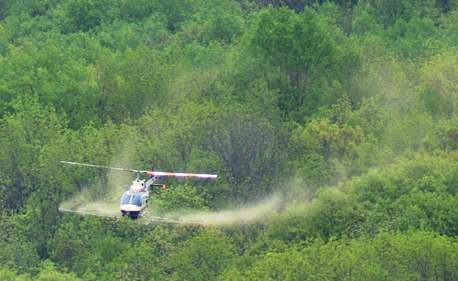
Aerial application.
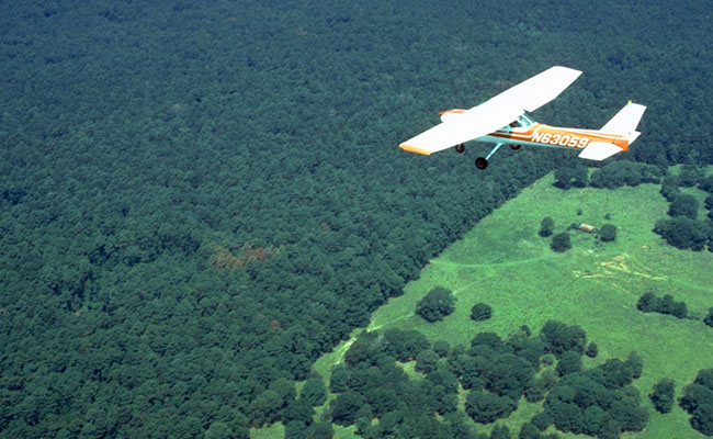
Aerial detection survey of Southern Pine Beetle. Photo: Ronald F. Billings, Texas A&M Forest Service, Bugwood.org
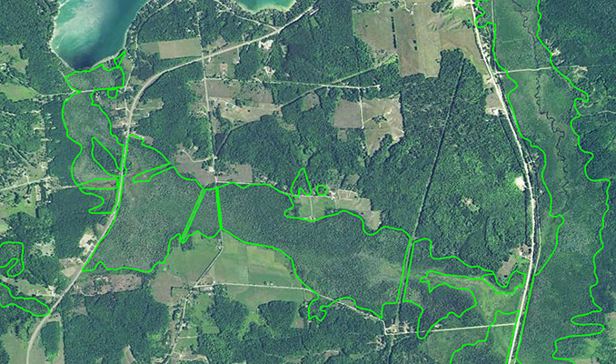
Remote Sensing. NAIP imagery showing damaged tree crowns of forested wetland boundaries. Photo: Colton Arnspiger, US Forest Service, Forest Health Assessment and Applied Sciences Team