
Recreation
View the Recreation opportunities, sites, trails, and areas on the Gifford Pinchot National Forest.
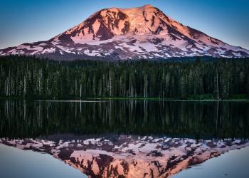
The Gifford Pinchot National Forest has many areas and places to explore through hiking, biking, climbing, fishing, hunting, snow sports, and many others.

This area is located in the Northern most portion of the Gifford Pinchot National Forest in southwest Washington, and comprises about 575,000 acres.
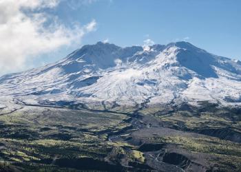
The Mount St. Helens National Volcanic Monument and District contains many wonderful places to see and explore.
This area is located in the eastern portions of Gifford Pinchot National Forest in southwest Washington and comprises 367,000 acres.
Ape Cave Interpretive Site
Site Open
Explore a chilly, pitch-black lava tube over two miles long. A short, paved, accessible trail beneath towering trees leads to a stairwell into the cave. The ¾ mile, one-way lower cave route is…
Bear Meadow Interpretive Site
Site Open
On May 18, 1980, Gary Rosenquist was camped at this site and took a series of photos capturing the first few moments of the landslide and eruption, barely escaping with his life. The site offers a…
Blast Edge Viewpoint; Monument Entry
Site Open
The lateral blast during the 1980 eruption thundered across the landscape as far as 17 miles from the volcano, blasting away, flattening or leaving standing dead trees. Stop and marvel at the…
Boating Site: Goose Lake
Site Open
Concrete boat ramp with a 10 vehicle parking lot.Fishing for stocked trout including rainbows and browns can be fair to excellent. Small brook trout and native cutthroat are also present. Try olive…
Boating Site: Mosquito Lakes
Site Open
Mosquito Lake is a beautiful subalpine lake with good fishing in season. It is an ideal lake for canoeing It has a paved parking area that holds 4 vehicles and a primitive boat ramp.
Campground: Adams Fork
Site Open
This wooded area along the Adams Fork of the Cispus River makes a great campground location. The campground contains historic basket trees used by the Upper Cowlitz Tribe and has interpretive…
Campground: Atkisson Group Camp
Site Open
Sitting just west of Washington's second largest mountain, Mt. Adams, Atkisson Group Camp is open for campers between May and September and becomes a Sno-Park for a variety of winter recreation…
Campground: Beaver
Site Open
Beaver Campground is nestled among large, old maple and sycamore trees, offering a quiet and private family camping experience. Its location along the Wind River provides opportunities for anglers,…
Campground: Big Creek
Site Open
Big Creek Campground is a single-loop campground located close to the west entrance of Mt. Rainier National Park. It is also close to Glacier View Wilderness and the Sawtooth Trail system including…
Campground: Blue Lake Creek
Site Open
Blue Lake Creek Campground is a small campground (11 single sites) off of Forest Road 23. The campground itself is located in a small hardwood stand surrounded by conifers. Sites are typically open…