
Official websites use .gov
A .gov
website belongs to an official government organization in the
United States.
Secure .gov websites use HTTPS
A lock
(
) or https:// means you've safely
connected to the .gov website. Share sensitive information only
on official, secure websites.


Cathedral Rock Trail No. 170
ALERT: The Cathedral Rock Trail will be closed for trail maintenance from Feb. 28 - April 13 on Wednesdays through Saturdays from 8 a.m. - 4:30 p.m. See a map of the closure here.

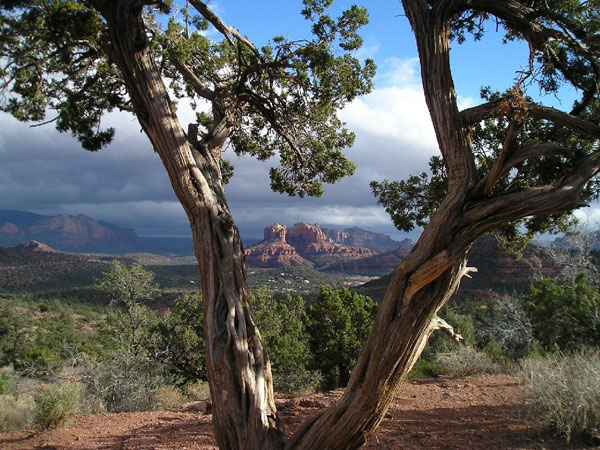
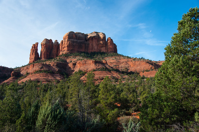
More of a rock climb than a hike, this trail is unshaded and steep and difficult in places. Follow the basket cairns across the wash and up the moderate slope toward the spires. At 0.25 mile, the trail emerges on a broad ledge with nice views. Then, it ascends steeply over bald rock and in a shallow cleft with a few toeholds notched into the rock to help on the steeper places.
Emerging on a small knob, cairns show the way up and across several ledges toward the deep drainage ahead which it follows, climbing moderately steeply to the top of a wide saddle between two spires. Great views all along, but quite spectacular from the top. An unmaintained path leads south along the west base of the spires giving access, with short climbs, to two more saddles between sheer rock faces and a close-up view of an exposed lava dike at the first. Return by the same route for a 1.5 mile hike. Hot in summer.
At a Glance
| Area Amenities: | Toilets |
|---|---|
| Usage: | Heavy |
| Best Season: | Spring thru Fall |
| Busiest Season: | Summer |
| Closest Towns: | Sedona, AZ |
| Passes: | Red Rock Pass or America the Beautiful Pass required to park at the trailhead. |
| Operated By: | Red Rock Ranger District - 928-203-2900 |
General Information
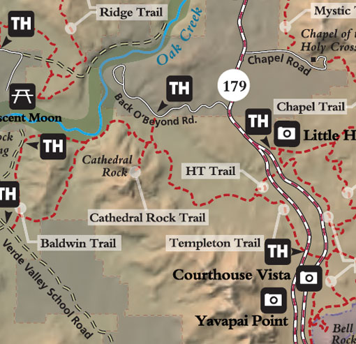
Directions:Location: 38 miles south of Flagstaff in scenic Red Rock Country.
Directions: From the junction of Routes 89A and 179, take 179 south 3.5 miles to Back O' Beyond Road on the right. Go 0.6 miles to the trailhead parking turnout on the left.
GPS (Map): 34°49'30.7"N 111°47'18.3"W
Maps
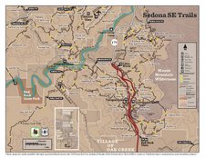
- Red Rock Country Maps: Download Red Rock Country trail maps and find other Sedona recreation resources. See the Sedona Southeast [PDF] map for this trail system.
- Red Rock Recreation Guide [PDF]: Info on hiking, biking, camping, and more in Arizona's magnificent Red Rock Country. Download the guide or pick one up at the Red Rock Ranger District Visitor Center.
- The Digital Travel Map Whether you're driving, hiking, riding, or exploring, you will find this full-color, GPS-enabled map a handy reference to have on your mobile device. The map show trails, recreation sites, major landmarks, and forest roads.
- Forest Service Topo Map (FSTopo Geo-enable PDF)
- More Maps:
Click map thumbnail for larger view.
General Notes:
Uses: Hiking only. Not safe for horses or bicycles
Activities
Day Hiking
Amenities
| Toilets: | Vault-type toilet |
|---|

Related Information
Location

