
Official websites use .gov
A .gov
website belongs to an official government organization in the
United States.
Secure .gov websites use HTTPS
A lock
(
) or https:// means you've safely
connected to the .gov website. Share sensitive information only
on official, secure websites.


Call of the Canyon Picnic Site
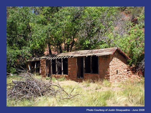
This picturesque day use site in Oak Creek Canyon is at the trailhead of the West Fork of Oak Creek Trail. The trail follows the West Fork stream into a side canyon of Oak Creek Canyon, rich with maples and breathtaking beauty. Bring a picnic, your camera, and go for a hike!
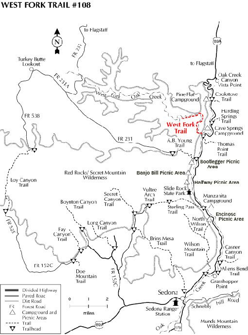
For more information, visit West Fork of Oak Creek Trail #108.
At a Glance
| Current Conditions: | Call of the Canyon (West Fork Trailhead) parking fills up every day by 9:30 a.m., seven days per week during busy seasons (summer, fall color, spring break). Have a backup plan for a different hike or day use area if the parking lot is full. |
|---|---|
| Operational Hours: |
|
| Area Amenities: | Picnic tables, Toilets, Parking |
| Fees: | Cash, check, and credit cards are accepted.
|
| Usage: | Heavy |
| Best Season: | Spring through fall |
| Busiest Season: | Summer and weekends |
| Restrictions: | Day use only. Camping is not permitted at this site. |
| Closest Towns: | Sedona, AZ |
| Water: | No Drinking Water |
| Restroom: | Vault-type Toilets |
| Passes: | Only the Grand Annual Red Rock Pass is accepted here, or you may pay the daily rate at the gate. Annual, Senior, and other Interagency passes are not accepted. |
| Operated By: | Concessionaire. 928-203-0624 |
General Information
Directions:Location: 17.5 miles south of Flagstaff (9.5 miles north of Sedona) on paved roads in scenic Oak Creek Canyon.
GPS (Map): 34°59'26.4"N 111°44'32.7"W
Access: Drive south 17.5 miles south from Flagstaff or north 9.5 miles from Sedona to about halfway between milepost 385 and 384. The West Fork of Oak Creek trailhead is on the west side of the highway down a paved lane that leads behind a few creekside houses.
Maps
- Red Rock Country Maps: Download Red Rock Country trail maps and find other Sedona recreation resources. See the Oak Creek Canyon North map for this site.
- The Digital Travel Map: Whether you're driving, hiking, riding, or exploring, you will find this full-color, GPS-enabled map a handy reference to have on your mobile device. The map show trails, recreation sites, major landmarks, and forest roads.
- Printed Maps: A variety of printed recreation maps for Sedona and Oak Creek Canyon can be purchased in our local offices and visitor centers, or ordered by phone.
Click map thumbnail for larger view.
Activities
Viewing Wildlife
Viewing Plants
Known for its red maples, West Fork of Oak Creek is a popular fall color destination.
Viewing Scenery
Picnicking
| No. of Sites | 6 picnic tables. |
Amenities
| Picnic tables: | 6 picnic sites |
|---|

Related Information
Location

