


Blue Mountain Ranger District
Recreation Sites, Trails and Campgrounds located on the Blue Mountain Ranger District

Billy Fields Campground is a great starting point for those wanting to hunt, fish, or look for wild horses.
This small campground offers fishing, exploring, nature watching and hunting opportunities in the Middle Fork John Day River State Scenic Waterway. The campground is
This is a great destination for berry picking, it is also a wonderful base camp for anyone wanting to hike, hunt or just explore the Malheur National Forest. The Sump
This rustic camp offers a few sites and is also a trailhead which accesses the Vinegar Hill-Indian Rock Scenic Area. From the trailhead visitors can access other trai
A pleasantly small campground tucked among ponderosa pines along a forest creek. This campground is popular with hunters. Just a short drive away from the beaut
Magone Lake Campground is situated along its namesake lake. Visitors enjoy fishing, canoeing, swimming and hiking.
This small campground along the Scenic Middle Fork of the John Day River set back amongst beautiful ponderosa pine trees is a great spot for fishing and viewing spawning st
Adjacent to Murderer's Creek, this little campground is a great base camp for hunters. Visitors to the campground can enjoy bird watching, hunting and fishing in near
The Parish Cabin Campground sets along Bear Creek affording fishing opportunities. The campground is within minutes of Logan Valley an exceptional place for viewing w
The Pine Creek Horse Camp has two sites, with picnic tables and fire rings and a vault toilet. There is a newly built two slot horse corral. The camp sets
Starr Campground is located just off of US Highway 395 making it very easy to get to. The campground has an upper level that is closer to the highway, yet still set b
Wickiup Campground sets off of Forest Road 15 tucked amongst trees, next to Canyon Creek, the perfect place to relax in the shade during the summer months and listen to the

Douglas-fir and Ponderosa pine dot this broad, flat expanse surrounding Deer Creek Guard Station. Chickadees and other songbirds flit and chatter.

As the afternoon slides into evening, gaze across the valley from your perch on the Fall Mountain Lookout. Watch as flashes of lightning cut jagged white lines throug

Murderer’s Creek was named in the 1860s, or so the story goes, after a party of eight prospectors who were exploring its banks were murdered.
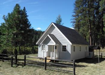
The Sunshine Guard Station is located approximately 43 miles from the town of John Day, Oregon at 3,700 feet in elevation.
The Cedar Grove Botanical Area in the Aldrich Mountains covers about 26 acres and contains the only isolated stand of Alaska yellow cedar east of the Cascades in the United
Provides access to: Buckhorn Meadows Trail #205 which accesses Strawberry Mountain Wilderness.
This trail provides access to East Fork Canyon Creek Trail #211 which accesses Strawberry Mountain Wilderness.
This rough and rugged backcountry trail takes one over granite boulder fields, through alpine meadows and affords spectacular mountain vistas.
The trailhead is near the day use area of Magone Lake. The trailhead is the starting point to explore the 1.5 mile Magone Slide Trail #353.

Fields Peak Trail, #212 starts at Fields Peak-McClellan Mtn Trailhead. Fields Peak Trail is an ATV trail.
This trail allows the recreationist access to the McClellan Mountain Semi-Primitive Roadless Area and is closed to all motorized vehicles.
This scenic trail offers a number of outstanding vistas from rocky crags and cliffs overlooking a great deal of the drainage basin of the East Fork of Beech Creek and the J
This trailhead provides access to Pine Creek Trail #201 within the Strawberry Mountain Wilderness. Ample parking at the trailhead. There are tie stalls for horse
This trail provides access to the backbone of the Strawberry Mountains within Strawberry Mountain Wild
The trailhead is the starting point for the 9.3 mile Princes Trail #251 that provides access to the Vinegar Hill-Indian Rock Scenic Area, which is non-motorized. Duri
The Starr Bowl Snowplay area provides for a day of fun on the sledding hill and a small warming cabin built during the Civilian Conservation Corps era with a big

Established in an old growth ponderosa pine stand, this area includes a short barrier-free trail with interpretive signs, longer trail through additional old growth ar
This trail into the Vinegar Hill-Indian Rock Scenic Area offers a spectacular vista of the Middle
The trailhead is a great starting point for hunters, hikers and horse riders that would like to explore the Strawberry Mountain Wilderness. This trailhead has a large
This trail gives good access to the upper end of the East Fork Canyon Creek Trail #211 and allows
This trail in Monument Rock Wilderness overlooks the Little Malheur River to the south and views o
This trail parallels Granite Boulder Creek and offers some very photogenic views.
This trail is within Strawberry Mountain Wilderness is a secondary trail off the main wilderness t

Situated at Dixie Mountain Summit along US Highway 26, the Dixie Sno-Park is a premier winter recreation hub in the Malheur National Forest.
The Starr Bowl Snowplay area provides for a day of fun on the sledding hill and a small warming cabin built during the Civilian Conservation Corps era with a big
