About the Area
About the Forest

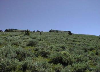
The Malheur National Forest sustains a diversity of vegetation ranging from juniper-sagebrush woodlands and bunchgrass grasslands to high elevation alpine forests of subalpine fir and whitebark pine. Extensive tracts of ponderosa pine, western larch, Douglas-fir, grand fir and lodgepole forests occur between the juniper/grassland foothills and alpine peaks. Elevations range from 4000 feet to 9038 feet atop beautiful Strawberry Mountain.
Most of the Forest lies in Grant and Harney counties, with portions in Baker and Malheur counties. State Highway 395 bisects the Forest north-to-south, and State Highway 26 from east-to-west. The Forest has 3 ranger districts: Blue Mountain Ranger District and Prairie City Ranger District in the north, and the Emigrant Creek Ranger District to the south.
About the Area Communities
John Day and Prairie City, Oregon: Grant County Chamber of Commerce: https://www.gcoregonlive.com/
Hines, Oregon: Harney County Chamber of Commerce: http://www.harneycounty.com/
Photos from Across the Forest