
Official websites use .gov
A .gov
website belongs to an official government organization in the
United States.
Secure .gov websites use HTTPS
A lock
(
) or https:// means you've safely
connected to the .gov website. Share sensitive information only
on official, secure websites.


Maps & Publications
The US Forest Service provides several types of publications and maps to the public. The material is available in many forms: brochures, maps, Recreational Opportunity Guides (ROGs), on such subjects as recreation, sightseeing, wilderness, travel management, and vegetation.
Forest Maps
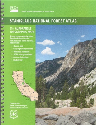 Looking for a Stanislaus National Forest map during our virtual operations?
The Forest Service publishes a variety of map products to help you plan your next adventure or enjoy your next visit. Select the "Forest Maps" link for a listing of other maps that are available from the forest.
- You can purchase National Forest Visitor Maps through our partner organization, Three Forests Interpretive Association (3FIA). Profits from sales are returned to the Stanislaus National Forest to help fund interpretive activities.
- You can purchase National Forest Visitor Maps through the US Geological Survey online store.
- Several types of mobile compatible maps are available from Avenza Maps.
- US Geological Survey website offers USGS Topographic Maps and a wide variety of maps on-line and for purchase.
In general, forest visitor and other kinds of maps may also be purchased at most Stanislaus National Forest Offices.
2023 Christmas Tree Permitted Areas Maps
Broadly speaking, only two areas are off limits for cutting Christmas Trees: designated Wilderness Areas and the Experimental Forest. The below link will take you to a map where Christmas Tree harvesting is prohibited. In addition, please do not cut any Christmas trees from any Forest Service administrative site (offices, campgrounds, or other facilities, etc.). Additional information and guidance regarding how and where to harvest your tree is contained in the permit.
Motor Vehicle Use Maps (MVUM)
The Motor Vehicle Use Map displays National Forest System routes (roads and trails) or areas designated open to motorized travel. The Motor Vehicle Use Map also displays uses allowed by vehicle class (highway-legal vehicles, vehicles less than 50 inches wide and motorcycles), and seasonal allowances.
Over Snow Vehicle Use Map (OSVUM)
The Forest Service has designated a system of trails and areas for OSV use on the Stanislaus National Forest to provide public access and ensure the safety and enjoyment for all users.
The Over-Snow Vehicle Use Map (OSVUM) identifies where and when OSV-use is authorized to occur. The Stanislaus National Forest OSV-use designations include:
- 119,104 acres of cross-country OSV use
- 24.7 miles of NFS OSV-use trails available for grooming
- 58.4 miles of un-groomed NSF OSV-use trails
- Minimum snow depth requirements
- Access our Over Snow Vehicle Use Map
Forest Publications
 Our publications fall into a few broad categories: administrative, general, recreation and research publications.
Stanislaus Forest Visitor Guide - New Edition - 2023
Your free guide for recreation all year round. Available online in both English and Spanish editions and at Stanislaus National Forest Offices and Visitor Centers.
Un Viajero al Stanislaus: Guía para vi sitantes del Bosque Nacional Stanislaus
Recreation Opportunity Guides (ROGs)
These are just a sampling of the types of handouts that are free at your local forest office. Check back! As ROGs are updated they will be posted here.
Wilderness
Know Before You Go
- 16-02a: Recreation facilities on Highway 108
- 16-02b: Recreation facilities on Highway 4
- 16-02c: Recreation facilities on Highway 120
- 16-03: Dispersed camping
- 16-04: Accessible recreation opportunities
- 16-05: Canine camper
- 16-06: Camping tips: what to know before you go
- 16-35: You can report on trail conditions
- 16-53-03: Pinecrest Recreation Area
- 16-61: Things to "bear" in mind
- 16-64: Mountain lions in the central Sierra
- 16-70: Hunting game or birds
- 16-100: Forest rules you need to know
- 16-104: Fire Restrictions - high hazard areas
- 16-101: Firearms Protocol
- 16-111: Heating your home with wood
Things To Do
- 16-08: Horse Camping
- 16-41 Favorite Hiking Trails
- 16-51-02: Highway 108 Picnic and Day Use Areas
- 16-51-03: Westside Rails Tuolumne City to North Fork Tuolumne River
- 16-51-04: Railroad logging on the Strawberry Branch
- 16-51-05: Trails: Lyons Reservoir to Fraser Flat
- 16-51-08: Bourland Trestle - Gateway to timber
- 16-53-01: Brightman Flat Complex
- 16-53-02: Clark Fork Recreation Area
- 16-53-03: Pinecrest Lake Basin Recreation Complex
- 16-71: Favorite Fishing Holes on the Stanislaus National Forest
Forest Products, Rocks, and Gold Panning
- 16-110: Personal use fuelwood gathering program
- 16-112: Gold panning, dredging and mining
- 16-117a: Forest products
- 16-117b: Rock collecting permits

Related Links
Highlights
- Maps for mobile devices
-
Fire Restrictions Map

Forest Orders are issued declaring campfires under restriction during dry weather trends.
Featured Events
- Silly Songs and Nature Crafts at Pinecrest Amphitheater
Date(s): Jun 25, 2024 - Jul 30, 2024 - Junior Ranger Club at Pinecrest Fishing Pier
Date(s): Jun 26, 2024 - Jul 31, 2024 - Campfire Programs at Pinecrest Amphitheater
Date(s): Jun 26, 2024 - Jul 31, 2024 - Yoga at Pinecrest Beach #3
Date(s): Jun 27, 2024 - Aug 8, 2024 - Me-Wuk Lifeways (Summit Ranger Station)
Date(s): Jun 27, 2024 - Aug 1, 2024 - Fishing Fridays at Pinecrest Fishing Pier
Date(s): Jun 28, 2024 - Aug 2, 2024 - Tree ID with the Ranger at Pinecrest (Miwok and Summit Ranger District)
Date(s): Jun 28, 2024 - Aug 2, 2024 - Wildflower Walk and Making Tracks at the Summit Ranger Station
Date(s): Jun 29, 2024 - Aug 3, 2024

