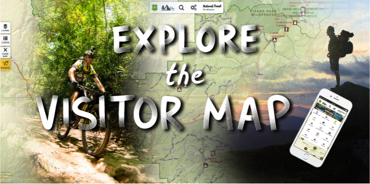
I was recently fortunate to receive some public feedback on the USDA Forest Service Visitor Map, a digital, interactive map I helped build that assists members of the public find outdoor activities to enjoy on national forests.
The Visitor Map was created in 2016 as a direct response to customer interest and feedback. Recreation sites on our website are routinely in the top 10 of our nearly 50,000 weekly website views. In website feedback, the public asked for a map to help them find recreational activities. The Visitor Map began in website form, as the Interactive Visitor Map, which still exists on the Forest Service front page, or directly at https://www.fs.usda.gov/ivm/. The public loved it, and it was used and shared so often that it became, and still is, our most popular website after the main Forest Service landing page.
Good customer service is a huge priority at USDA, so it was gratifying to know that we met the public’s needs. This feedback gave me a window to see just one of the ways the Forest Service improves people’s lives, especially during Customer Service Week (Oct. 7-11, 2019). I’d like to share a snapshot of one customer’s experience.
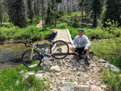
Bob Huber visited his first national forests in 1964 while on a road trip from New Haven, Connecticut, to Berkley, California, camping all the way. He has visited many national forests and worn out piles of paper maps since then, including three extended bicycle camping trips this year.
Now retired and living in Appleton, Wisconsin, he is a big fan of the Visitor Map. He remembers his lifetime of forest visits with paper maps fondly, but prefers the modern convenience and updated data on the Visitor Map. He visited the Boise, Payette and Sawtooth national forests during his trips this year, and used the Visitor Map to help him plan.
“It’s easy to plan a trip without spreading out many paper Forest Service maps. I like the quick access to data about the area I’m about to visit,” he explained, and added, “It’s very important for picking out campsites and highway vehicle appropriate roads for our chase vehicle, as well as zeroing in on areas with the numbers of campsites, trailheads and roads showing.”
Bob said his favorite memory from his most recent trip was riding over Lick Creek Summit from McCall, Idaho, and the long descent to the South Fork of the Salmon River and then up the paved road to Poverty Flats, all in Payette National Forest.

It’s great to hear the difference the Visitor Map has made, but we continue our commitment to service. The public asked for more, a mobile app to better reflect how they consume and use information, so we produced the Visitor Map app. Soon, in response to even more customer feedback, the app will have offline capability. This will allow users to either select a custom map area or an entire forest and download the latest map data to their device, so they can access the information without cellular connectivity.
The Visitor Map mobile app puts access to the 193 million acres of national forests and grasslands into customers’ hands. Users can easily find recreational activities across the country without having to carry a map or use a computer. They can even get wildfire and weather warnings to help them prepare safely. Further, the app is interactive—users can share the map and their activities on social media. The mobile app is available for Android and iOS. It can be found through the Apple and Google Play stores.
The map was built through a collaborative partnership with the Office of Communication, Geospatial Technology and Applications Center, Recreation and Chief Information Office staffs within the Forest Service.