
Official websites use .gov
A .gov
website belongs to an official government organization in the
United States.
Secure .gov websites use HTTPS
A lock
(
) or https:// means you've safely
connected to the .gov website. Share sensitive information only
on official, secure websites.


Blue Mountains Forest Plan Revision Maps
This page is for archive purposes only. To get the most up-to-date documents and information about the Blue Mountains planning process please click on our Final Blue Mountains Planning page.
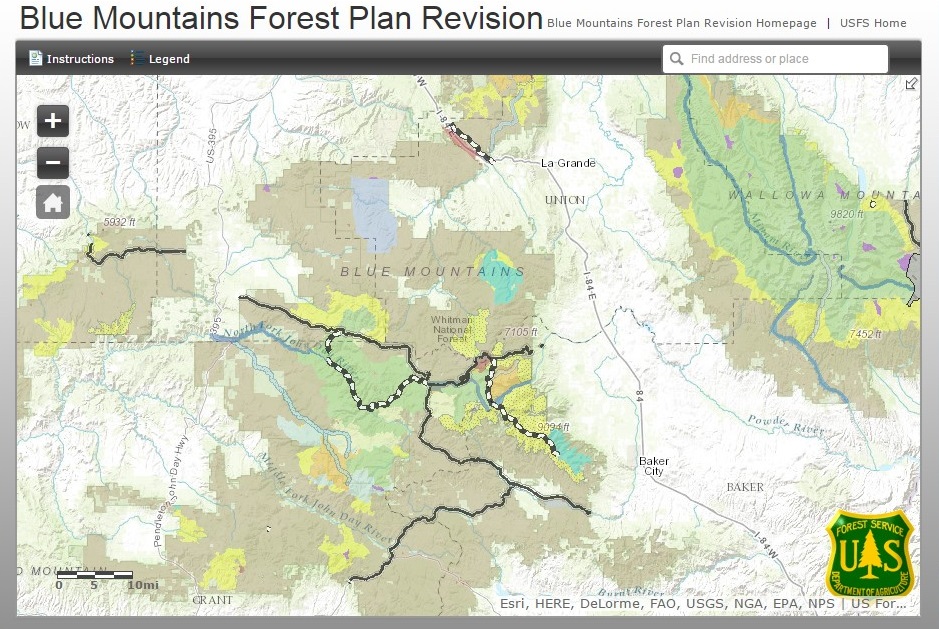
INTERACTIVE MAP
This site is best viewed using Chrome, Firefox or Internet Explorer 9 (or higher). In order to see the Legend, change the map layers, or print the map, it needs to be viewed in FULL SCREEN mode. Map can also be viewed on all mobile devices. If you experience technical issues with the Interactive Map, please call 541-523-1246.
Detailed Maps of Management Areas by Alternative
Malheur National Forest
Umatilla National Forest
Wallowa-Whitman National Forest
General Maps of Management Areas by Alternative
Malheur National Forest
Umatilla National Forest
Wallowa-Whitman National Forest
GIS Shape Files of Management Areas by Alternative
GIS Shape Files of Resources
Forest/Theme |
Shapefile/Data Set Description |
|---|---|
|
Malheur National Forest |
|
|
Umatilla National Forest |
|
|
Wallowa-Whitman National Forest |
(West) RMAs for Alternative C (East) RMAs for Alternative C |
|
All Three Blue Mountains National Forests |