

Explore the GO

You don't need a map to explore the Geospatial Office (GO) -- but you'll find one around every corner! At the GO, we advance the Forest Service mission through the application of new geospatial science, technology, and methods to meet business requirements.
Visualizing the Changing American Landscape
Online App Provides National Landscape Change Time-Lapse Imagery

Interested in how our national landscape changes over time? In February 2021, USDA Forest Service released its expanded online Landscape Change Monitoring System (LCMS), a publicly available dataset that combines remote sensing products (including Landsat imagery) with reference data to create meaningful spatial data products such as time-lapses showing annual vegetation change, land cover, and land use. The release, developed by staff at the agency's GO in Salt Lake City, greatly expands LCMS's coverage to include the entire continental United States and South and East Coastal Alaska. The update also adds five new data layers covering 1985 the present.
LCMS Data Viewer is Online
In 2020, the USDA Forest Service released an updated version of its Landscape Change Monitoring System (LCMS), a publicly available online tool that utilizes satellite data to generate annual maps showing vegetation change, land cover, and land use over time. The new release, developed cooperatively by the Rocky Mountain Research Station (RMRS) and the Geospatial Office (GO), adds the 2019 data layer to the previously available layers going back to 1985. Check it out here: https://apps.fs.usda.gov/lcms-viewer/
How is GO Remote Sensing Applied to Forests?
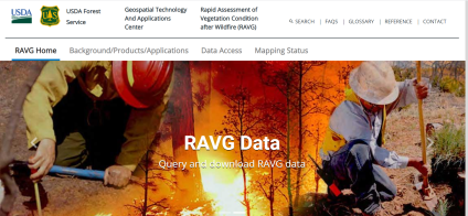
Ever wonder how our remote sensing services are applied on the National Forests? Well, here is one example! The Apache-Sitgreaves National Forest incorporated remote sensing into its Forest Plan Monitoring Implementation Guide. When monitoring how management activities are affecting late successional forest structure in relation to desired conditions, foresters can document acres of late-successional structure lost or converted by uncharacteristically hot wildfires by using RAVG (Rapid Assessment of Vegetation Conditions after Wildfire) burn severity maps from the GO. Learn more about the Forest Service's BAER program and RAVG program.