
Off-Highway Vehicles (OHV)
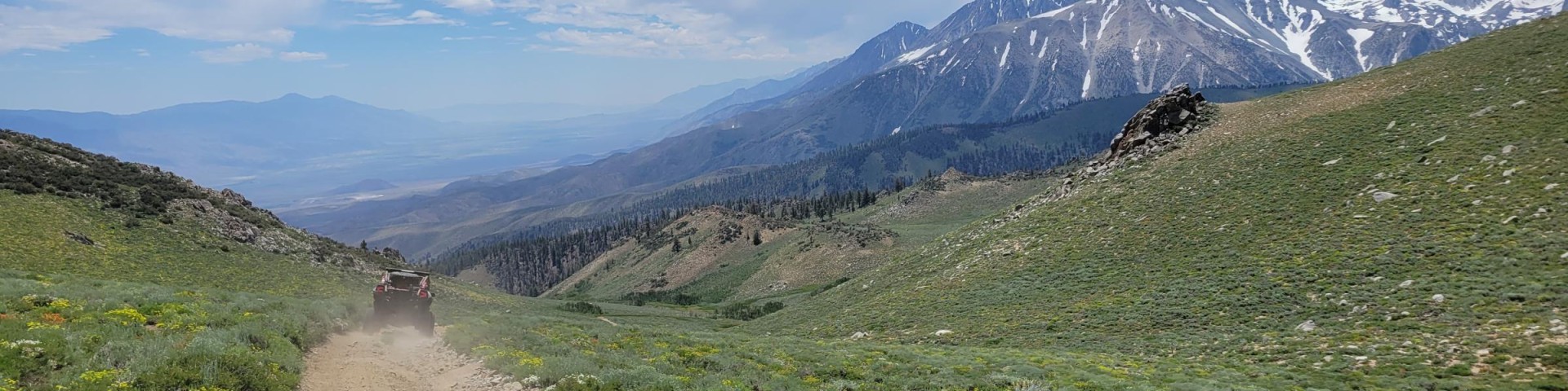
Off-Highway Vehicles (OHV’s) have access to nearly 2,200 miles of trails and roads leading through a million acres of non-wilderness lands on the Inyo National Forest. Some of these routes reach to nearly 12,000 feet in elevation (such as Coyote Ridge) and offer breathtaking views of the Sierra Nevada, Owens Valley, and Great Basin ranges.
Most of the OHV-legal routes in the Inyo National Forest are double-track, native-surface roads, though about 50 miles of single-track and ATV trails are interspersed throughout the network.
All vehicles must stay on these designated routes, except in the 2,500-acre Poleta Canyon Open Area, on the east side of Bishop. Managed jointly by the Forest and the BLM for cross-country, or open motorized vehicle travel, this area has short trails and single tracks as well as a dirt bowl. Shooting sports are prohibited in the developed day use area.
All vehicles must be equipped with a Forest Service approved spark arrester, required by state law.
California OHV Program
The State of California supports the Inyo National Forest in managing and enhancing some components of the OHV program, through trust funds managed by the California Off-Highway Motor Vehicle Recreation (OHMVR) division of the State Parks.
Maps
There are several types of maps that can help you in planning your trip and while you are out on your adventure! Our Motor Vehicle Use Maps (MVUMs) are the way to know whether you are riding on a designated route or not. You can download these maps for free on Avenza and navigate without the need for cell service! Just download the maps ahead of time before you lose cell phone signal. Visitor Maps and Guides
Travel Management Planning
In 2009, the Inyo National Forest designated a legal system of roads and trails for motorized vehicles. This effort required many years of inventorying and analysis, and included extensive public involvement – including many members of the public who came together to help balance the needs for recreational opportunities and access while protecting critical resources and the unique character of these public lands. All vehicles must stay on these designated routes, unless visiting an area designated for open riding.
Associated project documents for this plan are located here: Inyo National Forest Motorized Travel Management (Route Designation Strategy)
Related Links
- Tips for Riding Off Highway
- Off Roading Essentials
- Comment / Observation Form for Travel Management
- OHV Maps
- Backroad Tours in the Eastern Sierra - Inyo County & Death Valley
OHV Road Riding
Mammoth Ranger District
- Inyo Craters
- Inyo Craters Trailhead
- Little Antelope Valley
- Lookout Mountain Loop
- Mammoth Lakes Area
- Laurel Canyon
- Mammoth Knolls OHV Trail
- Sawmill-Alpers Canyon Trail
- Sherwin Creek Road
Mono Lake Ranger District
White Mountain Ranger District
- Bishop Area
- Buttermilk Country
- Coyote Flat
- Poleta Canyon OHV Area
- Wheeler Ridge
- White Mountains
- Mollie Gibson Canyon
- Silver Canyon
- Wyman Canyon
- McMurry Meadows
Mount Whitney Ranger District
OHV Trail Riding
OHV Open Area Riding
OHV Camping
- Mammoth Lakes Area
- Independence Area
- Mazourka Canyon
- Kern Plateau
- Monache Meadows Jeep Road
- Bishop Area
- Coyote Flat