

Incident Information
Inyo National Forest's breaking fire information is disseminated by the Public Affairs Officer initially through a Facebook post.
Depending on the length of time and the scale of the wildfire, information may be disseminated through a press release, posted here on this website under Alerts, or posted on Inciweb.
If you have a question about an incident, you may contact the Public Affairs Officer at (760) 873-2427.
Fire Restrictions

The Inyo National Forest will be in Stage 1 fire restrictions on June 16, 2025.
Inciweb
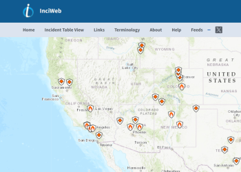
Stay informed about wildfires and natural disasters by visiting InciWeb. Click the button below for real-time updates, safety information, and resources to help you prepare and respond.
Prescribed Fire
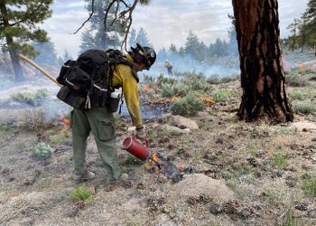
For current information on the latest prescribed fire (Rx) projects being implemented across the forest.
Fire Danger Levels
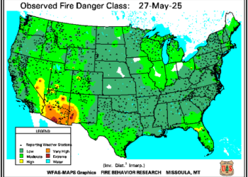
How is the "Fire Danger Level" determined on the Forest?
The "Wildland Fire Assessment System" (WFAS) is an internet-based information system that provides a national view of weather and fire potential, including national fire danger and weather maps and satellite-derived maps.