
Official websites use .gov
A .gov
website belongs to an official government organization in the
United States.
Secure .gov websites use HTTPS
A lock
(
) or https:// means you've safely
connected to the .gov website. Share sensitive information only
on official, secure websites.


Pandapas Pond Day Use Area
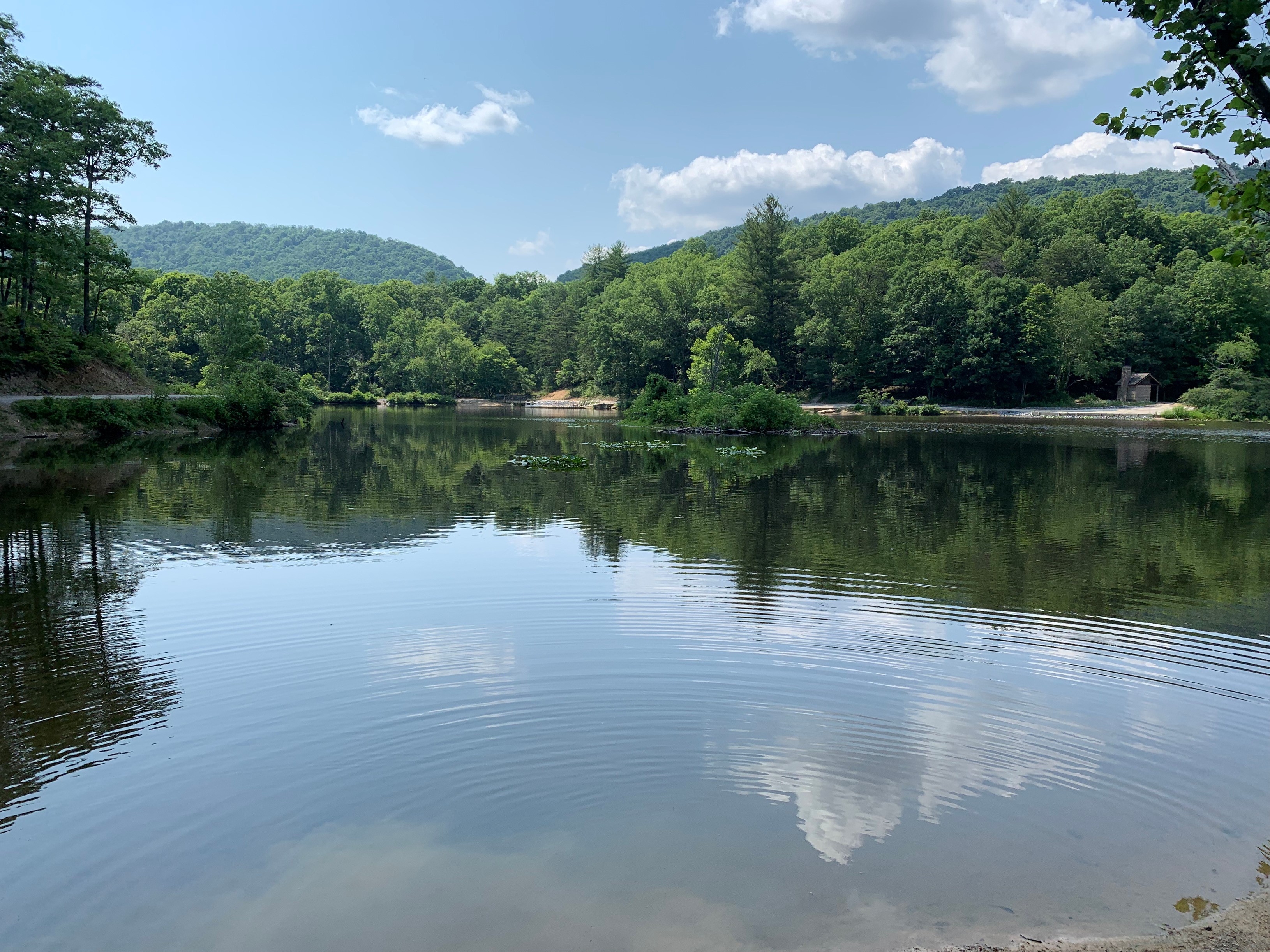
Pandapas Pond is a pastoral, 8 acre pond located just outside the town of Blacksburg. It sits on the Eastern Continental Divide and is surrounded by a forest of hardwoods and rhododendron. Visitors will enjoy strolling the one-mile wheelchair accessible trail that encircles the pond. A wooden boardwalk separates the pond from a small wetland area that is abundant with dragonflies, turtles, songbirds, and waterfowl. Horses and bicycles are not permitted on the trail around the pond; however they may use the 17-mile Poverty Creek Trail system that can be accessed from the upper parking lot.
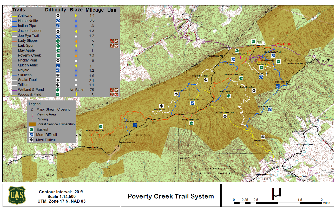
Poverty Creek Trail System Map
At a Glance
| Operational Hours: | Sunrise to Sunset | ||
|---|---|---|---|
| Fees: | No Fee. Donations accepted. | ||
| Open Season: | Open year round | ||
| Restrictions: | Dogs must be leashed.
|
||
| Closest Towns: | Blacksburg, VA | ||
| Water: | No drinking water available | ||
| Restroom: | Vault toilet | ||
| Operated By: | Eastern Divide Ranger District: 540-552-4641 |

General Information
Directions: From Blacksburg, VA: Follow US 460 West for 3 miles. Turn left across from SR 621 (Craig Creek Road) into Pandapas Pond Day Use Area. Horse and bike parking is located near the entrance. Continue to the lower parking area to access Pandapas Pond for hiking and fishing.Activities
Mountain Biking
Recreation areas with activity Mountain Biking:Lake and Pond Fishing
Recreation areas with activity Lake and Pond Fishing:Fishing Regulations and Permits.
Horse Riding
Recreation areas with activity Horse Riding:Viewing Wildlife
Recreation areas with activity Viewing Wildlife:Viewing Plants
Recreation areas with activity Viewing Plants:Viewing Scenery
Recreation areas with activity Viewing Scenery:Visitor Programs
Recreation areas with activity Visitor Programs:Picnicking
Recreation areas with activity Picnicking:| No. of Sites | Picnicking sites available |
| Reservation Info | No Reservations Required |

Related Information
Location


