
Recreation
The Gila National Forest has 3.3 million acres to explore. There are dozens of developed campgrounds and almost limitless opportunities for dispersed camping. With three designated wilderness areas, over 1,600 miles of trails, including almost 250 miles of the Continental Divide National Scenic Trail, the Catwalk National Scenic Trail, Woodhaul Wagon Road and Sawmill Wagon Road National Scenic Trails, there's no shortage of hiking, biking, and horseback riding opportunities. The forest's more than 3,300 miles of motorized routes and National and State Scenic Byways provide ample opportunity for OHV riding, scenic driving and nature viewing. Learn about cultural history at the Gila Cliff Dwellings, the Historical Fort Bayard Museum, the Catwalk, and discover traces of those who passed before us. Check out opportunities for recreation on the Gila!
Recreation on the Gila National Forest
Gila National Forest offers dozens of developed campgrounds, as well as millions of acres available for dispersed camping opportunities. Contact your local office to learn about the best camping opportunities.
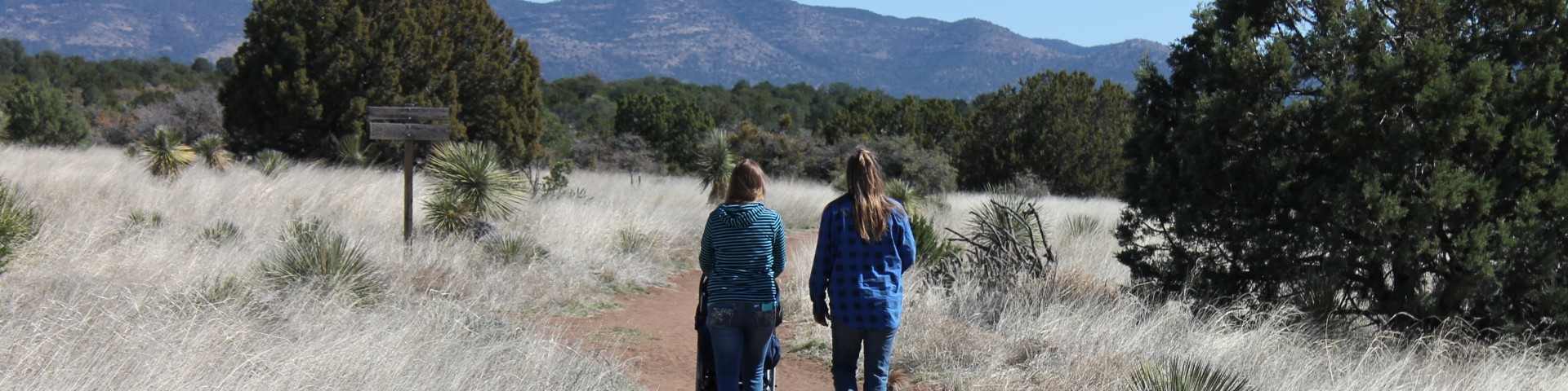
The Gila National Forest includes more than 1,600 miles of designated non-motorized trails for hiking, mountain biking, and horseback riding. There are also motorized trails for vehicles 50 inches in width or narrower. Learn more about trails on the Gila!
The Gila National Forest has 3,337 miles of forest service-designated motorized routes, as well as many miles of county, state, and US highways. Two designated scenic byways cross the Gila, the Geronimo Trail National Scenic Byway and the Trail of the Mountain Spirits Scenic Byway, providing ample scenic, wildlife, and nature viewing opportunities.
The Gila's three designated wilderness areas total nearly 790,000 acres for non-motorized, non-mechanized use. The Gila Wilderness was the first area to be designated as wilderness anywhere in the world, when it was created by the US Forest Service Southwest Regional Office on June 3, 1924, at the urging of renowned conservationist Aldo Leopold. The Aldo Leopold Wilderness and the Blue Range Wilderness are the Gila's other designated wilderness areas.
The Wilderness Act was created in 1964, securing a resource of wilderness for current and future generations. Congress holds the authority to designate wilderness areas. What began with 9.1 million acres in 1964 has grown to 111 million acres in 762 wilderness areas across 48 states. The Wilderness Act protects values such as air quality, water quality, wildlife, recreation, scenery, natural laboratories for education and scientific study, and historical and cultural artifacts.
The Gila landscape has been tread in the past by the likes of Geronimo and Billy the Kid. Evidence of the past is a nearly constant reminder that our time here is limited. Discover history on the Gila!
The Gila National Forest has six rural, backcountry airstrips that are commonly used by recreational visitors, local utility companies, and Forest Service fire and aviation support. The Gila National Forest has partnered with the Recreational Aviation Foundation of New Mexico to maintain and improve airstrips for public use.

The United States Congress designated the Aldo Leopold Wilderness in 1980 and it has a total of 202,016 acres.

The Black Range Ranger District is located in the eastern most portion of the Gila National Forest in southwest New Mexico and comprises 557,573 acres.

The 29,304 acre Blue Range Wilderness was designated in 1980 and is located on the western border of New Mexico and is managed by the Gila National Forest.

The 559,688-acre Gila Wilderness, created in June 1924 at the urging of the great conservation pioneer Aldo Leopold, was the world's first designated wilderness and al
The Glenwood Ranger District is located in Glenwood, New Mexico a town of approximately 300 people, known for its spectacular views of the Mogollon Mountains, the Catwalk N
Quemado is located in northern Catron County, 33 miles east of the Arizona border on US 60, at an elevation of 6,900 feet.
Reserve is located in western New Mexico near the Arizona border. The elevation is 5,832 feet above sea level.
The Silver City Ranger District is the southern-most district on the Gila National Forest.
The Wilderness Ranger District is located in the heart of the Gila National Forest and covers an area of 686,171 acres.
Recreation groups are areas where a variety of different recreational opportunities exist within close proximity.
The Fort Bayard Recreation Area is a day use area close to Silver City with a high density of trails for hiking, bicycling, and horseback riding.
Lake Roberts is a man-made lake of about 70 acres in size and maximum depth of 35 feet. It is located within the Wilderness Ranger District along New Mexico Highway 35.
Located just outside Silver City, the Little Walnut-Gomez Peak picnic grounds provide a pleasant day use area for small or large groups and individuals/families.
Snow Lake is a small reservoir, about 90 acres in size, located on the Reserve Ranger District, approximately 30 miles from the town of Reserve, NM.