

Recreation
On this page you can filter recreation opportunities below or view the entire list of opportunities in alphabetical order by scrolling toward the bottom of the page. The Keyword Search bar (above) is an excellent resource for finding anything on this site related to the word you enter, so make sure to use it if what you are looking for isn't easily found.

The Flagstaff Ranger District encompasses 849,249 acres of National Forest lands around the Flagstaff area, from Mormon Lake and Anderson Mesa to north of the San Francisco Peaks.

At 506,840 acres, the Mogollon Rim Ranger District is a rugged escarpment that forms the southern limit of the Colorado Plateau.
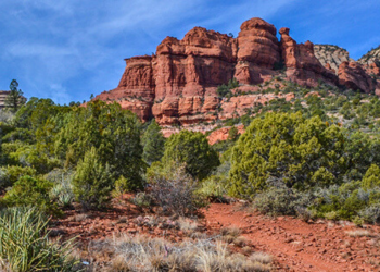
The Red Rock Ranger District includes 487,519 acres of magnificent splendor.

The 18,960-acre Kachina Peaks Wilderness was established as a Wilderness Area in 1984 and is located on the Coconino National Forest's Flagstaff Ranger District.
Kendrick Mountain Wilderness encompasses Kendrick Peak, one of the many peaks of the vast San Francisco mountain volcanic field located on the Coconino Plateau in north-central Arizona.
The 252,500 acres of the Mazatzal Wilderness Area span across both the Coconino and Tonto national forests.
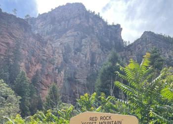
The 43,950 acres of the Red Rock - Secret Mountain Wilderness Area are full of stunning rosy-hued cliffs, buttes and canyons.
Abalone
Site Open
Abalone Trail is part of the Mount Elden Dry Lake Hills Trail System.The Mount Elden/Dry Lake Hills (MEDL) trail system was dedicated in 1987. There are eight trailheads providing access to 25…
Abineau-Bear Jaw Loop
Site Open
Abineau-Bear Jaw Loop is part of the Kachina Trail System.From the Abineau (#127) and Bear Jaw (#26) trails, on the north slope of the San Francisco Peaks, you can see the Grand Canyon seventy miles…
Afterglow
Site Open
Afterglow Trail is part of the Mount Elden Dry Lake Hills Trail System and the Schultz Creek Loops Trail System.The Schultz Creek area is the entry point to the Mt. Elden/Dry Lake Hills Trail System…
Airport Connector
Site Open
The Airport Connector Trail is part of the Kelly Motorized Trail System.The Kelly Motorized Trail System is south of Flagstaff, Arizona, south of Lake Mary Road (opposite the Skunk Canyon, Fay…
Anasazi Loop
Site Open
The Anasazi Loop is part of the Campbell Mesa Trail System.The various loops offer a wide variety of seasonal wildflowers, many examples of local birdlife, and frequent wildlife sightings. Visitors…
Apache Maid Cabin
Site Open
This rustic one-bedroom cabin, located at the eastern base of Apache Maid Mountain, provides an excellent getaway opportunity for forest visitors.
Apollo
Site Open
Apollo Trail is part of the Mount Elden Dry Lake Hills Trail System and the Schultz Creek Loops Trail System.The Mount Elden/Dry Lake Hills (MEDL) trail system was dedicated in 1987. There are eight…
Arizona Nordic Village
Site Open
Arizona Nordic Village, located on Coconino National Forest land and operating under a special use permit, features a host of activities for every season.
Arizona Snowbowl
Site Open
Arizona Snowbowl, located on Coconino National Forest land and operating under a special-use permit, offers exciting runs down Arizona's highest mountain as a full-service downhill ski area.
Around the Peaks Loop
Site Open
This drive takes you all the way around Arizona's highest mountain, winding through a land of pine forests and aspen groves, open prairies and rustic homesteads. Anytime is a good time to enjoy this…