| Collection: | Pacific Northwest Research Station, Alaska Image Archive |
| Keywords: |
plant ecology vegetation types ecotypes |
| Location: | Alaska; Fairbanks; Deadwood Creek |
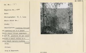
| Description: | Looking through an opening cut in a paper birch stand (slope exposure S 45 W, gradient 26%) across a small valley to a poor black spruce muskeg forest (slope exposure N 25 E, gradient of 50%). Permafrost was encountered at a depth of 8 inch. |
| Date: | 6/27/1957 |
| Collection: | Pacific Northwest Research Station, Alaska Image Archive |
| Keywords: |
plant ecology vegetation types ecotypes |
| Location: | Alaska; Fairbanks; Ester |
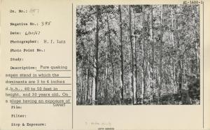
| Description: | Pure quaking aspen stand in which the dominants are 3 to 4 inches d.b.h., 40 to 50 feet in height and 30 years old. On a slope having an exposure of S 20 W and a gradient of 15%. Near Ester, Fairbanks district. |
| Date: | 6/20/1957 |
| Collection: | Pacific Northwest Research Station, Alaska Image Archive |
| Keywords: |
plant ecology: ecosystems vegetation types, ecotypes |
| Location: | Alaska; O'Brien Creek |
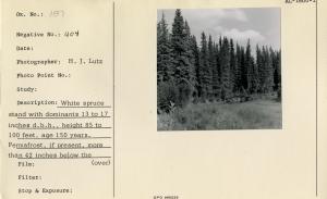
| Description: | White spruce stand with dominats 13 to 17 inches d.b.h., height 85 to 100 feet, age 150 years. Permafrost, if present, more than 42 inches below the surface. Adjacent to O'Brien Creek, about 12 miles above its junction with the Fortymile River. |
| Date: | 1957 |
| Collection: | Pacific Northwest Research Station, Alaska Image Archive |
| Keywords: |
plant ecology: ecosystems vegetation types, ecotypes |
| Location: | Alaska; Kenai Peninsula; Kasilof |
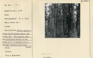
| Description: | White spruce-paper birch forest about 120 years old. The spruce with the aluminum holder at the base is 21.3 inches d.b.h. On well-drained land near Kasilof, Kenai Peninsula. |
| Date: | 1957 |
| Collection: | Pacific Northwest Research Station, Alaska Image Archive |
| Keywords: |
plant ecology: ecosystems vegetation types, ecotypes |
| Location: | Alaska; Fortymile River |
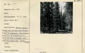
| Description: | White spruce forest on a 22 per cent slope, S 45 degrees W exposure. Dominants are 10 to 16 inches d.b.h., 70 to 90 feet in height, and 150-180 years old. South Fork of the Fortymile River. |
| Date: | 1957 |
| Collection: | Pacific Northwest Research Station, Alaska Image Archive |
| Keywords: |
plant ecology vegetation types, ecotypes |
| Location: | Alaska; Wasilla; Houston |
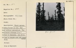
| Description: | Black spruce muskeg forest on wet, flat land without permafrost. The dominants average 2 to 3 inches diameter, are 20 to 30 feet in height and 140 years old. Near Houston, west of Wasilla. |
| Date: | 1957 |
| Collection: | Pacific Northwest Research Station, Alaska Image Archive |
| Keywords: |
plant ecology vegetation types, ecotypes |
| Location: | Alaska; Kenai Peninsula |
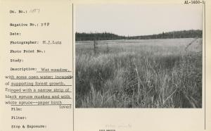
| Description: | Wet meadow, with some open water; incapable of supporting forest growth. Fringed with a narrow strip of black spruce muskeg and with white spruce-paper birch forest on the upland in the background. Kenai Peninsula. |
| Date: | 1957 |
| Collection: | Pacific Northwest Research Station, Alaska Image Archive |
| Keywords: |
plant ecology vegetation types, ecotypes |
| Location: | Alaska; Fairbanks; Fox Creek |
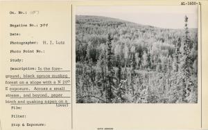
| Description: | In the foreground, black spruce muskeg forest on a slope with a N 20 degree E exposure. Across a small stream, and beyond, paper birch and quaking aspen on a slope with a S 20 W exposure. Fox Creek Valley. Fairbanks district. |
| Date: | 1957 |
| Collection: | Pacific Northwest Research Station, Alaska Image Archive |
| Keywords: |
plant ecology vegetation types, ecotypes |
| Location: | Alaska; Kenai Peninsula |
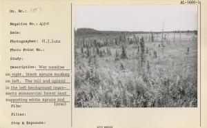
| Description: | Wet meadow on right, black spruce muskeg on left. The hill and upland in the left background represents commercial forest land supporting white spruce and paper birch. Here, as elsewhere on the Kenai Peninsula, the black spruce type boundaries tend to fo... |
| Date: | 1957 |
| Collection: | Pacific Northwest Research Station, Alaska Image Archive |
| Keywords: |
plant ecology vegetation types, ecotypes |
| Location: | Alaska; Kenai Peninsula |
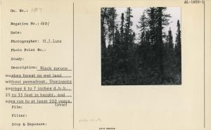
| Description: | Black spruce muskeg forest on wet land without permafrost. Dominants average 4 to 7 inches d.b.h., 50 to 35 feet in height and ages run to at least 220 years. Between Kasilof and Soldatna, Kenai Pensula. |
| Date: | 1957 |
| Collection: | Pacific Northwest Research Station, Alaska Image Archive |
| Keywords: |
plant ecology vegetation types, ecotypes |
| Location: | Alaska; Chatanika River |
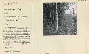
| Description: | Looking along the countour at the contact between the erosional slope (on the left, with paper birch) and the depositional slope (on the right, with black spruce muskeg). Slope exposure, S 25 E. Gradient of erosional slope, 20-30 per cent; gradient of dep... |
| Date: | 1957 |
| Collection: | Pacific Northwest Research Station, Alaska Image Archive |
| Keywords: |
plant ecology vegetation types, ecotypes |
| Location: | Alaska; Fairbanks; Deadwood Creek |
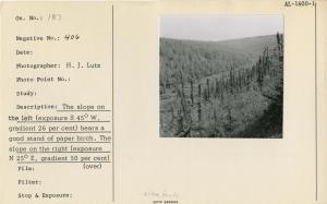
| Description: | The slope on the left (exposure S 45 W, gradient 26 per cent) bears a good stand of paper birch. The slope on the right (exposure N 25 E, gradient 50 per cent) bears a poor black spruce muskeg forest. The valley bottom is covered with willows. Looking up... |
| Date: | 1957 |
| Collection: | Pacific Northwest Research Station, Alaska Image Archive |
| Keywords: |
plant ecology vegetation types, ecotypes |
| Location: | Alaska; Matanuska Valley; King River |
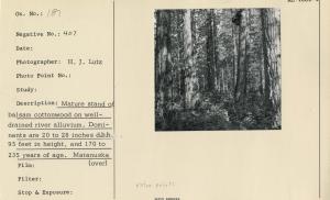
| Description: | Mature stand of balsam cottonwood on well-drained river alluvium. Dominants are 20 to 28 inches d.b.h., 95 feet in height and 170 to 235 years of age. Matanuska River Valley, above the mouth of King River. |
| Date: | 1957 |
| Collection: | Pacific Northwest Research Station, Alaska Image Archive |
| Keywords: |
forest fires fire losses, fire damage to timber stands from the economic point of view |
| Location: | Alaska; Matanuska Valley |
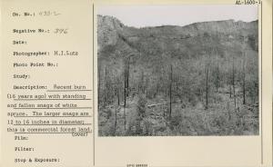
| Description: | Recent burn (16 years ago) with standing and fallen snags of white spruce. The larger snags are 12 to 16 inches in diameter; this is commercial forest land. Matanuska River Valley. |
| Date: | 1957 |
| Collection: | Pacific Northwest Research Station, Alaska Image Archive |
| Keywords: | damage by animals |
| Location: | Alaska |
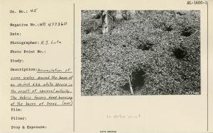
| Description: | Accumulation of cone scales around the base of an 18-inch d.b.h. white spruce is the result of squirrel activity. The debris favors deep burning at the bases of trees. Used as illustration, Fig. 5, Pg. 19, USDA Tech Bull 1133, 1956. |
| Date: | 1956 |
| Collection: | Pacific Northwest Research Station, Alaska Image Archive |
| Keywords: |
hydrology water conservation, soil conservation and erosion watershed management studies on stream-flow and bank erosion |
| Location: | Alaska; Tazlina River |
| Description: | Bank cutting along the Tazlina River. Erosion of this type is very common and is not related to forest fires. It contributes to the silt load of the rivers. View upstream from a high bluff on the north side of the river, about 1/2 mile above the Richardson [Highway?]. |
| Date: | 6/1951 |
| Collection: | Pacific Northwest Research Station, Alaska Image Archive |
| Keywords: |
hydrology water conservation, soil conservation and erosion watershed management studies on stream-flow and bank erosion: |
| Location: | Alaska; Copper River |
| Description: | Over-steepened slope caused by bank cutting. Slumping is so active here that the slopes are practically devoid of vegetation. Copper River, above Copper Center. [Date estimated. Year is likely 1950, 1951, or 1957.] |
| Date: | 1950s |
| Collection: | Pacific Northwest Research Station, Alaska Image Archive |
| Keywords: |
plant ecology vegetation types ecotypes |
| Location: | Alaska; Matanuska River |
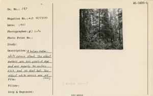
| Description: | A balsam poplar-white spruce stand. The oldest poplars are 200 years of age and 30 inches d.b.h. and 75 feet tall. The oldest white spruce trees are over 105 years of age, 13 inches d.b.h. and 70 feet tall. On Matanuska River, near Palmer, 1951. Used as... |
| Date: | 1951 |
| Collection: | Pacific Northwest Research Station, Alaska Image Archive |
| Keywords: |
plant ecology vegetation types ecotypes |
| Location: | Alaska; Copper River |
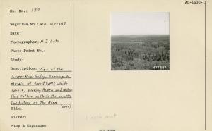
| Description: | View of the Copper River Valley, showing a mosaic of forest types, white spruce, quaking aspen, and willow. This pattern reflects the complex fire history of the area. Used as illustration, Fig. 2, Pg. 5 USDA Tech. Bull. 1133 March, 1956. |
| Date: | 1951 |
| Collection: | Pacific Northwest Research Station, Alaska Image Archive |
| Keywords: |
plant ecology vegetation types ecotypes |
| Location: | Alaska; Glenn Highway; Nelchina River |
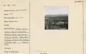
| Description: | Climax white spruce forest along the Nelchina River, marked by eroding bluffs. Along Glenn Highway, at mile 143, looking eastward. 1951. Used as illustration, Fig. 18, Pg. 57 USDA Tech. Bull. 1133 March, 1956. |
| Date: | 1951 |

![Bank cutting along the Tazlina River. Erosion of this type is very common and is not related to forest fires. It contributes to the silt load of the rivers. View upstream from a high bluff on the north side of the river, about 1/2 mile above the Richardson [Highway?]. Bank cutting along the Tazlina River. Erosion of this type is very common and is not related to forest fires. It contributes to the silt load of the rivers. View upstream from a high bluff on the north side of the river, about 1/2 mile above the Richardson [Highway?].](/rds/imagedb/images/_thm/31489.jpg)
![Over-steepened slope caused by bank cutting. Slumping is so active here that the slopes are practically devoid of vegetation. Copper River, above Copper Center. [Date estimated. Year is likely 1950, 1951, or 1957.] Over-steepened slope caused by bank cutting. Slumping is so active here that the slopes are practically devoid of vegetation. Copper River, above Copper Center. [Date estimated. Year is likely 1950, 1951, or 1957.]](/rds/imagedb/images/_thm/31379.jpg)
