| Collection: | Pacific Northwest Research Station, Alaska Image Archive |
| Keywords: |
hydrology water conservation, soil conservation and erosion watershed management studies on stream-flow and bank erosion |
| Location: | Alaska; Tazlina River |
| Description: | Bank cutting along the Tazlina River. Erosion of this type is very common and is not related to forest fires. It contributes to the silt load of the rivers. View upstream from a high bluff on the north side of the river, about 1/2 mile above the Richardson [Highway?]. |
| Date: | 6/1951 |
| Collection: | Pacific Northwest Research Station, Alaska Image Archive |
| Keywords: |
hydrology water conservation, soil conservation and erosion watershed management studies on stream-flow and bank erosion: |
| Location: | Alaska; Copper River |
| Description: | Over-steepened slope caused by bank cutting. Slumping is so active here that the slopes are practically devoid of vegetation. Copper River, above Copper Center. [Date estimated. Year is likely 1950, 1951, or 1957.] |
| Date: | 1950s |
| Collection: | Pacific Northwest Research Station, Alaska Image Archive |
| Keywords: |
plant ecology vegetation types ecotypes |
| Location: | Alaska; Matanuska River |
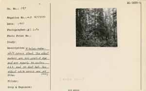
| Description: | A balsam poplar-white spruce stand. The oldest poplars are 200 years of age and 30 inches d.b.h. and 75 feet tall. The oldest white spruce trees are over 105 years of age, 13 inches d.b.h. and 70 feet tall. On Matanuska River, near Palmer, 1951. Used as... |
| Date: | 1951 |
| Collection: | Pacific Northwest Research Station, Alaska Image Archive |
| Keywords: |
plant ecology vegetation types ecotypes |
| Location: | Alaska; Copper River |
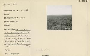
| Description: | View of the Copper River Valley, showing a mosaic of forest types, white spruce, quaking aspen, and willow. This pattern reflects the complex fire history of the area. Used as illustration, Fig. 2, Pg. 5 USDA Tech. Bull. 1133 March, 1956. |
| Date: | 1951 |
| Collection: | Pacific Northwest Research Station, Alaska Image Archive |
| Keywords: |
plant ecology vegetation types ecotypes |
| Location: | Alaska; Glenn Highway; Nelchina River |
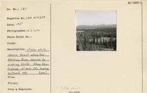
| Description: | Climax white spruce forest along the Nelchina River, marked by eroding bluffs. Along Glenn Highway, at mile 143, looking eastward. 1951. Used as illustration, Fig. 18, Pg. 57 USDA Tech. Bull. 1133 March, 1956. |
| Date: | 1951 |
| Collection: | Pacific Northwest Research Station, Alaska Image Archive |
| Keywords: |
plant ecology vegetation types, ecotypes |
| Location: | Alaska; Copper River |
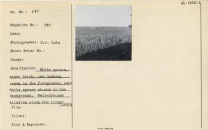
| Description: | White spruce, paper birch, and quaking aspen in the foreground; pure white spruce stands in the background. Well-drained alluvium along the larger rivers represents excellent forest land. Looking westerly across the Copper River Valley, about two miles ups... |
| Date: | 1951 |

![Bank cutting along the Tazlina River. Erosion of this type is very common and is not related to forest fires. It contributes to the silt load of the rivers. View upstream from a high bluff on the north side of the river, about 1/2 mile above the Richardson [Highway?]. Bank cutting along the Tazlina River. Erosion of this type is very common and is not related to forest fires. It contributes to the silt load of the rivers. View upstream from a high bluff on the north side of the river, about 1/2 mile above the Richardson [Highway?].](/rds/imagedb/images/_thm/31489.jpg)
![Over-steepened slope caused by bank cutting. Slumping is so active here that the slopes are practically devoid of vegetation. Copper River, above Copper Center. [Date estimated. Year is likely 1950, 1951, or 1957.] Over-steepened slope caused by bank cutting. Slumping is so active here that the slopes are practically devoid of vegetation. Copper River, above Copper Center. [Date estimated. Year is likely 1950, 1951, or 1957.]](/rds/imagedb/images/_thm/31379.jpg)


