


Current Conditions
District and Area Condition Reports
- Visitors to the district should expect spring conditions and prepare to encounter cold, rain, and snow.
- All roads on the Fairfield District are officially opened. Wet and muddy conditions may exist, and we ask visitors to exercise care in these areas to avoid causing resource damage.
- Dollarhide Summit remains closed due to snow.
- Visitors should note that:
- Trails may not be cleared
- Creek crossings may be running high.
- Snow should be expected at elevations around 7,000 feet and greater.
- The following campgrounds are open:
- Bird Creek Campground
- Willow Creek Campground
- Willow Creek Transfer Camp
- Bowns Campground
- Canyon Transfer Camp
- Baumgartner Site 100
- Baumgartner will open May 21. Reservations can be made on recreation.gov.
- Abbott and Chaparral will remain closed indefinitely due to tree damage from the winter winds.
- Bear Creek Campground/Transfer Camp will not be open for camping until further notice due to renovation construction. Visitors may still use the restroom but cannot camp.
- The Big Smoky RV Dump Station/Lagoon Project began April 27 and is expected to continue until mid-July. Heavy equipment and large gravel trucks will be on the roads between the Big Smoky work center and the top of Fleck Summit, as well as coming over Couch Summit. Due to this renovation effort, the Big Smoky RV Dump/Potable water fill Station will be closed until mid-July. Visitors will still be able to access Canyon Transfer Camp/Campground and Big Smoky trailhead. The nearest dump station and potable water RV fill is in Fairfield.
- Kelley Flats designated dispersed camping area and regular dispersed camping opened May 1. Lower Kelley Flats dispersed camping will remain closed for the time being due to flooding and hazard trees.
- The Fleck Summit road widening project is occurring this summer. Logging operations, in preparation for the road widening, are underway. People should expect to encounter logging trucks and may expect short delays during falling operations. Dirt work to widen the road is scheduled from July 6 -Aug. 14. The road will be closed 8 a.m.-noon and 1-5 p.m. Monday -Friday between these dates.
For additional information, contact the Fairfield Ranger District.
- This summer, the district and its partners will be replacing a bridge at the head of Fox Creek Trail, NFS Trail 149. Closures will be intermittent to allow as much access as possible. Please be cautious and defer to crews operating in the area. Scheduled closures include:
- June 27-29: Trailhead will be closed one of these days for helicopter delivery of bridge materials.
- July 13-17: Back up dates should June delivery be postponed for any reason.
- For the most current trail conditions, check out the Wood River Trails Coalition website.
- Boundary Campground opens May 22.
- Visitors are encouraged to refer to Motor Vehicle Use Maps when traveling on the district and to avoid wet, muddy roads to prevent resource damage
For additional information, contact the Ketchum Ranger District.
- Visitors are encouraged to prepare for all possible road conditions and refer to Motor Vehicle Use Maps when traveling on the district.
- Dry Creek Road (527) will open June 1st
- The Albion and Raft River Divisions still have snow in the higher elevations blocking many roads. Wet and muddy conditions may exist, and we ask visitors to exercise care in these areas to avoid causing resource damage.
- Snow and muddy conditions remain on the road to Independence Lakes Trailhead so this road remains closed until it dries out.
- The following campgrounds are open:
- All campgrounds in Rock Creek
- Bear Gulch Campground
- Bostetter
- Father and Sons
- Mill Flat
- Sublett
- Clear Creek
- Bennett Springs
- Howell Canyon campgrounds remain closed due to snow above Pomerelle, including:
- Thompson Flat Campground
- Lake Cleveland Campground
- Twin Lakes Campground
- Howell Canyon Fire Lookout
For additional information, contact the Minidoka Ranger District.
- All campgrounds, with the exception of Upper and Lower O'Brien, will open May 22. If reservations are available for campgrounds, sites will be listed on Recreation.gov. Otherwise, sites are first-come, first served. The Sawtooth National Recreation Area Fees & Policies webpage contains important Know Before You Go information important for all those planning to camp on the SNRA.
- Even though things are warming up for summer, trails at higher elevations above 7,500-8500 feet still have feet of snow. As the snow melts, it can create high creek crossings on trails, and there may be trees down on trails early season.
- The SNRA Trails Report will be updated as trail crews and partners start working on trails and sending in reports.
- Visitors are encouraged to refer to Motor Vehicle Use Maps when traveling on the district.
For additional information, please contact the Sawtooth National Recreation Area Headquarters or Stanley Ranger Station.
Other Helpful Links
Sawtooth National Recreation Area Trails Report
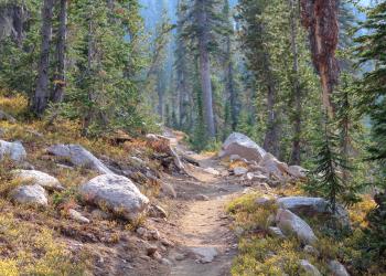
Sawtooth National Recreation Area trail reports are updated as often as possible, usually after crews return from their hitches.
Sawtooth Avalanche Center
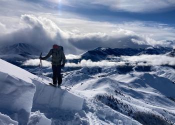
The mission of the Sawtooth Avalanche Center is to provide actionable avalanche and mountain weather information for people recreating, working, traveling, or living in south-central Idaho. Staff begin daily avalanche forecasts in the fall after enough snow accumulates in the mountains for on-snow travel in the backcountry. Updates continue until about mid-April.
Summer Trails Information
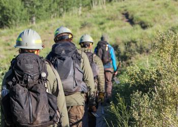
Our partners do a lot to help keep trails accessible on the Sawtooth National Forest. Check out their websites for more trails information and ways you can help:
Idaho Department of Parks and Recreation Summer Trails Map
Back Country Horsemen of Idaho
Student Conservation Association
Winter Trails Information

Groomed trails for Nordic skiers and snowmobile riders are available across the Sawtooth National Forest thanks to the the following partners:
High Desert Nordic Association
Idaho Department of Parks and Recreation Snowmobile Trail Map