Biking
Our national forests offer mountain bikers miles of roads and trails on which to ride. There are wide, quiet roads for beginners to get acquainted with their bikes and there are challenging, arduous trails that will test the advanced rider. If you plan to strike out on your own to explore with your bike, it would be wise to buy a National Forest map. Please respect the rights of private landowners and always ask permission before you ride on their land. Also, be aware of the wilderness boundaries when you are riding on the trails. Bicycles are not allowed in the wilderness areas.
E-Biking
Class 1, 2 and 3 e-bikes are allowed on motorized trails and roads on national forests and grasslands.
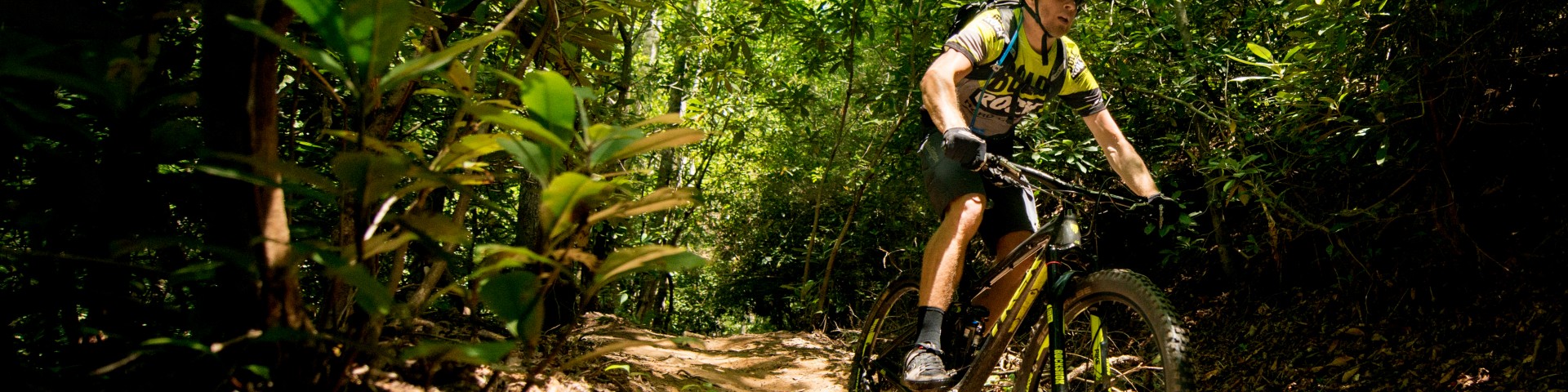
Mountain Biking
Whether you are looking for an easy afternoon ride or a challenging chain-breaking opportunity, our national forests are the go-to place for mountain biking. Just remember, many of these trails are used by hikers and horseback riders so please make sure to think of your safety and the safety of others as you travel.
Road Cycling
Cycling is a great way to travel through National Forest System lands. The Manti-La Sal hosts many winding roads and mountain pass, ideal for slowly absorbing the beauty of central Utah as you pedal.
Search for Biking Opportunities
Showing: 1 - 10 of 122 results
Abajo - Harts Draw Recreation Area
The Abajo - Harts Draw Recreation Area is located in southeastern Utah west of Monticello, south of Canyonlands National Park and north of Blanding, Utah. The area extends from the east Forest…
Aspen Flat Trail
The Aspen Flat Trail #018 is 5.3 miles long. The south end of this trail is located at Forest Road #381, a small spur off of Forest Road #079 (North Creek). The north end of this trail is located at…
Aspen Flat/Shay Ridge Trailhead
This trailhead (TH) marks the beginning of the northern end of both the Aspen Flat and Shay Ridge Trails. There is a dirt parking area here that is used for both trails. The Shay Ridge…
Big Bear CreekTrail
The Big Bear Creek Trail #5108 is 11.1 miles long and forms a loop between Big Bear and Little Bear Creeks. It begins and ends at Forest Road #50311. This trail passes through mixed conifer and open…
Black Canyon Trail
The Black Canyon Trail #5087 is 4.2 miles long. It begins at Forest Road #50038 and ends at Forest Road #52467 east of South Skyline Drive. It climbs 2,208 feet from 7,664 feet in elevation to 9,872…
Black Dragon Trail
The Black Dragon Trail #5035 (Arapeen Route #62) is 1.8 miles long and provides a connection between the Ferron Canyon Picnic Area adjacent to Forest Road (FR) 0022 and FR 0170 south of Joes Valley.…
Black Mountain Trail
The Black Mountain trail is 2.5 miles long. It begins at Forest Road #51213 and ends at Forest Road #50047. The trail is open for the following uses: Hiking, Mountain Biking, Horseback Riding
Bull Pasture Trail
The Bull Pasture Trail #5072 is 4.5 miles long. It begins at Highway 31 and ends at Forest Road #50250. The trail is located on steep slopes with loose, rocky soils. It climbs 2,097 feet from 7,414…
Burlfriends Trail
Burlfriends Trail is 4 miles one way and starts at the La Sal Pass kiosk on the La Sal Pass Rd (FS Rd 0073) on the Moab Ranger District of the Manti-La Sal National Forest. The trail ends at a lower…
Burro Pass Trail
The Burro Pass Trail #315 is 2.4 miles long and located on the Moab Ranger District on the Manti-La Sal National Forest. It begins at Forest Road #240 (Burro Pass) and ends at Forest Trail #033…