

About the Area
The Santa Fe National Forest is one of five national forests in New Mexico, managing nearly 1.6 million acres of diverse landscapes and cultural resources. It was established in 1915 when President Woodrow Wilson signed Executive Order 2160, merging the former Jemez and Pecos National Forests. Today, the forest plays a vital role in supporting communities across northern New Mexico and the greater southwestern United States.
The forest is organized into five ranger districts. The Coyote, Cuba, and Jemez Districts lie west of the city of Santa Fe, commonly referred to as the “west side.” The Pecos–Las Vegas District spans the Sangre de Cristo Mountains east of Santa Fe, known as the “east side.” The Española District extends across both sides, running down the center of the forest.
The Santa Fe National Forest shares boundaries with the Carson National Forest, Bandelier National Monument, Pecos National Historical Park, the Valles Caldera National Preserve, Los Alamos National Laboratory, Bureau of Land Management lands, nine Pueblos, one Tribal nation, and several traditional land grants.
The forest manages an array of nationally significant resources, including:
- Four congressionally designated wilderness areas, representing roughly 18 percent of the forest
- Three designated wild and scenic rivers
- The Jemez National Recreation Area, the only national recreation area in the Southwest Region
- Four of New Mexico’s eight national scenic byways
- One national scenic trail, two national recreation trails, and three national historic trails
About our Seasons
Climate across the Santa Fe National Forest varies widely with elevation. In north‑central New Mexico, average daily temperatures range from about minus 35 to 14 degrees Fahrenheit in winter, and from 30 to 95 degrees Fahrenheit in summer. Annual precipitation varies from roughly 12 to 35 inches, with the greatest amounts falling at higher elevations. The region is known for its clean, clear air and abundant sunshine, averaging nearly 300 sunny days each year.
At higher elevations, the first snow typically arrives in October, with mountain peaks remaining snow‑covered from late November through spring. Snow can linger on high‑elevation trails into June. At lower elevations, snowfall is more variable—some winters bring significant accumulation of up to 40 inches, while others produce little to none.
Spring is generally windy and dry. The rainy season begins in June with the onset of the Southwest monsoon, which peaks in August. Summer storms frequently bring lightning, especially across the highest peaks. Autumn is marked by brilliant colors, with golden aspens on the mountain slopes and cottonwoods glowing along the streams.
About our Major Mountain Ranges
The forest spans mountains, valleys, and mesas that form two distinct regions: the west side, centered on the Jemez Mountains, and the east side, located in the Sangre de Cristo Mountains. Elevations range from 5,000 to over 13,000 feet. Truchas Peak, at 13,108 feet in the Pecos Wilderness, is the highest point on the east side, while Chicoma Mountain, at 11,561 feet, is the highest peak on the west side.
Approximately 95 percent of the forest lies within the Rio Grande watershed.
Be Prepared
Due to the rapidly changing environment, forest users are constantly faced with safety factors with which they should be familiar. Avoid trouble through awareness and preparedness.
Learn More About the Forest
Alerts
See what alerts and closures have been posted in the area that may affect your visit.
Fire Prevention
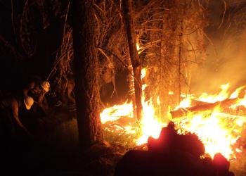
Fires don't care about property lines. Visit the fire prevention page to see steps you can take to protect people, pets and property during the fire season.
Projects

See what projects to implement the Forest Plan are happening in the Santa Fe National Forest.
Recreation

Rising from deserts, meadows and grasslands, the mesas, canyons and peaks of the Santa Fe National Forest are a place for recreation. Learn more about recreation on the Santa Fe National Forest and start planning your next visit.