Recreation

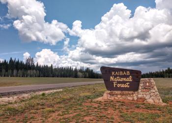
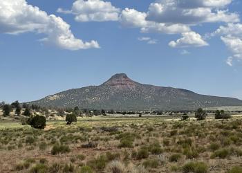
From canyons to prairies, peaks to plateaus, the Kaibab National Forest, which is nestled on the Colorado Plateau, offers layers of opportunity for discovery. The Mogollon Rim forms the southern boundary while extending to the north almost to the Utah border. Meanwhile, the majestic Grand Canyon National Park bisects the center of the forest.

Elevations range from about 3,000 feet to 10,418 feet at the top of Kendrick Mountain. Beginning in low elevation grasslands and sagebrush, the forest steps up through forests of pinyon-juniper and ponderosa pine to fir, spruce and aspen. Summer temperatures range from 50° F at night to 80-90° F during the day. Summer thunderstorms, known as the monsoon, can build up quickly, especially during July and August. Snow is common from December through March.

In all, the entire Kaibab National Forest is approximately 1.6 million acres. This includes four designated wilderness areas totaling about 114,845 acres that are managed for challenge and solitude. The Kaibab Plateau-North Rim Scenic Byway winds through meadows and forest ending at Grand Canyon National Park's North Rim. Opportunities for recreation including developed facilities such as campgrounds, picnic areas and viewpoints are plentiful.

Not all trail information may be present below - click here for a comprehensive list of Kaibab NF trails 

Showing: 1 - 10 of 76 results

Arizona Trail #101 ~ North Kaibab

Hiking Biking Horse Riding and Camping
The North Kaibab Ranger District features a section of the iconic Arizona National Scenic Trail. It is the oldest section of the Arizona Trail, and it passes through a number of different…

Arizona Trail #101 ~ Tusayan

Hiking Biking Horse Riding and Camping
The Arizona Trail is an 800+ mile recreation trail from Mexico to Utah that connects mountain ranges, canyons, deserts, forests, wilderness areas, historic sites, trail systems, points of interest,…

Beale Wagon Road Historic Trail #61

Biking Hiking Horse Riding and Camping
This historic trail has as much to offer the modern traveler as it did the ranchers and immigrants of the 1860s and 70s when it was a 1,240-mile route stretching from Ft. Smith, Arkansas, to the…

Benham Trail #38

Hiking Biking Horse Riding and Camping
This trail starts in ponderosa pine and oak thickets, and climbs into the mixed conifer forest on Bill Williams Mountain. At several places along the trail the hiker has a good view of the forest…

Big Springs Cabins

Site Open
Big Springs Cabins provide a unique opportunity to stay in a historic cabin as part of Arizona's Rooms with a View cabin rental program. Made up of of seven cabins that can be rented individually,…

Big Springs Trail #51

Hiking
A steep 1.3 mile trail that goes between the Big Springs cabins and the fire lookout tower. On the lower end, you can park at the Big Springs administrative site and on the upper end parking is…

Bill Hall Trail #95

Hiking
Hikers originally accessed Thunder River, Tapeats Creek, and Deer Creek via the trail from Indian Hollow, but the Bill Hall Trail east of Monument Point offers a 2.5 mile shortcut and, as a result,…

Bill Williams Mountain Trail #21

Hiking
This trail starts in ponderosa pine and oak thickets. As it crosses West Cataract Creek, it goes through stands of aspen and fir carpeted by a dense ground cover of ferns, Oregon grape and Arizona…

Brow Monument Trail #108

Horse Riding and Camping Hiking Biking
The Brow Monument trail offers a short, two-mile hike through ponderosa pine, pinyon, and juniper to one of the few remaining survey markers left in place from the John Wesley Powell surveying…

Buck Farm Viewpoint

Site Open
Outdoor Science and Learning
This scenic drive takes you off the east rim into House Rock Valley. As the Kaibab Plateau spreads out to the west, rolling pinyon and juniper woodlands cross the buffalo range. The overlook offers a…