


Hot Loop Trail No. 40
Two things are hot about this trail:
- The way you'll feel when you complete the climb to the top of Horse Mesa and
- The way you'll describe the views when you get there.
There's actually two ways to approach the Hot Loop, one is from a trailhead in Jacks Canyon near the Pine Flat Subdivision. The other is a trailhead at the Red Rock Visitor Center in Woods Canyon off state Route 179.
From the Jacks Canyon Trailhead (which has the best parking lot) a connector trail leads up and over a low saddle to join the Hot Loop just as it begins the steepest part of its 1,000 foot climb to the top of Horse Mesa.
From the Woods Canyon Trailhead, you can access this trail near the Red Rock Visitor Center on state Route 179. At 1.25 miles, a trail sign marks the junction where Hot Loop branches off from Woods Canyon Trail, which continues up Woods Canyon. Once the Hot Loop trail reaches the top of Horse Mesa it meanders across the broad, flat plain to a panoramic overlook of the eastern limits of the Sedona red rocks (4 miles from the trailhead). From here you can see a number of landmarks including Bell Rock, Courthouse Butte, and west to Sycamore Pass. The trail continues across the mesa top to equally impressive views of Woods Canyon. The trail ascends to the top of Jacks Point and across the rim and eventually ties into the Jacks Canyon Trail.
Specific Trail Information
Trail Number
Trail Type
General Information
- Difficulty: Strenuous.
- Trailhead Elevation: 4,284 ft. (at Jacks Canyon Trailhead).
- Elevation Gain: 2,012 ft. (at Jacks Point Tank)
- Length: 11.2 miles.
- Time: 2.5 hours one way to Woods Canyon overlook.
- No motor vehicles, no bicycles, unmanned aircraft (including quadcopters or "drones"), or mechanized equipment in Munds Mountain Wilderness.
- Portions of this trail are hard to follow. You must follow rock cairns to find your way.
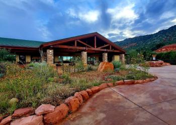
Address: 8375 State Route 179, Sedona, AZ 86351
Phone: 928-203-2900
Hours: Wednesday 12 p.m.-4:30 p.m. All other days, open 9 a.m.-4:30 p.m. See "Additional Office Information" below for holiday hours.
Office Email: SM.FS.Cof_Webmail@usda.gov
Getting There
Directions
Location: 42 miles south of Flagstaff (11.5 miles east of Sedona) in scenic Red Rock Country.
Access: (Jacks Canyon Trailhead) Drive south 30 miles out of Flagstaff on US 89A to the Rt 179 intersection in Sedona. Turn left at the traffic light and drive about 7.3 miles to Jacks Canyon Road (FR 793). Follow this road about 3 miles to the trailhead.
For the Woods Canyon Trailhead, continue on AZ 179 about 2 miles beyond the Jacks Canyon turnoff to where the Red Rock District Ranger Offices are on the east side of Hwy. 179. The Woods Canyon Trail heads up canyon. A sign marks where the Hot Loop branches off.
GPS (Map): 34°47'02.8"N 111°43'57.6"W (Jacks Canyon Trailhead)


