
Official websites use .gov
A .gov
website belongs to an official government organization in the
United States.
Secure .gov websites use HTTPS
A lock
(
) or https:// means you've safely
connected to the .gov website. Share sensitive information only
on official, secure websites.


About the Trail
About the Trail
The Pacific Northwest Trail travels through some of the region's most spectacular and diverse terrain along its 1,200-mile journey from the Continental Divide to the Pacific Ocean. The trail crosses through five primary geographic areas: the Rocky Mountains, Columbia Mountains, North Cascades, Puget Sound, and Olympic Peninsula.
The National Trails System Act describes that National Scenic Trails... 'will be extended trails so located as to provide for maximum otudoor recreation potential and for the conversation and enjoyment of the nationally significant scenic, historical, natural, or cultural qualities of the areas through which such trails may pass.'
Know Before You Go
Conditions on the Pacific Northwest National Scenic Trail (PNT) can change rapidly due to events such as wildfires or flooding. Some sections of the PNT may be closed or have other restrictions. The Pacific Northwest Trail Association aggregates information from local land managers and visitors to provide Trail Conditions, Trail Alerts, and COVID-19 Updates. For the latest information, visitors should check with the local office of the land management agency for the section of the PNT you plan to visit.
The Geographic Areas the Trail Crosses Through:
-
Rocky Mountains
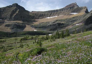
The Pacific Northwest Trail begins its westward journey high in the Rocky Mountains within sight of the Canadian border. The trail’s eastern terminus is located at Chief Mountain Customs in Glacier National Park.
-
Columbia Mountains

The Columbia Mountains is the largest geographic area along the Pacific Northwest Trail, and includes a mix of rugged mountain ranges interspersed with rolling hills and river valleys.
-
North Cascades

The transition from the Columbia Mountains to the North Cascades is subtle at first but soon reveals a much different character. The North Cascades geographic area is much more remote and difficult to access with a long section through the Pasayten Wilderness.
-
Puget Sound

The Puget Sound section, from Mt. Josephine to Whidbey Island, is the shortest and most easily accessible section of the Pacific Northwest Trail. Most of the trail in this area is at or near sea level and is hike-able year round.
-
Olympic Peninsula
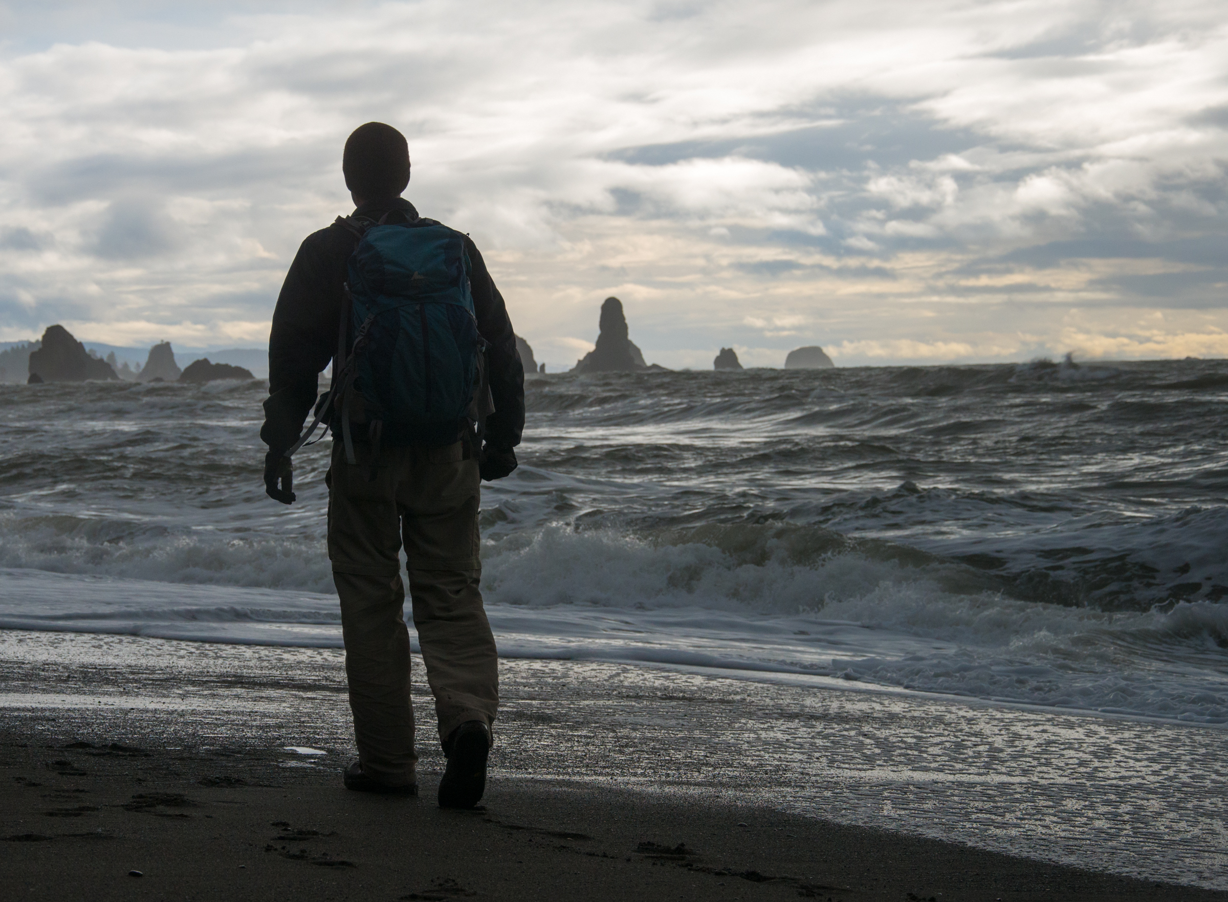
The Olympic Peninsula section of the Pacific Northwest Trail is an experience of extremes – it begins and ends at sea level with a ferry on one end and pristine, rocky beaches on the other. In the middle is some of the most remote country anywhere in the United States, deep within the heart of Olympic National Park.
More About the Trail:
-
Thru-hiking the PNT

If you are interested in hiking the entire PNT make sure to plan and prepare appropriately. Learn more about this process from the Pacific Northwest Trail Association (PNTA). Their website has information to help guide you through the planning process and can provide you with the information you may need to consider the difficult task of thru-hiking.
-
National Trails System

In 2018, we celebrated the 50th anniversary of the birth of our National Trails System, 11 National Scenic Trails (including the Pacific Crest Trail) and 19 National Historic Trails authorized by Congress, and more than 1,200 National Recreation Trails. These trails provide outdoor recreation opportunities, promote resource preservation and public access, and encourage the appreciation of the great outdoors and America's history and cultural diversity.
-
Connecting Landscapes and Communities

The Pacific Northwest National Scenic Trail (PNT) travels through some of the most spectacular and scenic terrain in the United States, connecting diverse landscapes and communities of the Northwest. Beginning at the Continental Divide in Glacier National Park the trail travels over 1,200 miles through Montana, Idaho, and Washington before reaching the Pacific Ocean near Cape Alava.
-
One of America's Newest National Scenic Trails

First proposed in the early 1970s, the Pacific Northwest Trail was designated by Congress as one of eleven National Scenic Trails in the Omnibus Public Lands Management Act of 2009. The National Trails System Act calls for these trails to be located to provide for maximum outdoor recreation potential as well as the conservation and enjoyment of the scenic, historic, natural, and cultural resources in the areas through which these trails pass.
-
All about the PNT

Download the flyer which has the basic information you need to know about the Pacific Northwest National Scenic Trail. Use the flyer to learn more about the trail's location and the terrain it traverses to help prepare your next trip to America's National Trails System. To learn more details visit the Pacific Northwest Trail Association's website, which provides maps, permit information, and other help to plan your visit.
-
Food Storage Regulations

Much of the PNT travels through terrain that is home to bears, both black and grizzly. Before traveling through bear country, learn about proper ways to store your food as you travel along the PNT. To learn more about food storage visit the PNTA's Food Storage Regulation website. For specific grizzly bear food storage regulations click on the link below.
Share the Journey


