
Official websites use .gov
A .gov
website belongs to an official government organization in the
United States.
Secure .gov websites use HTTPS
A lock
(
) or https:// means you've safely
connected to the .gov website. Share sensitive information only
on official, secure websites.


Maps & Publications
Maps | Publications | Brochures (Auto Tours) | Exhibits | Passport Stamp | Videos
Brochures
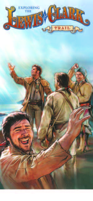
The NPNHT Brochure includes an overview of the Trail, a map and photos, sources for hard-copy maps, local information contacts for sites along the Trail, and a short list of additional sources of information on the Nez Perce and the Trail.
Auto Tours
Retrace the routes used by the Nez Perce Indians and U.S. military forces during the summer of 1877. With the cooperation of State Highway Departments and County Commissioners in the states of Oregon, Washington, Idaho, Wyoming, and Montana, over 1500 miles of Federal, state, and county roads have been designated as the Nez Perce National Historic Trail Auto Route. The route roughly parallels the course traveled by the Nez Perce bands during their historic 1877 flight beginning near Wallowa Lake, Oregon and ending at the Bear Paw Battlefield south of Chinook, Montana. The auto route consists of three-season, all weather roadways ranging from high-standard gravel segments to portions of Interstate 15 and 90. Nez Perce National Historic Trail signs have been erected along the primary auto route and two alternate segments.
Maps of the Nez Perce National Historic Trail
Official Visitor Map
The new (2016) official visitor map of the Trail, produced on “plastic paper,” can be purchased at Forest Service and National Park Service offices along the Trail and online through Discover Your Northwest and the U.S. Geological Survey Store. Click the map cover to see an image of the map.
Visit Nez Perce (Nee-Me-Poo) National Historic Trail (NPNHT) visitor tear sheet map.
Visit the Google Map interactive map.
The content can be viewed in a virtual environment using Google Earth.
Simple Map
Select the map to enlarge it.

Publications
Documents produced by the Nez Perce National Historic Trail can be found below. Some of these publications can be ordered in hard copy, some are available online, and some are available in both formats. The quarterly progress report online documents are provided in PDF or a text-only, screen-reader-accessible version (in progress). For further information on hard-copy publications, contact us.
Past Quarterly Newsletters and Progress Reports (1995-2022)
Exhibits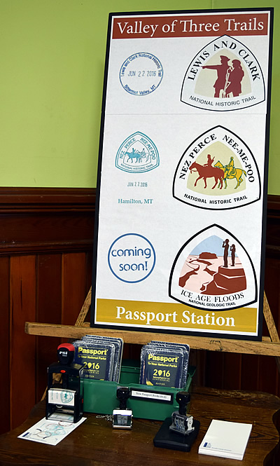
The Nez Perce (Nee-Me-Poo) National Historic Trail Traveling Exhibits are available for loan. If you would like additional information on how to reserve the exhibits, please visit Nez Perce (Nee-Mee-Poo) National Historic Trail Traveling Exhibits.
Passport Stamp
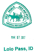
NPNHT Passport Stamps have been placed at visitor centers and partner locations along the Trail so you can memorialize your visits in the National Park Service Passport.
The Passport to Your National Parks was created to help visitors explore their National Parks and has become a popular way for people to document their travels. The program has expanded to include a number of USDA Forest Service locations, like the NPNHT. More information, including purchasing a Passport or retail opportunities, can be found at www.eparks.com. Many locations offering the stamps also offer passport sales.
Current Passport Stamp locations
Videos
We have three videos featuring the Nez Perce and the sacred lands of the Nez Perce National Historic Trail. View videos.
Features
Bibliography
This historical resource bibliography (annotated and non-annotated) has been compiled to aid the trail manager, interpreter, or novice researcher in the quest for quality information on Nez Perce history, culture, and involvement with the U.S. military during the conflict of 1877.


Key Contacts
12740 Hwy 12
Orofino, Idaho 83544
(208) 476-8234


