

Welcome to Prescott National Forest
On April 22, 2025, we transitioned our public websites to a modern web platform to better serve the public. With thousands of pages to update, some content may take longer to appear. Some old content has been archived during this process, as well.
We appreciate your patience as we work to make it easier than ever to access information and explore your national forests—both online and on the ground. Please send us an email using our Contact Us form if there is something you can't find!
Prescott National Forest is guardian of 950 miles of scenic trails and more than 100,000 acres of wilderness. Its mild climate allows for outdoor adventures year-round. From picnicking, developed campsites and gentle trails to rock climbing, bouldering, dispersed camping and rafting on more than a million acres of incredible landscapes, there's something for everyone to see and do!
Apply Now to Become a Wildland Firefighter
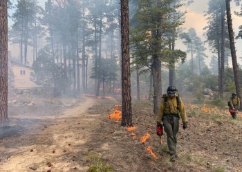
Applications for temporary seasonal fire hire positions are due by July 14.
You can also connect with a Fire, Fuels and Aviation Management recruiter to learn about future openings and hiring events.
Plan Your Adventure
Places to Stay

From the desert to the pines, discover your next destination on the Prescott National Forest. Find recreation, camping and cabins.
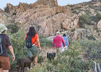
Recreation Opportunities

With over 950 miles of trails, four lakes, a Wild & Scenic River, picnic sites and more—all surrounded by natural beauty—Prescott National Forest has something for everyone!
Recreation Passes
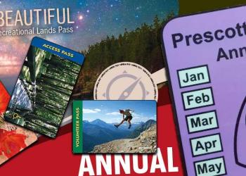
You may need to pay a fee depending on which sites you visit. Passes for a day, four months, a year or a lifetime.
Forest Product Permits

Permits are required for collecting fuelwood and cutting Christmas trees. Transplant permits allow for the removal of certain small trees.
Special Use Permits

Examples of activities that require special use permits includes recreation events, large group gatherings (outside of reserved group sites), communication towers, power lines, pipelines, roads, outfitter/guide businesses and commercial endeavors.
Trails
Follow this link for an overview of the Prescott National Forest trails system, a list of trails in different parts of the Forest, advice on best trails for different user types, volunteering, trail etiquette and more.