

Welcome to the Nebraska National Forests and Grasslands
In the Nebraska National Forests and Grasslands you can find quiet, undeveloped spaces. Here, East meets West as seen in the wildlife and plant mix. These large tracts of public land are the closest places for Midwesterners to hunt and play. Nebraska National Forests and Grasslands include the Nebraska National Forest, Samuel R. McKelvie National Forest, Buffalo Gap National Grassland, Fort Pierre National Grassland and Oglala National Grassland.
We've got a new look!
In April 2025, we transitioned to a new web platform to better serve the public. With thousands of pages to update, some content may take additional time to appear. Some older content has been archived during this move as well.
We appreciate your patience as we make it easier than ever to access information and explore your national forests - both online and on the ground.
If you cannot find what you are looking for, please contact your local Forest Service office or submit your question using the Contact Us form.
Popular Places
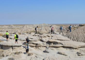
Buffalo Gap National Grassland
Wild and weird, this landscape is vast and unforgettable. The Buffalo Gap National Grassland has a rich history and the most genetically diverse population of endangered black-footed ferrets in the country.
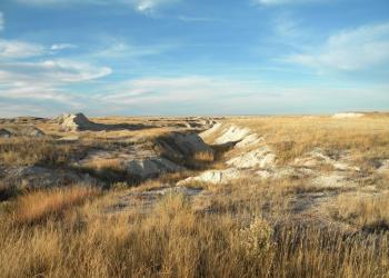
Toadstool Geologic Park and Campground
Noted for its unusual geologic formations and scientifically valuable fossils, Toadstool Geologic Park is a popular destination. During your hike, look for - but don't collect! - fossils that help scientists understand animal behavior 30 million years ago.
Nebraska National Forest - Bessey / Halsey

Bessey is where the largest hand-planted forest in the western hemisphere is nestled within the most intact temperate prairie on Earth. Bessey is known for its off-highway vehicle trails, hunting, camping, kayaking, and horseback riding.
Fort Pierre National Grassland

Fort Pierre National Grassland is widely known for its mixed grass prairie that provides shelter to the greater prairie chicken, the sharptail grouse, the Chinese ring-neck pheasant, and numerous migrating birds.
National Grasslands Visitor Center
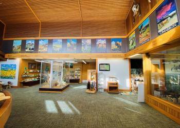
The National Grasslands Visitor Center introduces and invites visitors to explore the 20 National Grasslands and Midewin National Tallgrass Prairie. These public lands are restored prairie landscapes managed by the Forest Service to conserve their natural beauty, ecological diversity, and sustainable productivity for generations to come.
Charles E. Bessey Nursery
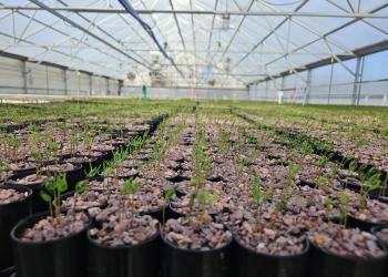
The Nursery has a long-standing reputation for producing top-quality planting stock due to its deep sandy soils, abundant water and relatively long growing season. Production facilities and equipment are state-of-the-art. The Nursery is capable of producing 4.5 million bare root conifer and hardwood seedlings each year.