
Official websites use .gov
A .gov
website belongs to an official government organization in the
United States.
Secure .gov websites use HTTPS
A lock
(
) or https:// means you've safely
connected to the .gov website. Share sensitive information only
on official, secure websites.


Angelina National Forest
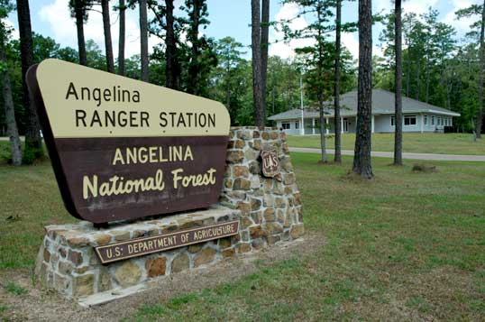
Angelina National Forest
~ Forest Map ~
Welcome to the Angelina National Forest, one of four National Forests in Texas. Located in the heart of east Texas, the 153,179-acre Angelina National Forest is located in Angelina, Nacogdoches, San Augustine and Jasper counties. The forest lies in the Neches River Basin and on the north and south shores of Sam Rayburn Reservoir, a 114,500-acre lake on the Angelina River formed by the construction of Sam Rayburn Dam in the early 1960's.
The Angelina National Forest lies in the upper Gulf Coastal general plain province and the terrain is gently rolling. Longleaf pine is the predominant cover type in the southern portion, while loblolly and shortleaf pine are the dominant types in the rest of the forest.
Summers in the Angelina National Forest are hot and humid and winters generally are short and mild. Average mid-summer temperatures in the forest range from the mid-80's to the mid-90's, with an average mid-winter temperature a mild 52 degrees. Rarely do temperatures in the forest drop to less than 10 degrees or rise above 110 degrees. The average annual rainfall is 46 inches.
HISTORY
Man came to the area now known as the Angelina National Forest around 8,000 years ago. Archeological sites have been located as part of the U.S. Forest Service's cultural resource inventory in addition to those resources located and excavated prior to the construction of Lake Sam Rayburn Reservoir. These sites document the evidence of man's presence over the entire period since then.
One of Angelina County's original settlers, John H. Graham, lies buried in a small cemetery overlooking the creek which bears his name in the southwestern part of the forest. His name and birthdate may still be seen on his grave marker.
Of more recent setting is the old Aldridge Sawmill site near the terminus of a spur of the Sawmill Hiking Trail near the Neches River south of the Boykin Springs Recreation Area. Hand-poured concrete structures remain, rapidly deteriorating under the onslaught of vandalism and the advancing forest cover, and these stand as mute testimony to the aspirations and dreams of turn-of-the-century timber barons.
In 1934, the Texas Legislature approved a resolution to urge federal purchase of land to create National Forests in Texas. In 1935, acquisition began on the Davy Crockett, Sam Houston, Angelina and Sabine National Forests.
Early management efforts centered on timber inventory, planting trees and fire protection. Much of the land had begun to seed-in naturally, due mostly to the Texas Forest Service's fire protection efforts which had begun years earlier. The two agencies, the Texas Forest Service and the U.S. Forest Service, began a harmonious working relationship with the inception of the National Forests in Texas.
ECOSYSTEM MANAGEMENT
The Angelina National Forest is managed under the ecosystem management concept. Ecosystem management is a means to achieve sustainable conditions and provide wildlife and fish habitat, outdoor recreation, wilderness, water, wood, minerals, and forage for the public while retaining the esthetic, historic, and spiritual qualities of the land.
In 1960, the Multiple Use-Sustained Yield Act put into law what had been practiced on the National Forests in Texas for almost 30 years. This act emphasized that resources on public lands would be managed so that they are used in the combination that will best meet the needs of the people, that the benefits obtained will exist indefinitely and that each natural resource would be managed in balance with other resources to meet public needs.
Forest management plans outline direction under ecosystem management, but even the most carefully planned system of management cannot foresee environmental or natural factors which can cause drastic changes in a forest. Fire, storms, insects and disease, for example, can prompt managers to deviate from land management plans and can alter the way a forest is managed.
RECREATION
To serve the increasing number of people who use the National Forests and Grasslands for sport and relaxation, visitors to the Angelina National Forest have a choice of several developed recreation areas for outdoor activities.
Sam Rayburn Reservoir - In the middle of the Angelina National Forest lies Sam Rayburn Reservoir, noted for its fishing, pleasure boating and skiing. Fishermen are required to have a Texas fishing license and follow state regulations concerning water sports.
Two developed recreation areas, Caney Creek and Sandy Creek, offer recreation users camping, picnicking, boating and fishing on or near the shores of Sam Rayburn Reservoir. Caney Creek has a campfire theater for visitors. Additional boat ramps on the reservoir are available at Harvey Creek and Townsend Recreation Area (operated and maintained by San Augustine County - 936-275-2762-no showers) as well as at U.S. Army Corps of Engineer parks.
Bouton Lake - Boykin Springs - Sawmill Hiking Trail - Camping and fishing are favorites at Bouton Lake Recreation Area, built on a 12-acre natural lake near the Neches River. Boykin Springs Recreation Area, built in 1938 by the Civilian Conservation Corps, surrounds a 9-acre man-made spring-fed lake and offers recreation visitors camping, picnicking, swimming, fishing and canoeing in a scenic setting of longleaf pine.
The 5 1/2-mile Sawmill Hiking Trail winds between Bouton Lake and Boykin Springs recreation areas, with a 3/4-mile spur near the middle portion of the trail leading to the abandoned Aldridge Sawmill site. Part of the trail follows an old tramway, used until 1920 to haul logs to the sawmills. Portions of old bridges and sawmill ruins can be seen at various points along the trail. A trail map is available at the District Ranger's office and at the trail head at Boykin Springs.
WILDLIFE
Wildlife management focuses on keeping animal populations in balance with available food and shelter. Hundreds of wildlife species exist in the Angelina National Forest. Principal game in the forest is deer, squirrel, wild turkey, woodcock, quail, dove and duck, and sportsmen can enjoy hunting and fishing in accordance with state game laws.
The fish and wildlife habitat created by Sam Rayburn Reservoir offers 114, 500 acres of water for fish and waterfowl populations to exist and multiply and feed and resting grounds for migratory birds before they proceed south toward the Gulf Coast. A resident population of wood ducks remains in the forest year-round.
The 20,700-acre Bannister Wildlife Management Area is located north of Lake Sam Rayburn. The objectives for the area are (1) to provide an area of multiple resource management with increased emphasis on wildlife management; (2) to develop and maintain population levels of various game species to provide an improved hunting opportunity; and (3) to demonstrate wildlife/timber management coordination techniques, applicable to the pineywoods of East Texas. In the wildlife management area, improvements include game stocking, water impoundments and forage planting.
Sam Rayburn Reservoir and the surrounding Angelina National Forest provide wintering habitat for the threatened bald eagle. During the winter months, forest visitors may see the bald eagle soaring over the lake, perched on a flooded snag or in a tall pine along the shoreline.
The red-cockaded woodpecker, an endangered species, is found throughout the forest. A small black and white woodpecker, it makes its home by pecking cavities in large, living pine trees. Around the entrance to its cavity nest, the red-cockaded woodpecker chips pitch wells resulting in pitch flow giving the cavity tree a candle stick appearance below the nest opening and serves to protect the bird from predatory snakes.
The red-cockaded woodpecker was designated an endangered species in 1973. This unique little bird and its habitat are protected in the Angelina National Forest and all federal lands. Wherever these birds are found, management emphasis is directed toward providing the special habitat they require.
TIMBER MANAGEMENT
When the Angelina National Forest was established, most of the land was severely cut-over, and almost no commercial timber was left standing. Today, the Angelina is second-growth or third-growth forest and most of the land is very productive for growing trees.
The timber management objective is to maintain healthy diverse forest conditions while providing a continuous supply of wood products for local and national needs. All resources are considered and timber management practices are used on extensive areas to provide quality habitat for the red-cockaded woodpecker. Other areas are managed to restore, enhance, or maintain desired forest communities such as the longleaf pine or shortleaf pine-oak communities. The timber resource is managed to provide areas of older or larger trees.
FIRE MANAGEMENT
Wildfire - The U.S. Forest Service and the Texas Forest Service have a cooperative agreement and action plan to coordinate the prevention, law enforcement, aerial detection and suppression of wildfire.
In a recent 10-year period on the Angelina National Forest, there was an average of 19 wildfires per year. These fires burned an average of 318 acres of federally-managed land each year and were 93 percent people-caused. All visitors to the forest are asked to use care with fire. Keep campfires small, never leave one unattended and completely extinguish all fires, matches and cigarettes.
Prescribed Fire - Fire has a proven ecological role in the development and management of the forest and rangelands and is used as a tool for ecosystem management in the Angelina National Forest. Most of the sensitive and endangered plants and wildlife species need the benefits of fire to survive. The red-cockaded woodpecker prefers a park-like forest opened up by controlled, prescribed fires. Sensitive seepage bogs also require frequent burns to keep woody plants from encroaching and shading out the sundews and pitcher plants. Prescribed fire can reduce heavy accumulations of forest fuels to minimizes damages in the event of wildfires. After an area is prescribe burned, a new shrub understory sprouts to supply food for wildlife. By removing thick underbrush, prescribed burning also improves accessibility for forest visitors.
Weather, fuel conditions, seasonal timing of burning projects and specific techniques of fire application are all considered by trained professionals in prescribed burning.
WATER-SOIL-MINERALS
Water - The management of watersheds is to regulate stream flow, control floods, erosion, and serve as water storage areas and supply water for agriculture, industry, recreation and domestic use.
Most of the Angelina National Forest drains into Sam Rayburn Reservoir. South of the forest boundary at the confluence of the Angelina and Neches Rivers lies Steinhagan Lake, a 16,830-acre reservoir managed by the Corps of Engineers.
Soil - Soil productivity is the backbone of all multiple uses found in the National Forest. A primary task is to manage and protect the existing soil resource so that it will continue to provide the forest environment we now enjoy. The objective of soil management on the Angelina National Forest is to maintain or improve soil productivity.
Minerals - Visitors may see oil and gas wells in the Angelina National Forest. The United States does not own all of the mineral rights for these lands as many of the sellers retained mineral ownership either for a fixed period of time or in perpetuity.
Where the United States owns the mineral rights (oil and gas in particular), receipts from oil and gas exploration and production are paid to the U.S. Treasury. Like the money collected for timber sales, grazing, recreation and other land uses in the National Forests and Grasslands in Texas, a portion of receipts from minerals exploration and production is returned to the counties in which the Angelina National Forest is located, earmarked by law to be used for public schools and roads.
HOW TO RECOGNIZE NATIONAL FOREST LAND
Maps commonly show proclaimed National Forest boundaries. However, all land within this boundary is not National Forest land; some is privately owned. The land shown in green on the Angelina National Forest map indicates National Forest land. The user should comply with state law and the owner's rules with entering onto private land.
Red paint and signs mark the boundaries between National Forest land and private property. Recognition of these markings and boundary signs will help the user be certain to stay on National Forest land.
Entrance (portal) signs - These signs can be seen along major roads entering the National Forests, usually on the first tract of government land encountered. Generally, portal signs are not used on low traffic volume roads.
Welcome signs - These signs are located on or just inside the boundaries or individual tracts of National Forest land where the road enters. The sign will be oriented so that the land behind the sign is public land. Generally, they are not used on dead-end or woods roads or on small blocks of public land. Upon entering the woods on public land, welcome signs will not be present and the user should then rely on the following method of boundary identification.
Property line marking and boundary signs - The boundaries of individual National Forest tracts adjacent to other ownerships are marked with brown and yellow property boundary signs. The small metal boundary signs are fastened either to trees or posts located on the boundary line and at road crossings, and the signs are placed so that public land is behind the sign. Red paint spots on trees define the boundary line through the woods.
There are nearly 554 miles of boundary line on the Angelina National Forest. While the majority are identified and posted, occasionally one may encounter an area where signs have been vandalized or lines are not yet marked. In these cases, one should be alert to avoid accidentally trespassing on private land.
REGULATIONS
Rules and regulations are posted on the bulletin boards in all Forest Service recreation areas. By observing the following regulations, all forest users can enjoy the peacefulness and serenity of the Angelina National Forest.
1. In developed areas, put tents and trailers only in places provided.
2. Occupy your campsite the first night you arrive; do not leave it unoccupied for more than 24 hours at a time.
3. Camping is not permitted in day-use areas such as picnicking or boating sites, swimming areas and scenic areas.
4. Maximum length of stay: 14 consecutive days. This limit also applies to the general forest area.
5. Only campers are permitted inside campgrounds during established night hours (usually posted).
6. Build fires only in stoves, grills, fireplaces or fire rings.
7. Help preserve all facilities and vegetation. Protect recreation areas for future generations.
Events such as fishing tournaments which involve more than 75 participants and spectators or for which there is an entrance fee requires a special use permit.
"GOOD NEIGHBOR" CAMPING for DEVELOPED RECREATION AREAS:
1. Use containers provided for garbage and unburnable trash.
2. Use grill or stove to burn paper and cardboard trash.
3. Clean up your campsite before you depart.
4. Keep pets on leash and quiet!
5. Refrain from making noises that might disturb your neighbor's sleep during night hours (10 p.m. - 6 a.m.).
6. Put nothing in toilets that might damage or clog them.
7. Observe speed limits. Drive carefully.
8. Keep all vehicles on roads and spurs.
9. Shooting and fireworks are prohibited.
10. Keep glass and pets away from beach and swimming areas.
11. Boaters must observe 5 m.p.h. speed limit when within 150 feet of swimmers, other boats and boat landings.