Official websites use .gov
A .gov
website belongs to an official government organization in the
United States.
Secure .gov websites use HTTPS
A lock
(
) or https:// means you've safely
connected to the .gov website. Share sensitive information only
on official, secure websites.


Total Solar Eclipse
 Don't miss the total solar eclipse in southern Illinois - Eclipse Crossroads of America. The entire Shawnee National Forest is in the path of totality and on April 8, 2024 will experience the full 4 minutes 7 seconds of darkness. Use the information & resources on this page to plan your trip, be safe, and enjoy the great 2024 Eclipse on the Shawnee National Forest.
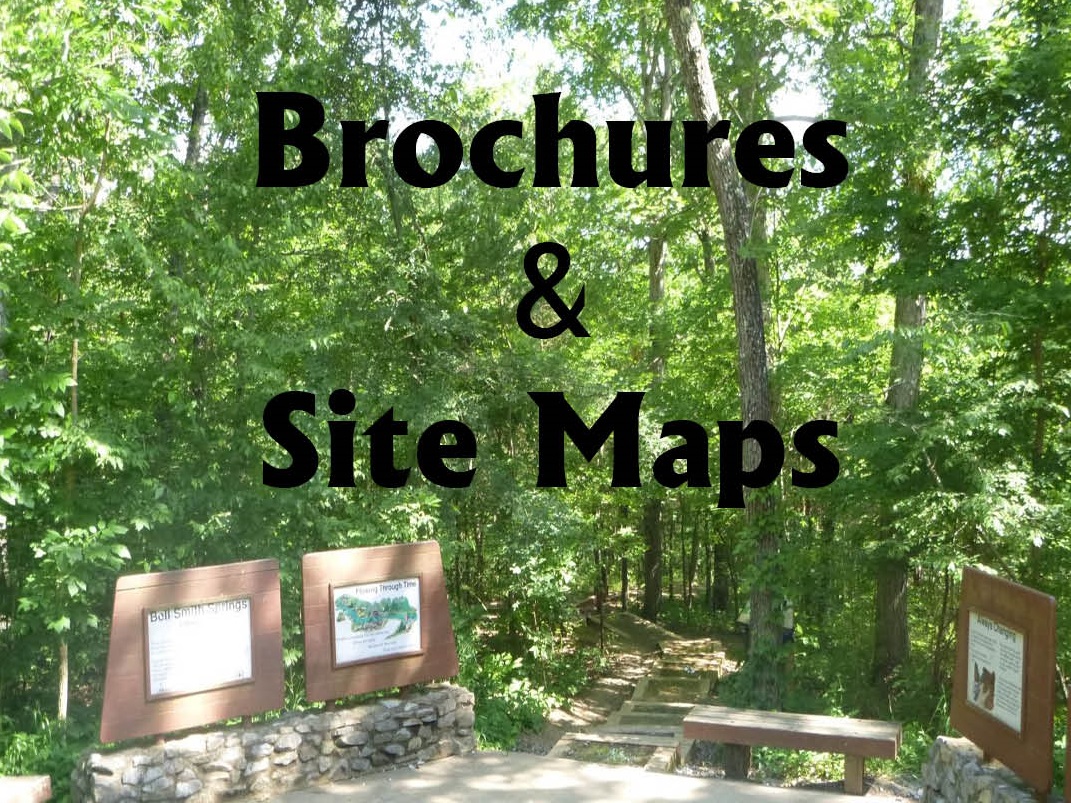
Print and Go
- Eclipse Visitor Information
- Eclipse Camping
- Dispersed Camping Maps with directions
- Developed Recreation Site Information
Prepare for the Eclipse
-
Know Before You Go

Prior to your visit, review guidelines on responsible recreation. Get the most out of your experience and check out Know Before You Go.
-
National Forest Maps

In addition to your eclipse maps, check out the Forest Guide Map to find your way around the Shawnee National Forest.
We offer both Digital and Paper maps; visit the Maps & Publications page or stop by one of our offices to learn more.
-
Camping

Find a spot! Use our interactive map to find a camping location and enjoy the Eclipse. Or download and go with the Eclipse Camping brochure.
The interactive map is best viewed using a desktop computer, laptop or tablet.
-
NASA Viewing Tips
What is the difference between the 2023 annual eclipse and the 2024 total solar eclipse? What exactly is a total solar eclipse? What are some amazing things happening the sky right now?
Check out NASA's daily skywatching calendar and upcoming eclipse information.
-
Poster Contest Winners

Recently local students participated in an eclipse poster contest. We received many colorful creations reflecting the solar eclipse and the forest. We’d like to thank those that participated and congratulate the winners.
Local Eclipse Resources
 There’s a lot going on in southern Illinois during the 2024 Eclipse. Explore the links below to find out what’s happening outside the Shawnee National Forest.
- Southern Illinois Eclipse
- Illinois State Parks Eclipse Info
- Southern Illinois University
- Southernmost Illinois Tourism
- Carbondale Illinois Facebook page
- NASA
Frequently Asked Questions
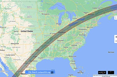
Monday, April 8, 2024, total solar eclipse will begin over the South Pacific Ocean and will cross North America, passing over Mexico, United States, and Canada.
The path of totality for the Shawnee enters southern Illinois at 1:58:15 PM (CDT) along the Mississippi River, just south of East Cape Girardeau. The shadow leaves the state at 2:07:04 PM (CDT), at a bend in the Wabash River on a road labeled E. 700th Ave, a few miles SE of Palestine. Not quite 9 minutes from first touch to last.
The ‘path of totality’ – Weather permitting, the first location in continental North America that will experience totality is Mexico’s Pacific coast at around 11:07 a.m. PDT. The path of the eclipse continues from Mexico, entering the United States in Texas, and traveling through Oklahoma, Arkansas, Missouri, Illinois, Kentucky, Indiana, Ohio, Pennsylvania, New York, Vermont, New Hampshire, and Maine. The eclipse will exit continental North America on the Atlantic coast of Newfoundland, Canada, at 5:16 p.m. NDT.
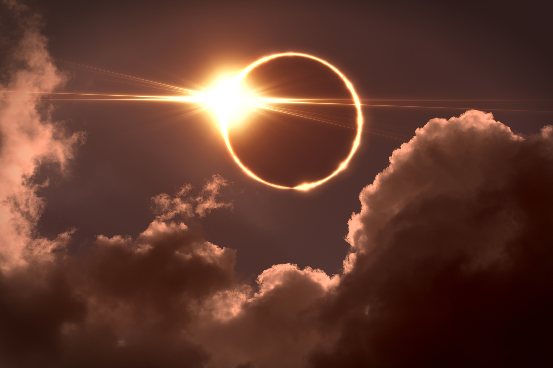
A rare occurrence during which the moon, earth, and sun align in such a way that the moon momentarily blocks the sun for viewers along the path of totality. During totality, the 1 – 2 minutes when the alignment is complete, darkness falls along the path of totality, the only sunlight coming from the narrow lip of the surface of the sun that remains visible beyond the moon.
Except for the 1 – 2 minute of totality, it is dangerous to look at the eclipse without eye protection designed specifically for eclipse viewing. While the partially obstructed sun won’t appear as blindingly bright as on a sunny day, harmful rays continue to emit from the sun and can permanently damage eyes. It is also dangerous to view any phase of the eclipse, including totality, with binoculars or a telescope without a filter designed for viewing the sun.
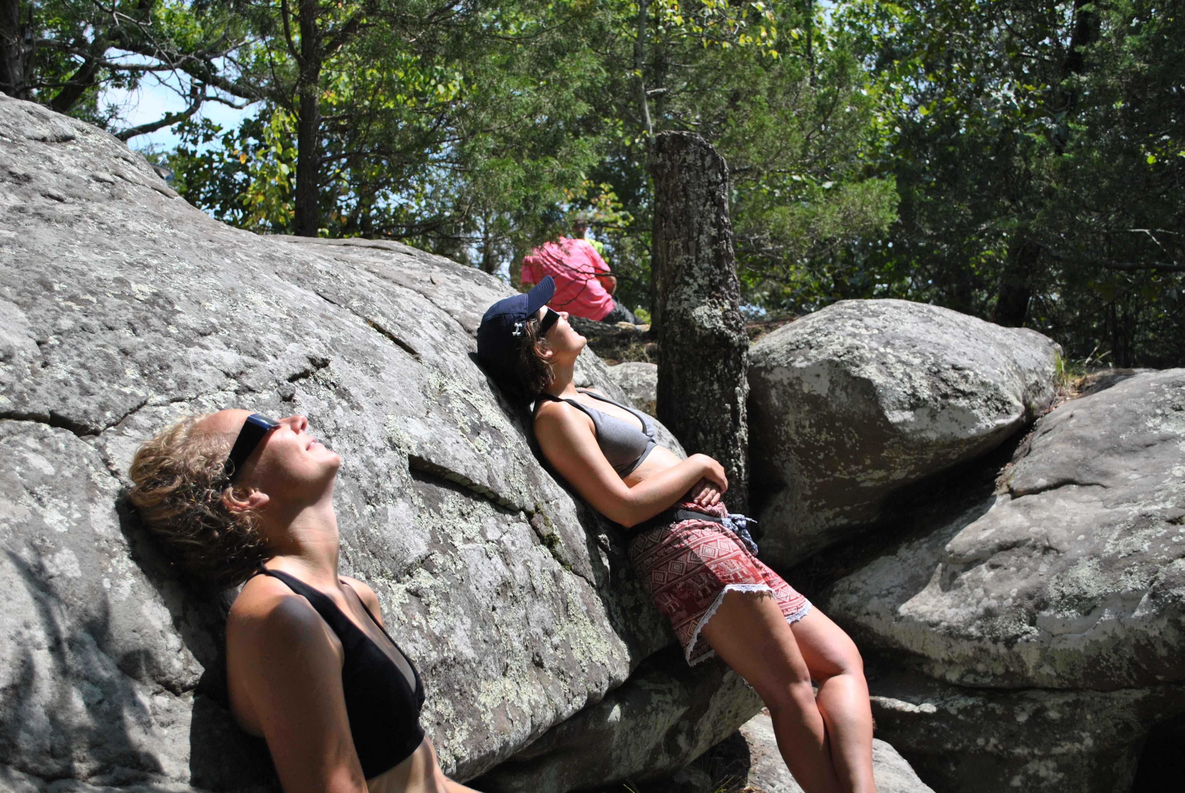
Popular viewing areas like Garden of the Gods Recreation Area, Bell Smith Springs Recreation Area, Lake Glendal, etc. while great for viewing, will fill quickly. Sites are first come, first served, to provide a unique viewing experience, while ensuring public safety, clear access for emergency vehicles, and protection of sensitive nature areas. Visitors should expect campgrounds to be full, so please consider one of several other areas on the forest suitable for dispersed camping. Expect roads and highways to be congested.
The Shawnee National Forest falls completely within the path of totality, meaning anywhere on the forest is a perfect location for the 2024 Solar Eclipse. Although much of the Shawnee is covered in forests, there are open areas that provide good locations for viewing the eclipse. National Forest land extends across southern Illinois from the Ohio River to the Mississippi River and is intermixed with private land, so be sure you are on public land before setting up your camp or picnic. Forest maps are available at all our offices and on our website.
No, designated campsites within the Shawnee National Forest are available on a first-come, first-serve basis. We do not accept reservations.
Campgrounds (campgrounds are listed from west to east locations in Shawnee NF):
- Johnson Creek Recreation Area
- Turkey Bayou Campground*
- Pine Hills Campground
- Bell Smith Springs Recreation Area
- Lake Glendale Recreation Area
- Garden of the Gods Recreation Area
- Pounds Hollow Recreation Area
- Camp Cadiz Campground
- Tower Rock Campground*
Instructions for paying campsite fees are located at the entrance of the campground. Campgrounds are patrolled regularly. Please note that some of the campgrounds do not have drinking water. For a list of developed campground amenities and fees, visit our website.
*Turkey Bayou and Tower Rock Campgrounds are no-fee campgrounds.
The following regulations apply in designated Campgrounds:
Leaving your campsite unoccupied during the first night after equipment is set-up or leaving equipment unattended for more than 24 hours thereafter is prohibited. Check out time is 2:00 p.m. Parking on the grass and camping outside the designated campsite is prohibited. Keep campfires contained in the fire rings provided at each campsite. The cutting of live trees, shrubs and other vegetation is prohibited. Quiet hours are in effect from 10:00 p.m. to 6:00 a.m. Weapons, firearms and fireworks are not to be discharged in campgrounds or picnic areas. Pets are welcome, but must be leashed and are not allowed in designated swimming areas.
Yes! Primitive camping, also called dispersed camping, is allowed on National Forest land ¼ mile outside the boundaries of developed campgrounds and picnic areas. Primitive camping is NOT allowed within Natural Areas, Research Natural Areas, on trails within 150 ft of a lake or stream. There is no fee for primitive camping in general forest areas, however visitors are limited to camping a maximum of 14 continuous days. Recreate responsibly and remember to pack it in, pack it out! Help us protect our lands for all to enjoy. Practice Leave No Trace Ethics. Refer to the 2024 Solar Eclipse – “Improved” Dispersed Camping Locations brochure for primitive camping suggestions in the forest.