
Official websites use .gov
A .gov
website belongs to an official government organization in the
United States.
Secure .gov websites use HTTPS
A lock
(
) or https:// means you've safely
connected to the .gov website. Share sensitive information only
on official, secure websites.


Tongass National Forest
Water stored in glaciers creeps out to the sea. Water falls as rain and snow and feeds the temperate rainforest. Water carves the rocks and sheer cliffs. Water defines the Tongass National Forest.
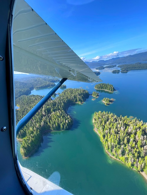
At nearly 17-million-acres the Tongass is the largest national forest in the United States. It encompasses nearly 90 percent of the southeastern panhandle of Alaska. It stretches from the southern tip of Prince of Wales Island 500 miles north to the Hubbard Glacier just north of Yakutat. After crossing Dixon Entrance, a voyager traveling north on the waters of the Inside Passage is surrounded by the Tongass.
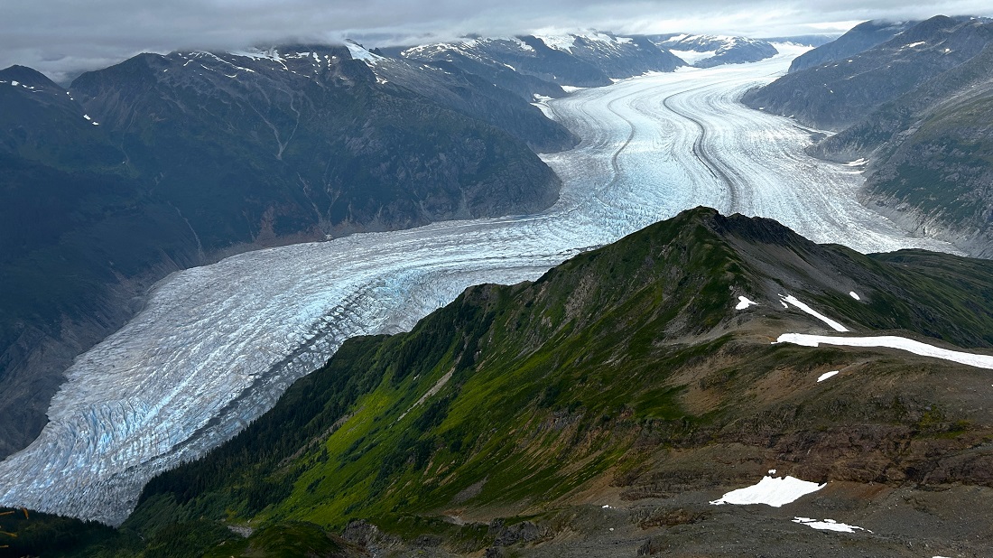
Though it is home to the largest intact temperate rainforest in the world, over half of the Tongass is covered by ice, water, muskeg, and rock. The islands and mainland create 11,000 miles of saltwater shoreline where regal mountains rise from tidewater to overlook a mostly undeveloped and isolated landscape.
A Varied Landscape
Few places in the world can boast of the geologic and climatic variations that characterize the Tongass. At sea level, rain, and lots of it falls throughout the year. Climb just 1,600 feet, and the climate is too harsh for trees. Lush temperate rainforest thrives at sea level, less than a two-mile hike from the frigid, windy alpine where buttercups and sedges cling to a tenuous existence.
"Rivers of ice," or glaciers, grind their way down from the mountaintops. While some glaciers remain perched above sea level, others, called "tidewater glaciers" deliver their icy cargo into the ocean. Even the face of the sea changes here as it surges through narrow channels and up glacier-carved fjords. Tides in Southeast Alaska, while not as severe as some of the tides further north, have a variation of as much as 25 feet in one 6-hour period. Tidal highs and lows alternate every 6.5 hours.
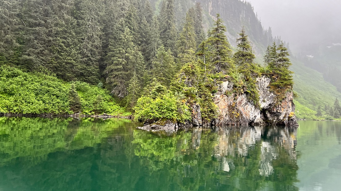
Coastal Temperate Rainforest
Alaska’s National Forests harbor the largest remaining temperate rainforest in the world. The Tongass National Forest contains fourteen percent of the world total acreage of these productive forests. The forests of Prince William Sound on the Chugach National Forest represent the northernmost extent of this rich, but uncommon, ecosystem.
Coastal temperate rainforests are found in wet, cool climates where the collision of marine air and coastal mountains causes large amounts of rainfall. Rainfall in Southeast Alaska varies from two to 25 feet each year, depending on location.
Coastal temperate rainforests extend from Kodiak Island along the coast to the California "fog belt" redwoods. Much of their remaining 75 to 100 million acres is found there and in Chile. Ecologists use four features to distinguish coastal rainforests from other temperate forest types: proximity to oceans, the presence of coastal mountains, cooler summer temperatures, and higher rainfall levels with significant precipitation occurring in all seasons. These unique conditions lead to vital links between the marine and terrestrial environments. The rainforest ecosystem does not end at the high tide line, rather, nutrients are cycled throughout the system.
Coastal temperate rainforests foster a hugely disproportionate share of the world biological production. They accumulate and store more organic matter than any other forest type (including tropical rainforests) as much as 1,000-2,000 metric tons of wood, foliage, leaf litter, moss, other living plants, and organic soil per acre. The adjacent waters are productive as well. Alaska temperate rainforests are comprised of thick stands of Sitka spruce, yellow cedar, redcedar, and western and mountain hemlock.
Unlike most places in the Lower 48, it is wind, and not fire, that disturbs the forests of the Tongass, sometimes toppling acres of trees at a time. In areas protected from the wind, usually on the north side of ridges, trees may live to be more than 500 years old. About 90 percent of these old growth forests remain as they were 100 years ago.
Unparalleled Wildlife
Each spring, the buzzy call of the varied thrush announces the arrival of warmer weather. It is joined by songbirds migrating their way north and others, such as the chestnut-backed chickadee and pine siskin, which make their homes here year-round. The largest known concentration of bald eagles gathers each fall and winter along the Chilkat River near Haines. Here, thousands of eagles feast on late runs of chum salmon. In spring, a eulachon (sea-run smelt) run lures hundreds of eagles to the Stikine River Delta near Wrangell. Within weeks, thousands of shorebirds stop on the delta to rest from their long trek north to summer breeding grounds.
Marine mammals are also abundant. Sea otters, seals, sea lions, porpoises and whales are often viewed throughout Southeast Alaska.
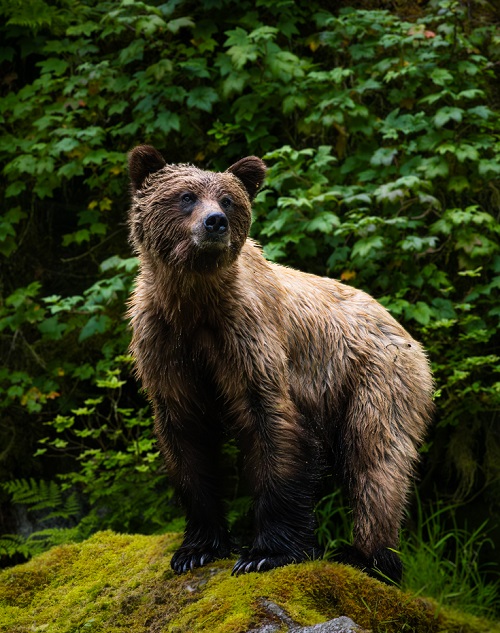
The Tongass is home to healthy populations of animals that have become uncommon in other areas of the United States. Biologists estimate that 1,700 coastal brown (grizzly) bears, the highest density in North America, roam Admiralty Island and share the island with large populations of nesting bald eagles. The Alexander Archipelago wolf is fairly common throughout much of Southeast Alaska. Mountain goats climb along steep, rocky crags above the timberline. In fact, there are no threatened or endangered species on the Tongass National Forest. Other animals such as moose, deer, beaver, fox and porcupine are common throughout the forest.
All five species of Pacific salmon (chum, coho, king, pink and sockeye) thrive and spawn in the streams and waters of the Tongass National Forest. Dolly Varden char, and rainbow, steelhead, and cutthroat trout are common freshwater fish.
A Working Forest That Provides
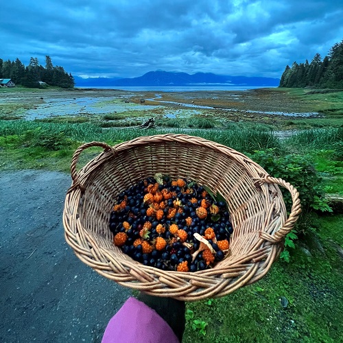
People have lived and worked in this water-drenched land for a multitude of centuries. For thousands of years the Tlingit and Haida peoples have pulled the salmon and herring out of these waters and gathered the berries and other land bounty. Each generation shares its knowledge of the land with the next. The Tsimshian moved from their former home in British Columbia to Annette Island in the late 1800’s.
Gold in this era drew thousands of fortune-seekers up though the Inside Passage to the towns of Douglas, Juneau and Skagway. As the gold potential dwindled in the 1900’s, communities built their economies around fishing, timber and then tourism. Past ways still flourish. Today, many rural residents depend on a subsistence lifestyle, just as Alaska Natives have for centuries.
A Forest for Visitors
The water routes are the gateway for Alaska visitors. Each year, nearly one million visitors travel through the Tongass National Forest aboard cruise ships or the Alaska Marine Highway ferries. Residents and tourists enjoy sailing, motor boating, kayaking and getting out on the water to fish.
The Mendenhall Glacier Visitor Center in Juneau is among the top three tourist attractions in the state. Visitors also travel to the Juneau Ice Field via helicopter and take organized boat trips into Misty Fiords and Tracy Arm. Ecotourism is one of the faster growing portions of the tourism industry.
Traveling through this watery world is a challenge. Roads between communities are rare. Only Hyder, Haines, and Skagway are connected to the North American road system. Roads connect many of the communities of Prince of Wales Island. The Alaska Marine Highway ferries, boats or large and small aircraft, are commonly used to get to communities throughout Southeast.
The changes in day length are far more pronounced here than in the Lower 48. Residents may see more than 17 hours of daylight in June. In winter, the daylight dwindles to just over seven hours at most.
The maritime environment dominates the weather. Normal summer highs average 55 to 60 degrees, with winter highs hovering around 30 to 35. Only rarely will the temperatures drop below zero. Average precipitation varies from 162 inches a year in Ketchikan to 26 inches a year in Skagway.
People from all over are passionate about the wet and enigmatic Tongass National Forest. Some say they want a sense that wild places remain where wildlife may roam undisturbed. Others defend the need to go to the woods and waters to make their living. With demands from all sides, the Forest Service works to balance the needs of people whose way of life is based in using resources while leaving large stretches of the ecosystem undisturbed for people who want to go to the woods for recreation and inspiration.
Facts & Figures
- The Tongass National Forest, at nearly 17 million acres, is twice the size of Maryland.
- Less than 8% of the Tongass is developed, primarily from past timber management activities.
- About 35% (6 million acres) of the Tongass is set aside as:
- 19 Congressionally designated Wilderness Areas
- 2 National Monuments
- 12 LUD (land use designation management)
- Another 43% of the Tongass is land use allocations that do not allow development activities.
- The remaining 22% is in land allocations that could allow development activities such as timber management.
- Timber management can occur on about 4% of the Tongass, which is located within this 22% of the forest where development could be allowed.
Learn about some of the special places on the Tongass National Forest.