Missouri Outdoor Connections - Using Stewardship Mapping to Connect Partners


Missouri Outdoor Connections, Mark Twain National Forest and Urban Connections. Bringing people together who care about our natural resources.

The Forest Service is excited to work with organizations that care for the lands and environment of Missouri’s central and southern regions to increase stewardship across landscapes and get more people out enjoying nature. Whether that’s on the Mark Twain National Forest, a city or state park, or in their own backyard. We hope to accomplish this by mapping and connecting the many different groups and natural resource stewards who care for Missouri’s natural areas, from rural to urban communities and everywhere in between.

We’re happy to share that the USDA Forest Service’s Missouri Outdoor Connections project is moving ahead and making progress.  The public survey closed on September 15, and we are now reviewing data from more than 170 organizations

  • Let's Get Connected!

    StewMap: Puzzle Pieces

    Let's get outdoors and let's make a difference together!

    By developing the Missouri Outdoor Connections, the Forest Service is looking beyond National Forest System lands to bring together the people and organizations that care for the natural resources of Missouri's central and southern regions so they can work better together.   

    It is important that diverse groups involved in different aspects of caring for, and about, public lands complete the stewardship mapping 2023 survey. 

    Visit the Missouri STEW-MAP webpage to learn more about this and other stewardship mapping projects.

  •  

Processing Survey Results

t will take a few months for our technical team to review, clean, and process the survey data.  We hope to share the survey results and initial visualization tools in early 2024.  I

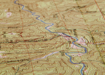
Researchers will apply results from the public survey. The effort will result in the development of a new, interactive tool which identifies, maps, and visualizes relationships of land stewards.  

  • The Stewardship Mapping and Assessment Project (STEW-MAP), a research tool and mapping platform, is the guiding force behind the Missouri Outdoor Connections project.  
  • The mapping tool can help foster connections across the landscape, including the Mark Twain National Forest and the USDA Forest Service St. Louis Urban Connections Office. 
  • STEW-MAP has supported community organizing and partnerships across many other cities nationally and internationally.  

Building partnership networks

Connecting Missouri’s outdoor groups and land stewards will have multiple benefits.  

  • It will identify, connect, and leverage existing and potential partners.  
  • It will increase collaboration across boundaries – from the city to the forest.  
  • It will help us understand the extent to which lands are being cared for and why.  

Common questions

What was the criteria used to determine who would be selected to participate in the survey?

A team of Forest Service program managers reviewed a comprehensive list of partners, interested parties, and others to create a curated, inclusive list of any groups that may be engaged in stewardship activities. This list was combined with a search of all publicly available nonprofit organizations in Missouri from IRS 990s and organizational websites. In addition, we are outreaching far and wide through efforts include social media, a postcard partner networks, and news release to reach anyone who takes care of Missouri’s natural spaces.

Why connect Missouri’s outdoor groups?

Land stewardship has increasingly become more collaborative and participatory. Across the country, people are working to create stronger, healthier, greener, and more resilient communities by caring for forests, parks, and other natural lands. Linking these individuals and groups allows us to advance stewardship & equity together, leverage resource capacity, share expertise, and make the impossible possible.

Will survey results be made public?

The summary report is anticipated in spring of 2024. The network visualization tools will be publicly available online.

What is the goal of this effort?

To look beyond National Forest System lands to bring together a large and diverse group from Joplin to St. Louis. This group, Missouri Outdoor Connections will link stewards from rural to urban communities and everywhere in between.

What is STEW-MAP?

The Stewardship Mapping and Assessment Project (STEW-MAP) is a research tool, community organizing approach, and partnership mapping platform developed by scientists at the U.S. Department of Agriculture, Forest Service, Northern Research Station. Stewardship data collected through STEW-MAP tells us about the presence, capacity, spatial distribution, and social networks of stewardship groups in each city or region.

Partners that have joined the Missouri Outdoor Connections development effort

Luckily, Mark Twain National Forest and the Eastern Region Urban Connections program already have a great group of partners to start this mapping effort off.  Initial meetings to talk to existing partners about this stewardship mapping opportunity were held in January 2023.

Have questions?

There are many people that are assisting with the Missouri Outdoor Connections project and are listed below, but for most questions the best people to reach out to are:

Email Connor Landeck Email Jenniqual Johnson

Other Forest Service team members contributing to this effort

  •