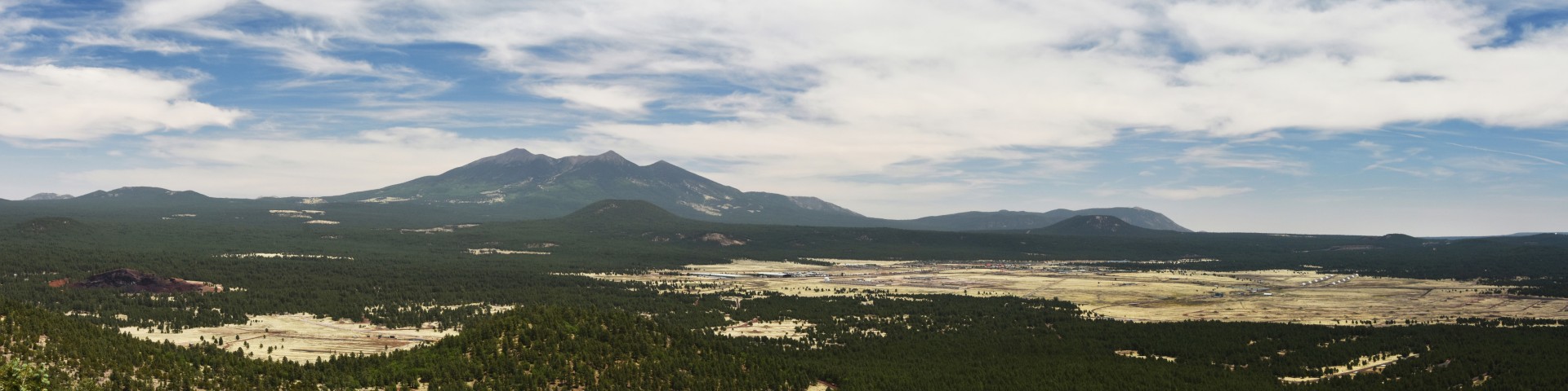
Fire Danger - Color Code, Preparedness Levels & Industrial Plan

Fire Danger sign with color descriptionsIn 1974, the Forest Service, Bureau of Land Management and state forestry organizations established a standard adjective description for five levels of fire danger for use in public information releases and fire prevention signing.

For this purpose only, fire danger is expressed using the adjective levels and color codes described below. In 2000, the NWCG Fire Danger Working Team reviewed and slightly revised these terms and definitions for adjective fire danger.


Fire Danger Rating and Color Code

Description

Low (L)
(Green)

Fuels do not ignite readily from small firebrands although a more intense heat source, such as lightning, may start fires in duff or punky wood. Fires in open cured grasslands may burn freely a few hours after rain, but woods fires spread slowly by creeping or smoldering, and burn in irregular fingers. There is little danger of spotting.

Moderate (M)
(Blue)

Fires can start from most accidental causes but, with the exception of lightning fires in some areas, the number of starts is generally low. Fires in open cured grasslands will burn briskly and spread rapidly on windy days. Timber fires spread slowly to moderately fast. The average fire is of moderate intensity, although heavy concentrations of fuel, especially draped fuel, may burn hot. Short-distance spotting may occur, but is not persistent. Fires are not likely to become serious and control is relatively easy.

High (H)
(Yellow)

All fine dead fuels ignite readily and fires start easily from most causes. Unattended brush and campfires are likely to escape. Fires spread rapidly and short-distance spotting is common. High-intensity burning may develop on slopes or in concentrations of fine fuels. Fires may become serious and their control difficult unless they are attacked successfully while small.

Very High (VH)
(Orange)

Fires start easily from all causes and, immediately after ignition, spread rapidly and increase quickly in intensity. Spot fires are a constant danger. Fires burning in light fuels may quickly develop high intensity characteristics such as long-distance spotting and fire whirlwinds when they burn into heavier fuels.

Extreme (E)
(Red)

Fires start quickly, spread furiously, and burn intensely. All fires are potentially serious. Development into high intensity burning will usually be faster and occur from smaller fires than in the very high fire danger class. Direct attack is rarely possible and may be dangerous except immediately after ignition. Fires that develop headway in heavy slash or in conifer stands may be unmanageable while the extreme burning condition lasts. Under these conditions the only effective and safe control action is on the flanks until the weather changes or the fuel supply lessens.


The Five Preparedness Levels (PL ratings)

National wildfire preparedness is typically described in five levels with regards to fire activity and resources committed. A Summary of the Nation’s Wildfire Response Stages (pdf).

The National Multi-Agency Coordination Group (NMAC) establishes preparedness levels throughout the calendar year to help ensure that firefighting resources are ready to respond to new incidents. Preparedness levels are dictated by burning conditions, fire activity, and especially resource availability.

Each preparedness level has specific management directions. As the preparedness levels rise, more federal and state employees become available for fire mobilization if needed.

  • PREPAREDNESS LEVEL 1—Minimal large fire activity nationally. Most geographic areas have low to moderate fire danger. There is little or no commitment of national resources.

  • PREPAREDNESS LEVEL 2—Several geographic areas are experiencing high to extreme fire danger. Wildland fire activity is increasing and large fires are occurring in one or more geographic areas. Minimal mobilization of resources from other geographic areas is occurring. The potential exists for mobilizing additional resources from other geographic areas.

  • PREPAREDNESS LEVEL 3—Two or more geographic areas are experiencing wildland or prescribed fire activities requiring a major commitment of national resources. Additional resources are being ordered and mobilized through the National Interagency Coordination Center (NICC). Incident management teams are committed in two or more areas, or 275 crews are committed nationally.

  • PREPAREDNESS LEVEL 4—Two or more geographic areas are experiencing incidents requiring Type 1 teams. Competition exists for resources between geographic areas. When 425 crews or five Type 1 teams are committed nationally.

  • PREPAREDNESS LEVEL 5—Several geographic areas are experiencing major incidents that have the potential to exhaust all agency fire resources. When 550 crews are committed nationally.
     

Industrial Plan

  • Industrial Plan A:  No Restrictions. Normal Fire Precautions - No fire guard required except for welding and blasting operations.

  • Industrial Plan B:  Stage 1 restrictions. Normal Fire Precautions - Authorized user will provide fire guard.

  • Industrial Plan C:  Stage 2 restrictions. All power equipment use as well as blasting and welding operations will shut down from 9 a.m. until 8 p.m. Mountain Standard Time (10 a.m. to 9 p.m. MDT). Operations on mineral soil involving activities such as road excavation, watering, grading, surfacing, rock crushing, and/or other equipment may continue. Authorized user will provide fire guard.

  • Industrial Plan D:  Stage 3 restrictions - Forest Closure/*Partial Closure. Shut down all operations; except operations on mineral soil involving road excavation, watering, grading, surfacing, and rock crushing may continue with special Forest Service permit. Blasting and welding are prohibited. Authorized user will provide fire guard.

*Partial Forest Closure-

Project areas which are outside the boundaries of the partial forest closure may continue to operate under Industrial Fire Plan "C" operating criteria as agreed upon between the Permit Administrator and Purchaser in writing.

Project areas within the boundaries of the proclaimed partial forest closure area are to operate under Industrial Plan "D".

Staged restrictions levels are determined by the appropriate Forest Line Officer in consultation with the Forest Fire Management Officer and Permit Administrator. The appropriate Forest Line Officer may adjust the predicted Industrial Plan for local weather conditions within a Project Area. Changes in the predicted Industrial Plan shall be agreed to in writing.


~ Return to Fire Management ~